Goodbye Exumas…Hello Eleuthera

4/3/17
Rock Sound, Eleuthera, Bahamas
Position: 24 51.870N, 076 09.788W
Posted by Bill

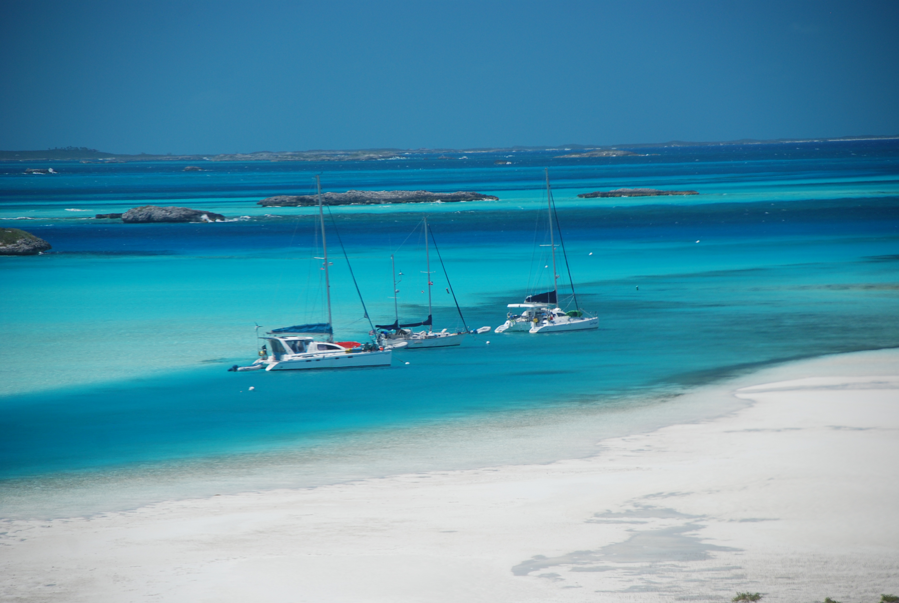
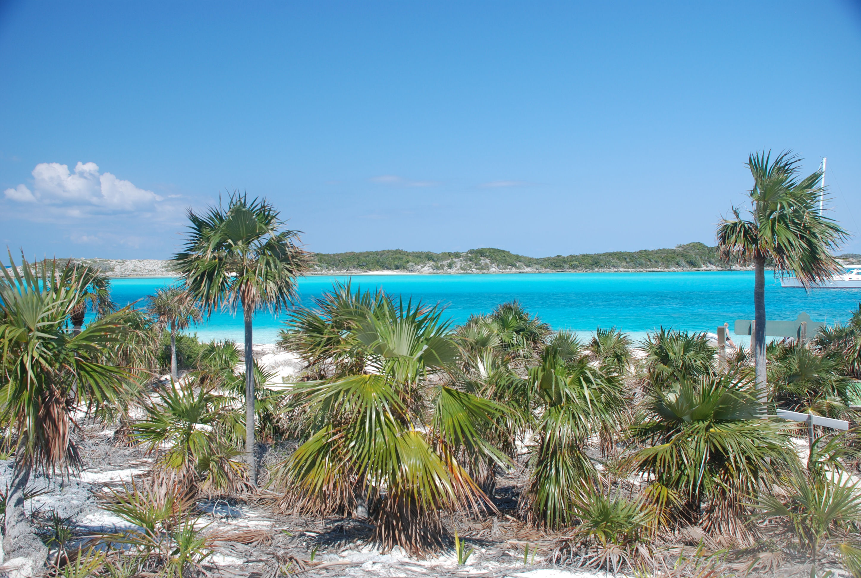
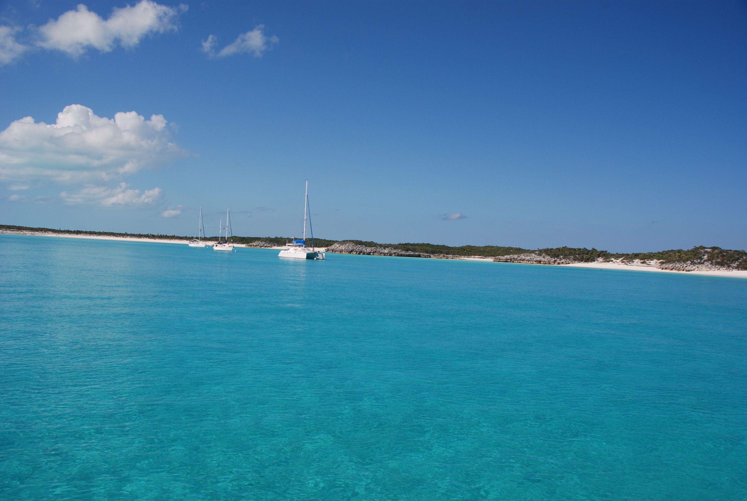
We left Big Majors Spot on 3/30 and moved a few miles north to Sampson Cay, one of our favorite anchorages. We moved to get some protection from south and southeast winds that were coming, but Sampson didn’t give us very much protection because of wrap around waves and bouncing off the rock walls behind us. We did enjoy the sand bars behind the anchorage. A great weather window was forming, so we moved back to Warderick Wells to stage to cross to Eleuthera. We picked up mooring number 12 on 4/1, and went swimming off of one of our favorite beaches. It is finally getting hot here and the swimming was wonderful! We had a very calm and peaceful night, thankfully.

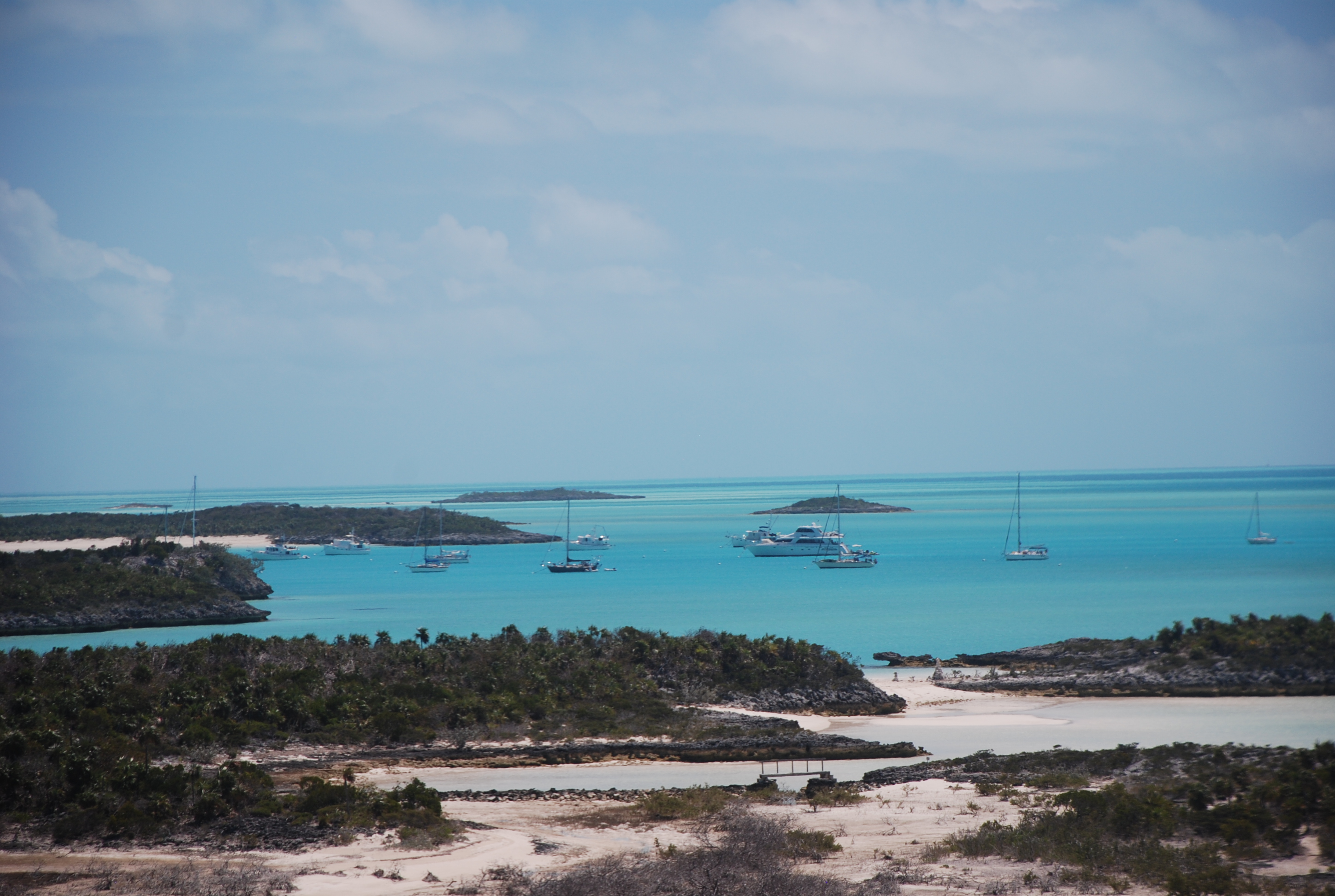
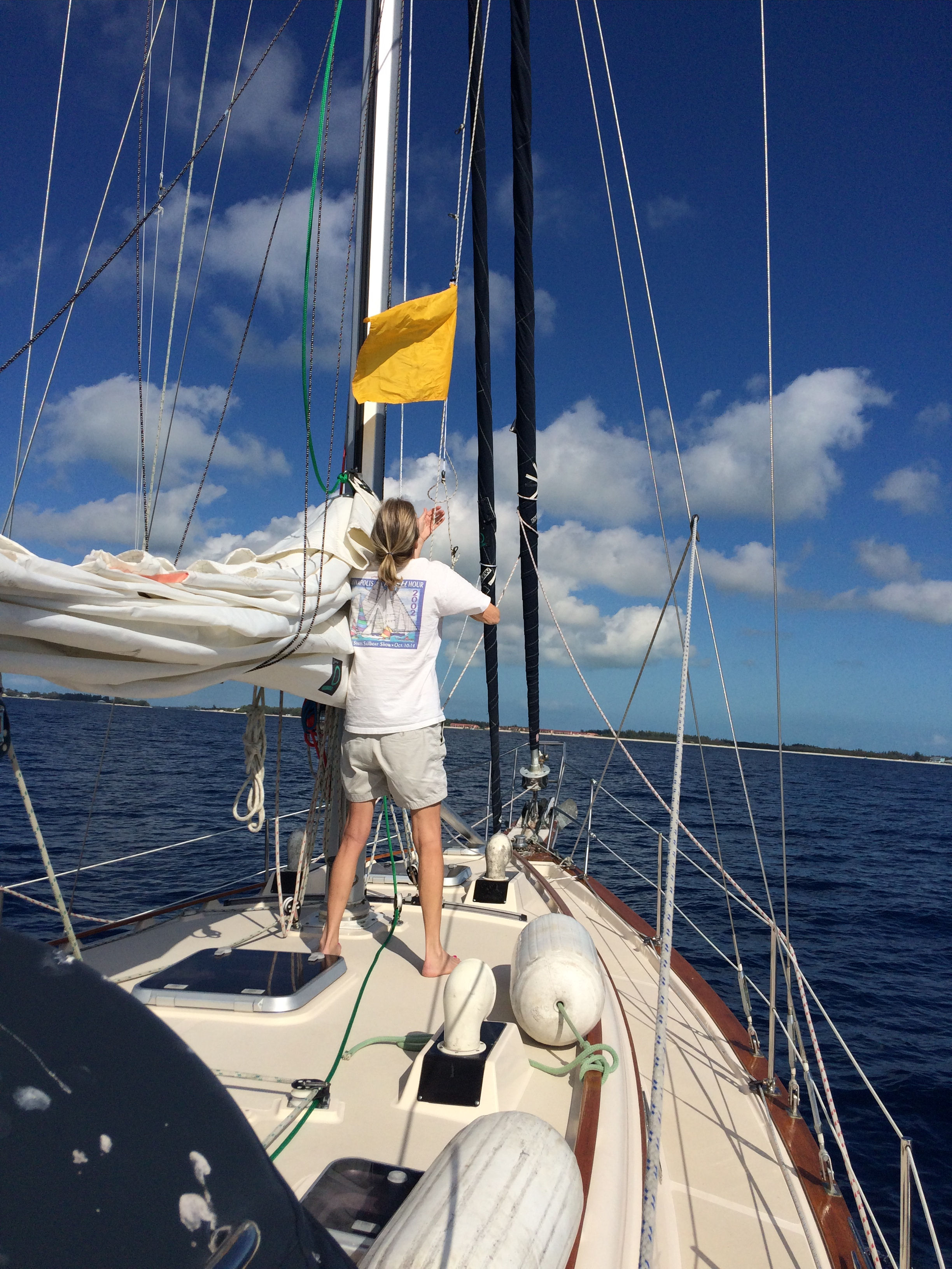
Yesterday we left Warderick Wells, slipped out the inlet and made our way to the bottom of Eleuthera Island. We actually raised both sails!! It was the best ocean crossing we have ever had…calm seas and a nice gentle breeze. Both boats tried to do some fishing offshore, with no success. We tried a cedar plug that our good friend John Reddington gave us to try, but no luck. We went around the cape of Eleuthera and into Rock Sound Harbor. There is a nice settlement there with excellent provisioning, including a grocery store like we find back in the States. Most grocery stores in the Bahamas are like a small convenience store and there are very few stores like those we have come to take for granted in the US. We tried to do some shopping yesterday and also go to dinner, but almost everything was closed on Sundays, so we will catch up today. We are also going to wait out a short bout of strong winds tonight, and shoot for a 2 day run to Spanish Wells if weather allows. Longer term, we plan on taking the first good weather window to cross the ocean to the Abacos and then work our way back to the US by late April/early May. As always, we will travel based on the weather.

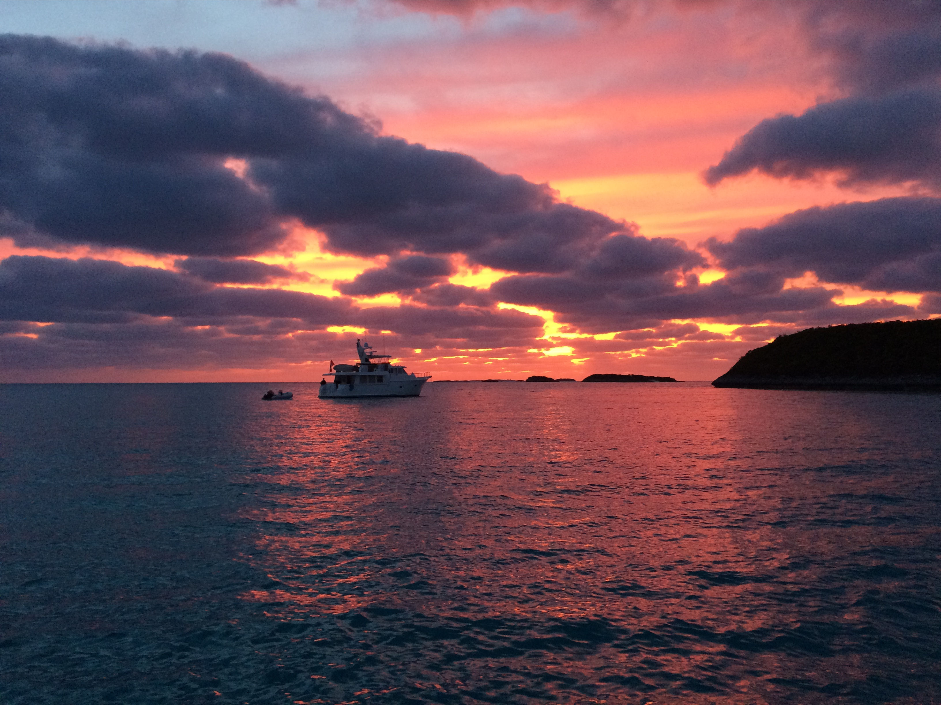
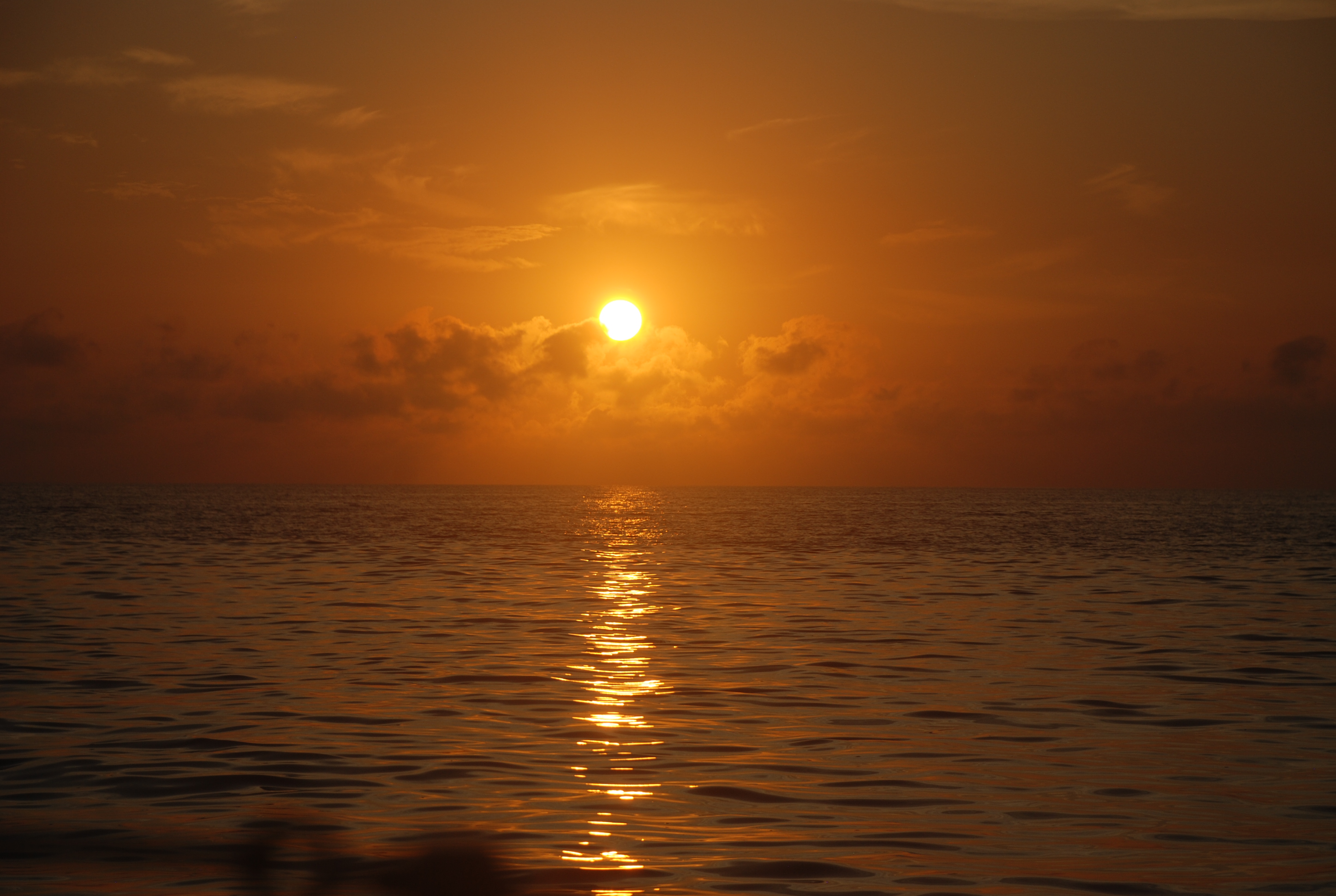
Sunrise on Exuma Sound yesterday:
DSC_0015
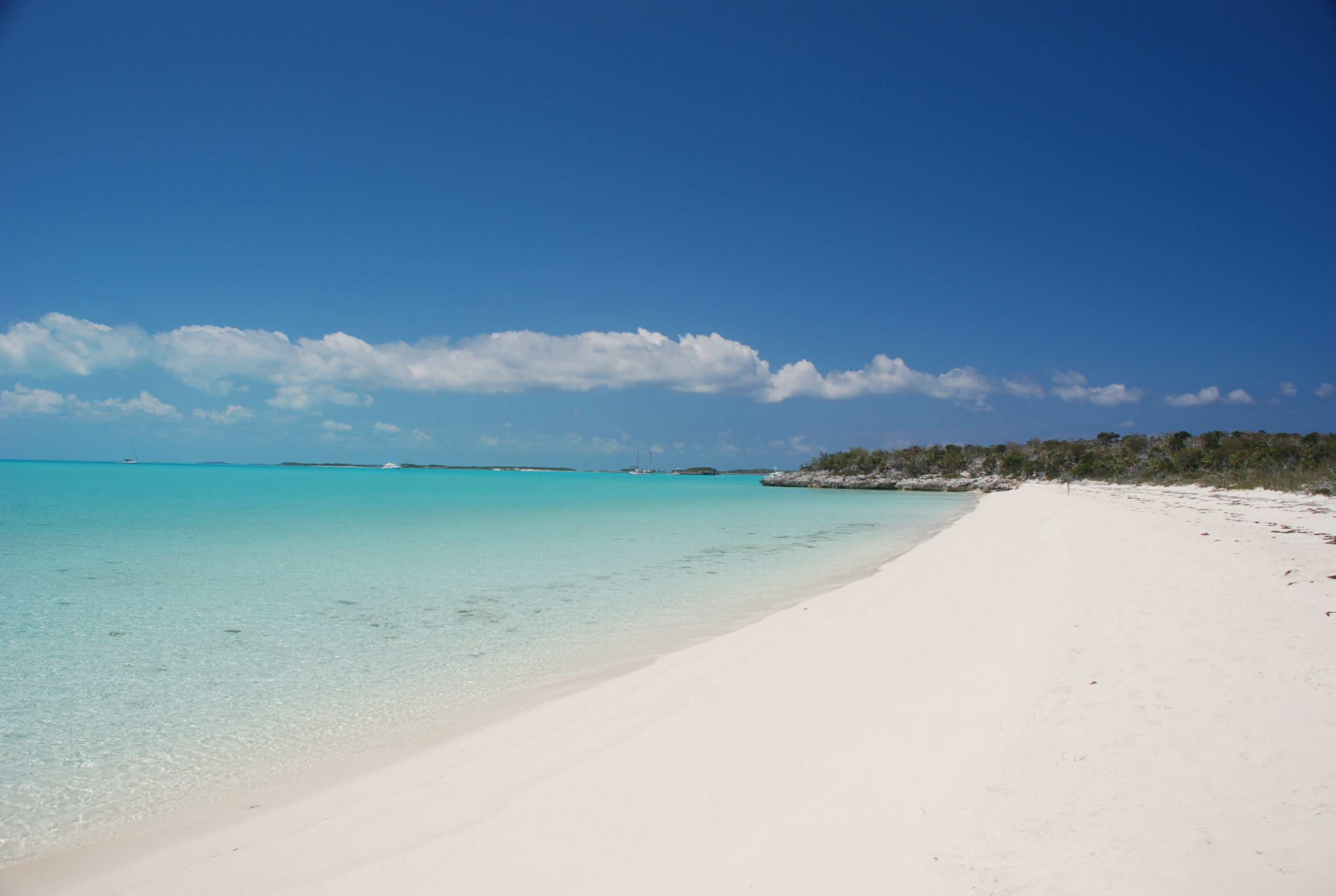
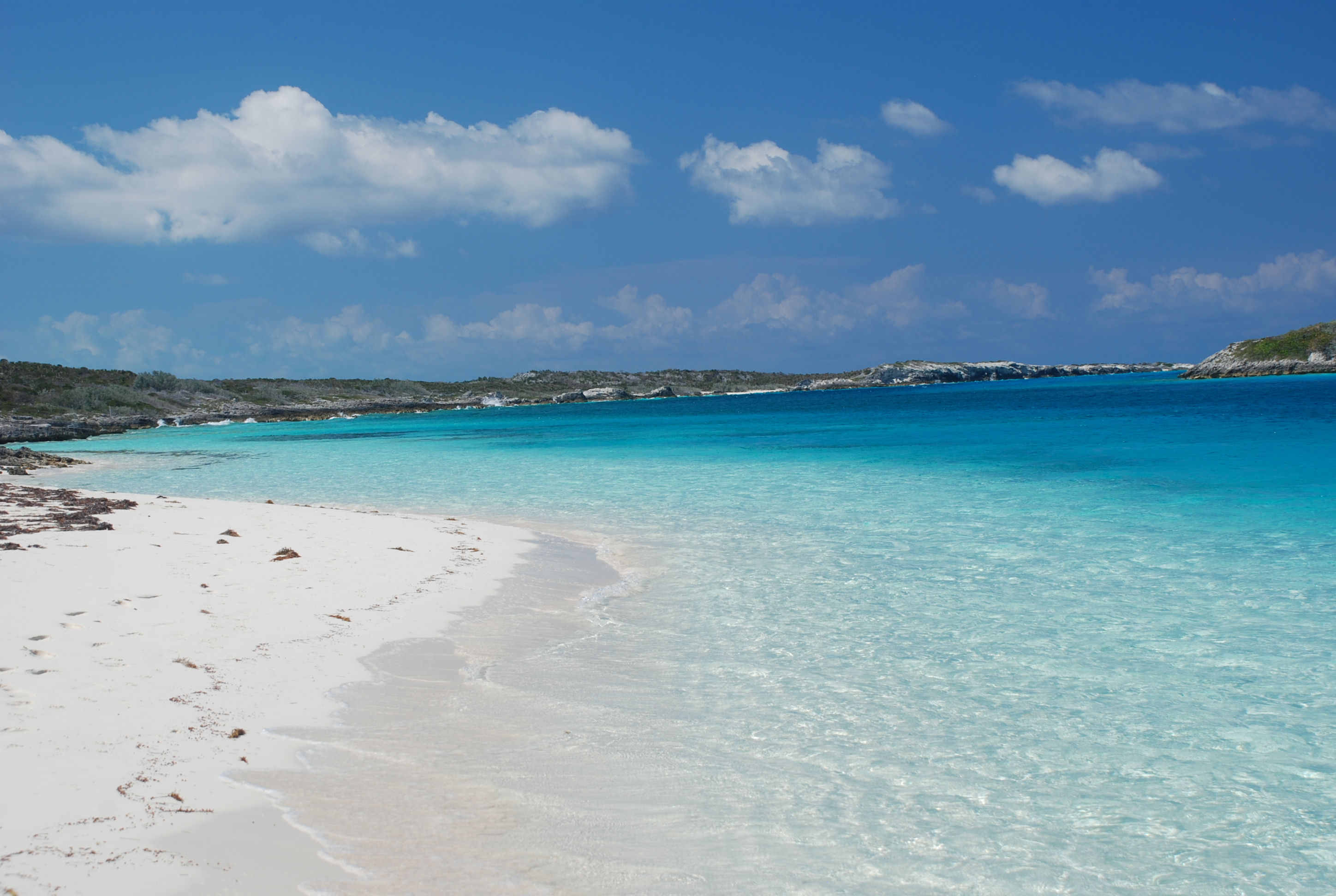
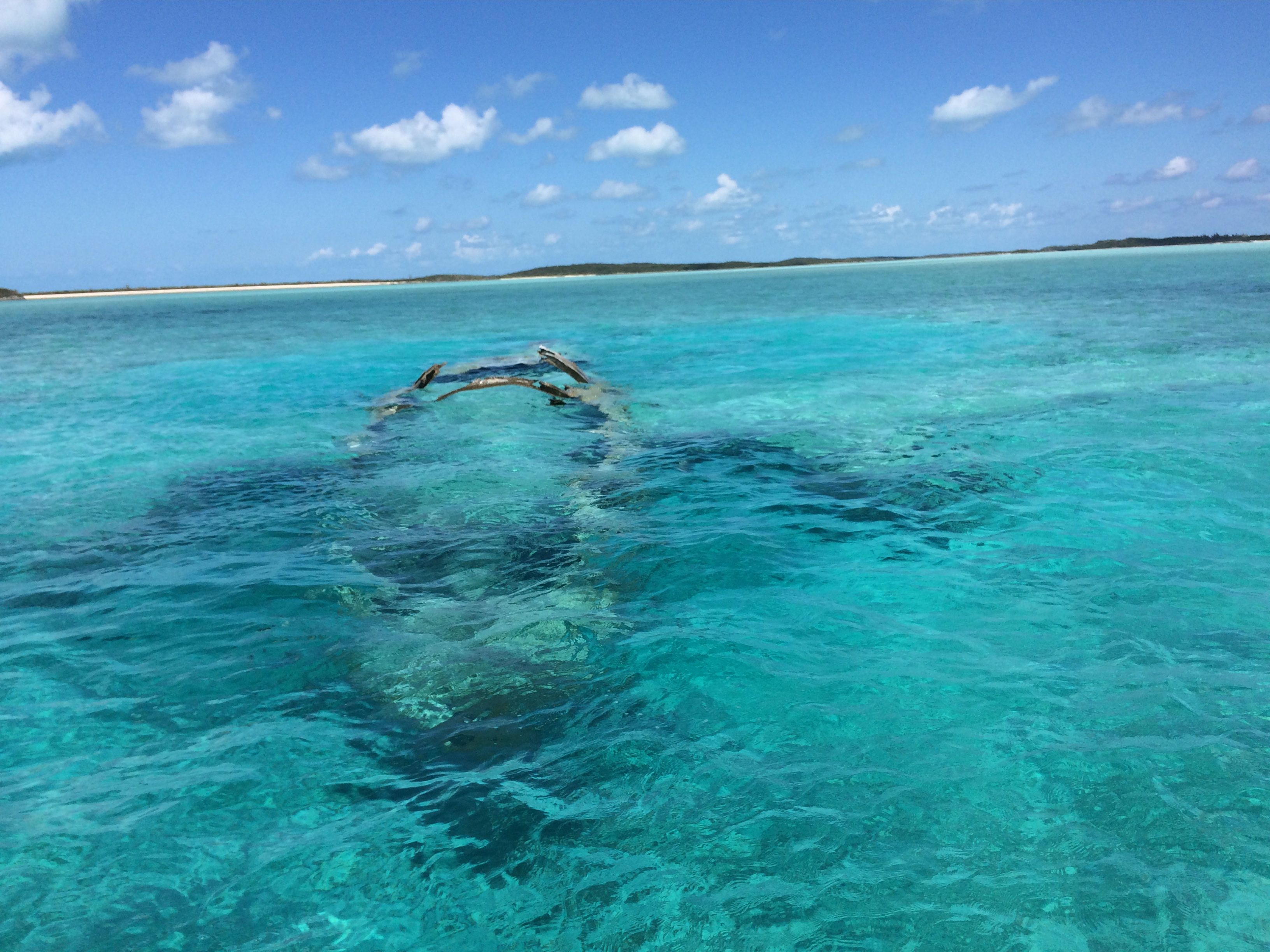
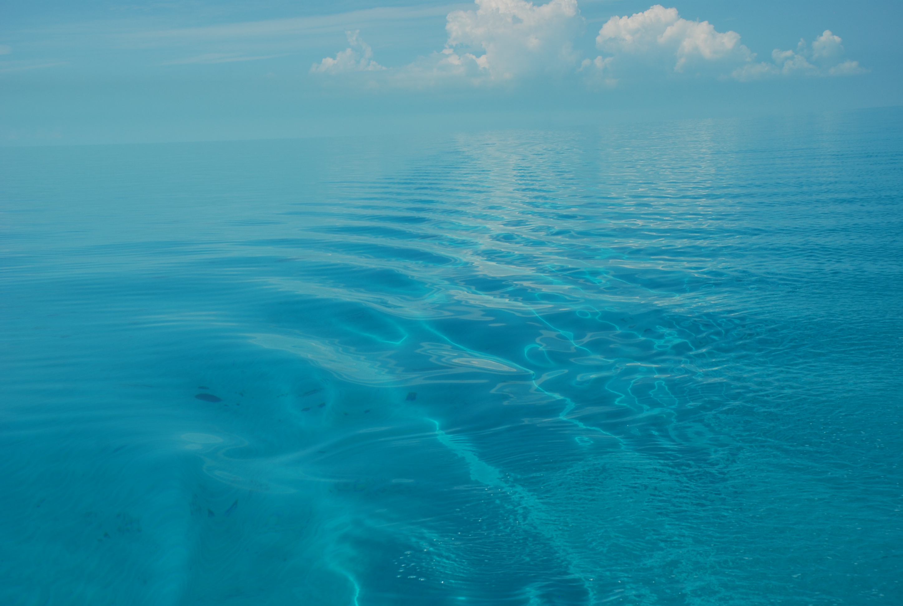
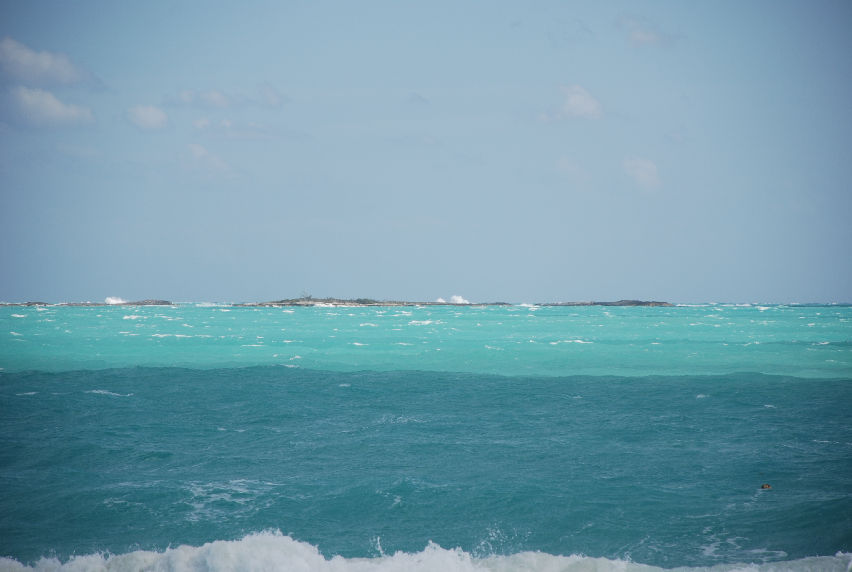
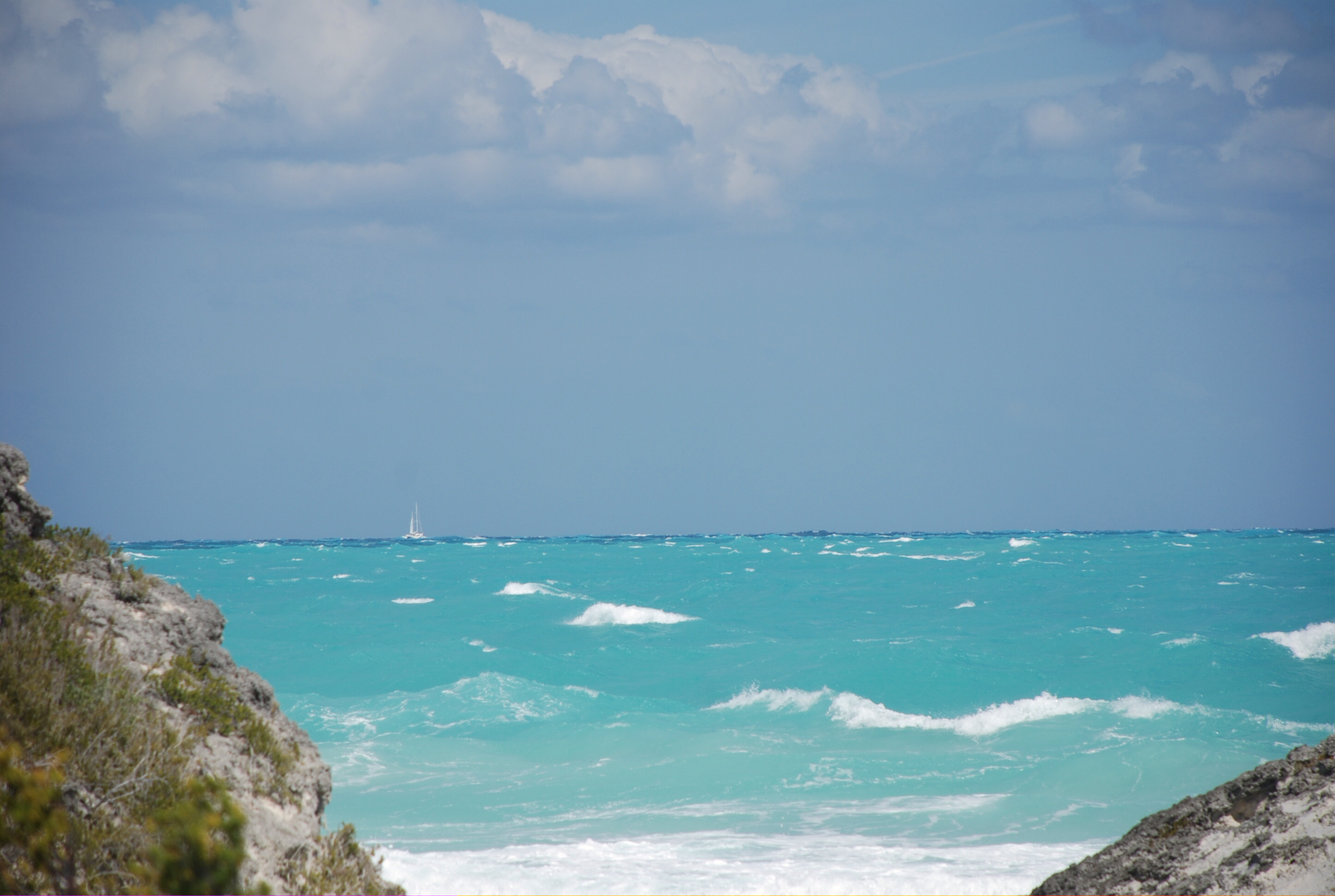
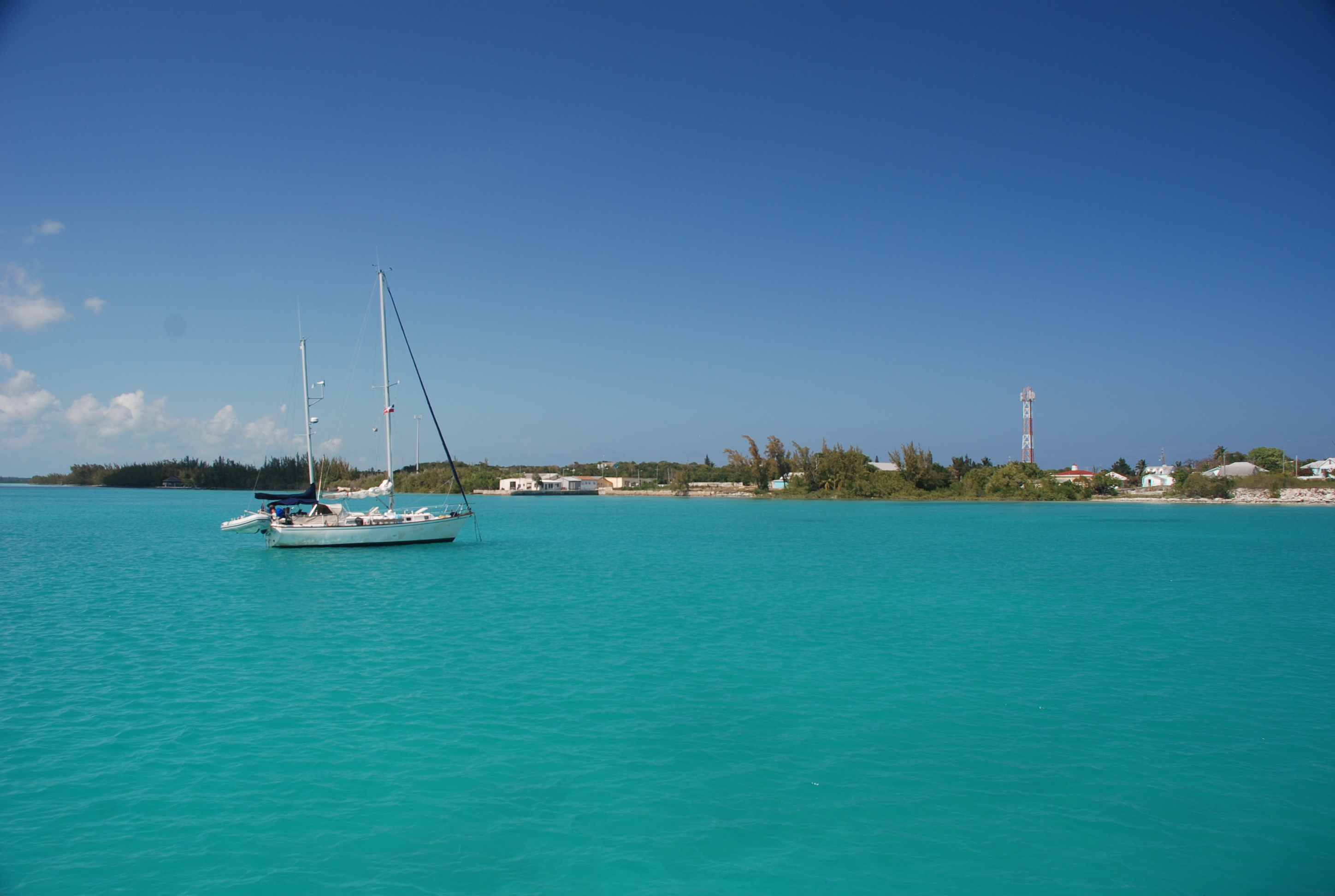
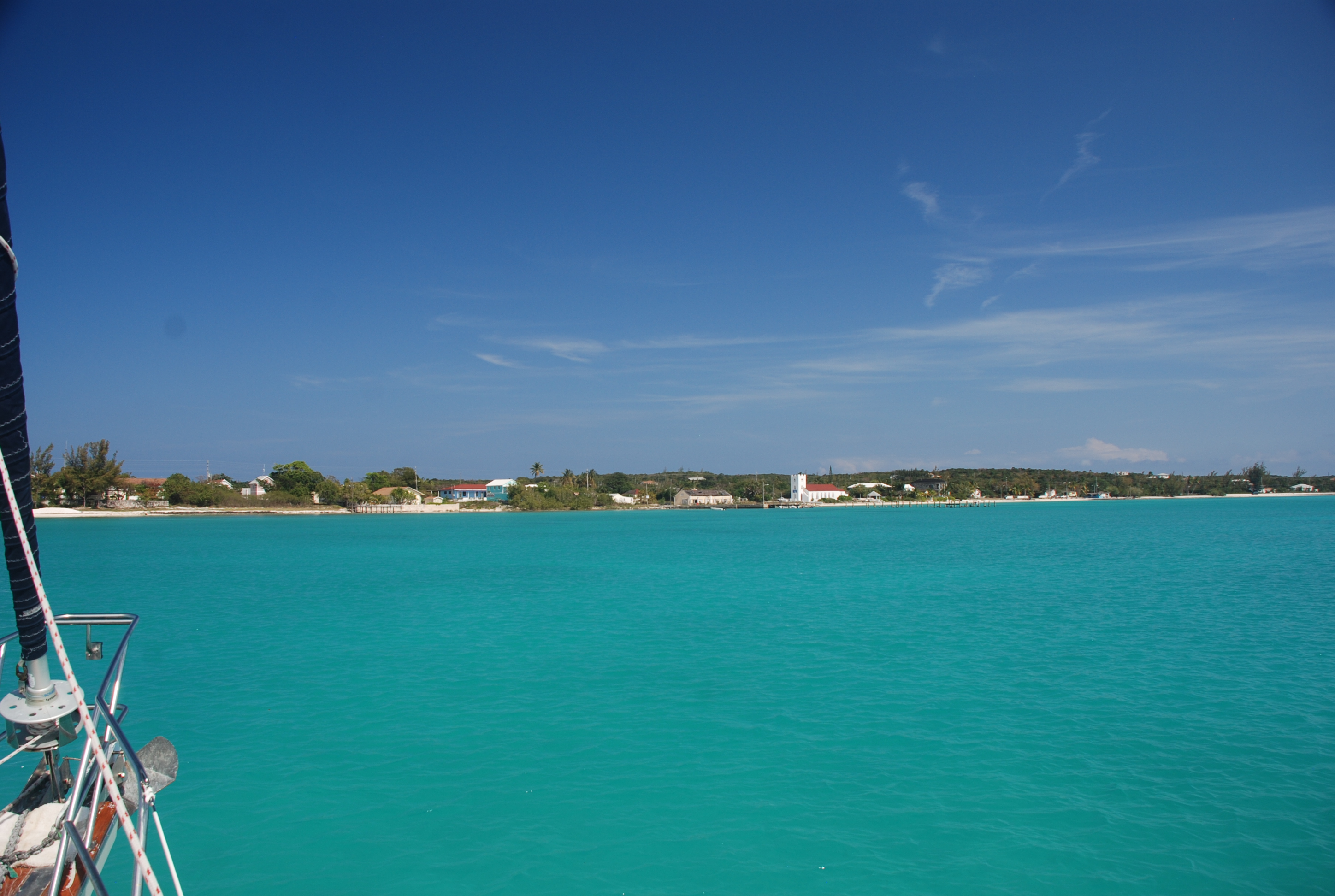
I still marvel at the color of the ocean when you get off shore. Here is an example of the water at about 4,000 feet deep:
DSC_0021
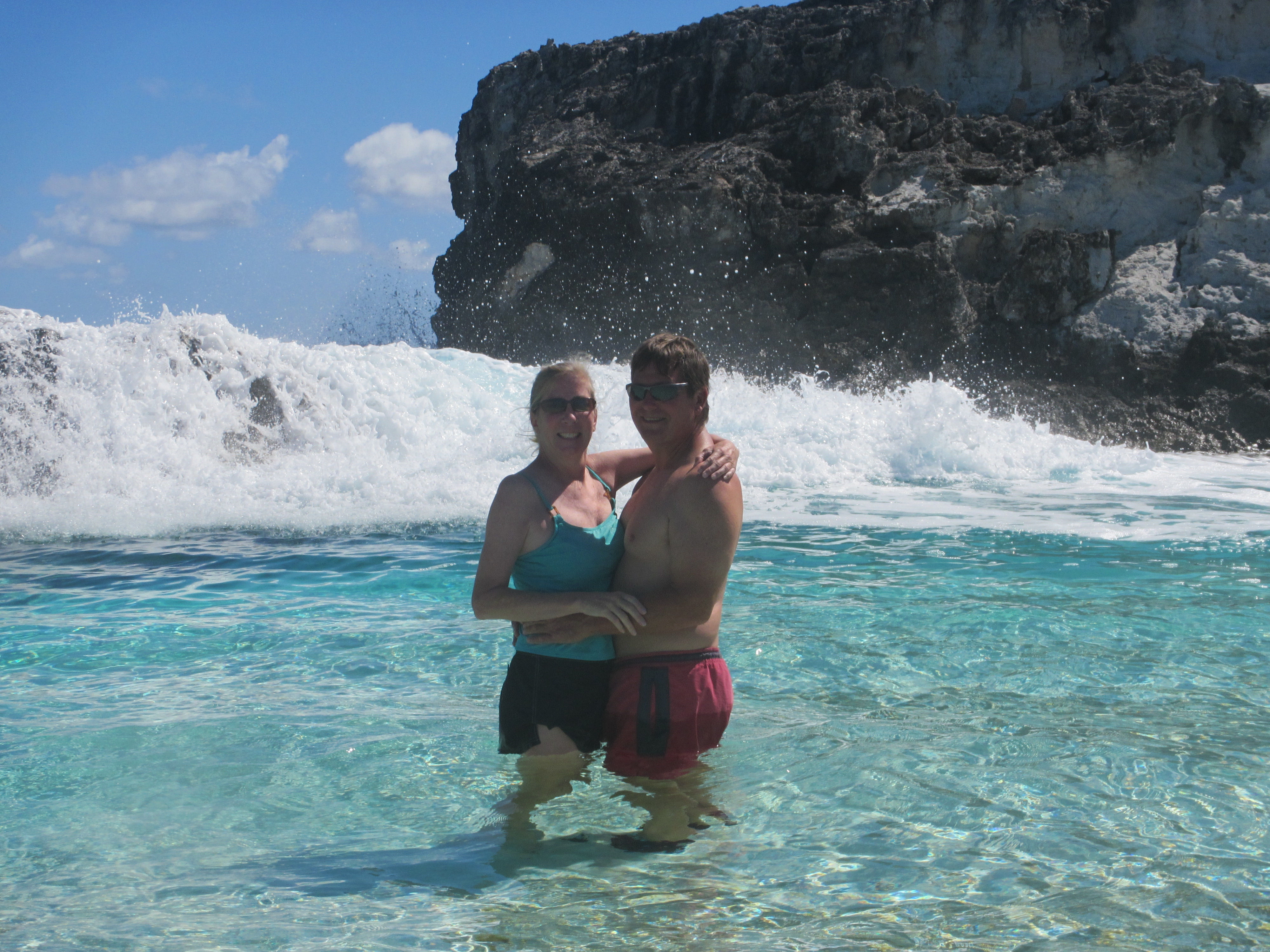
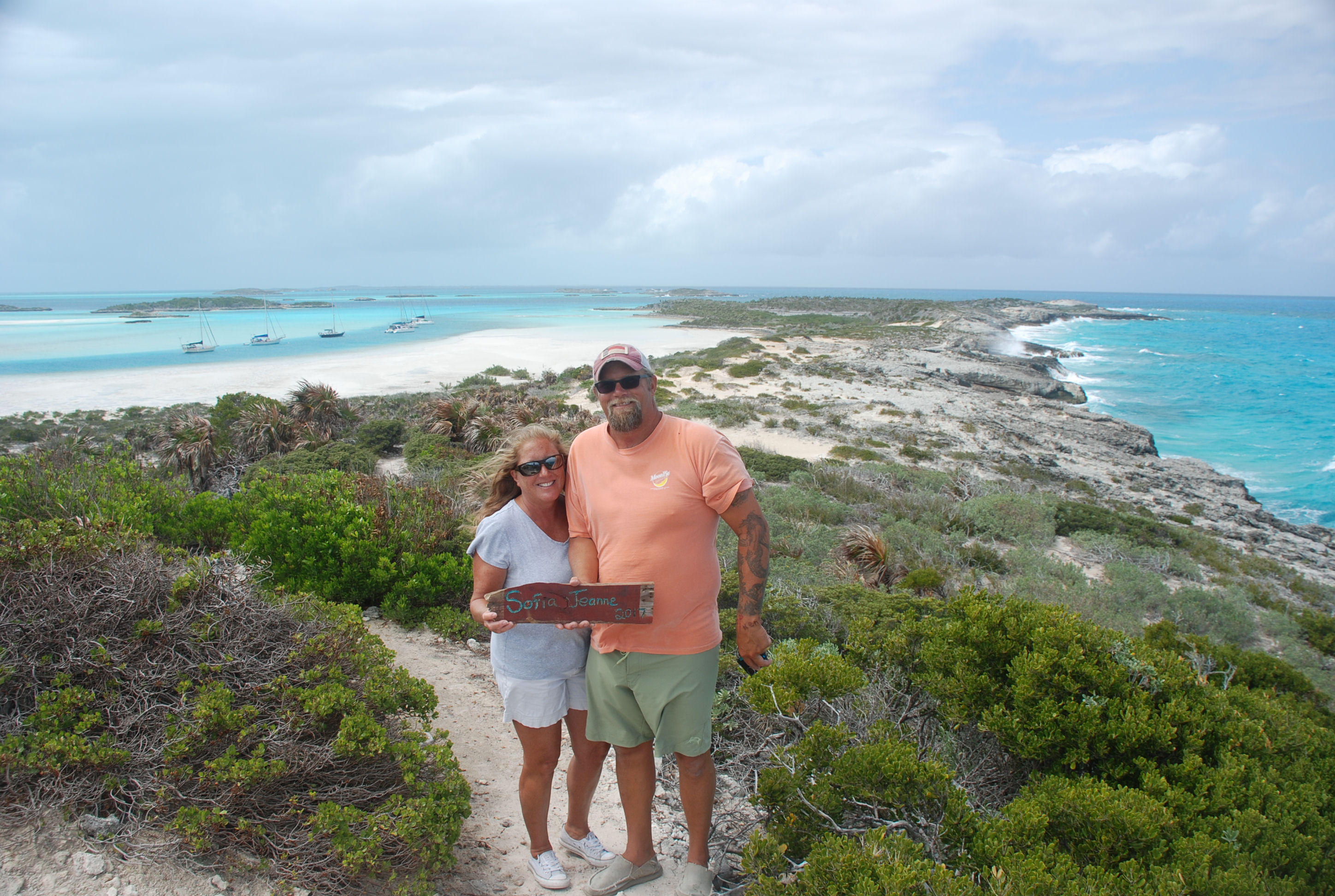
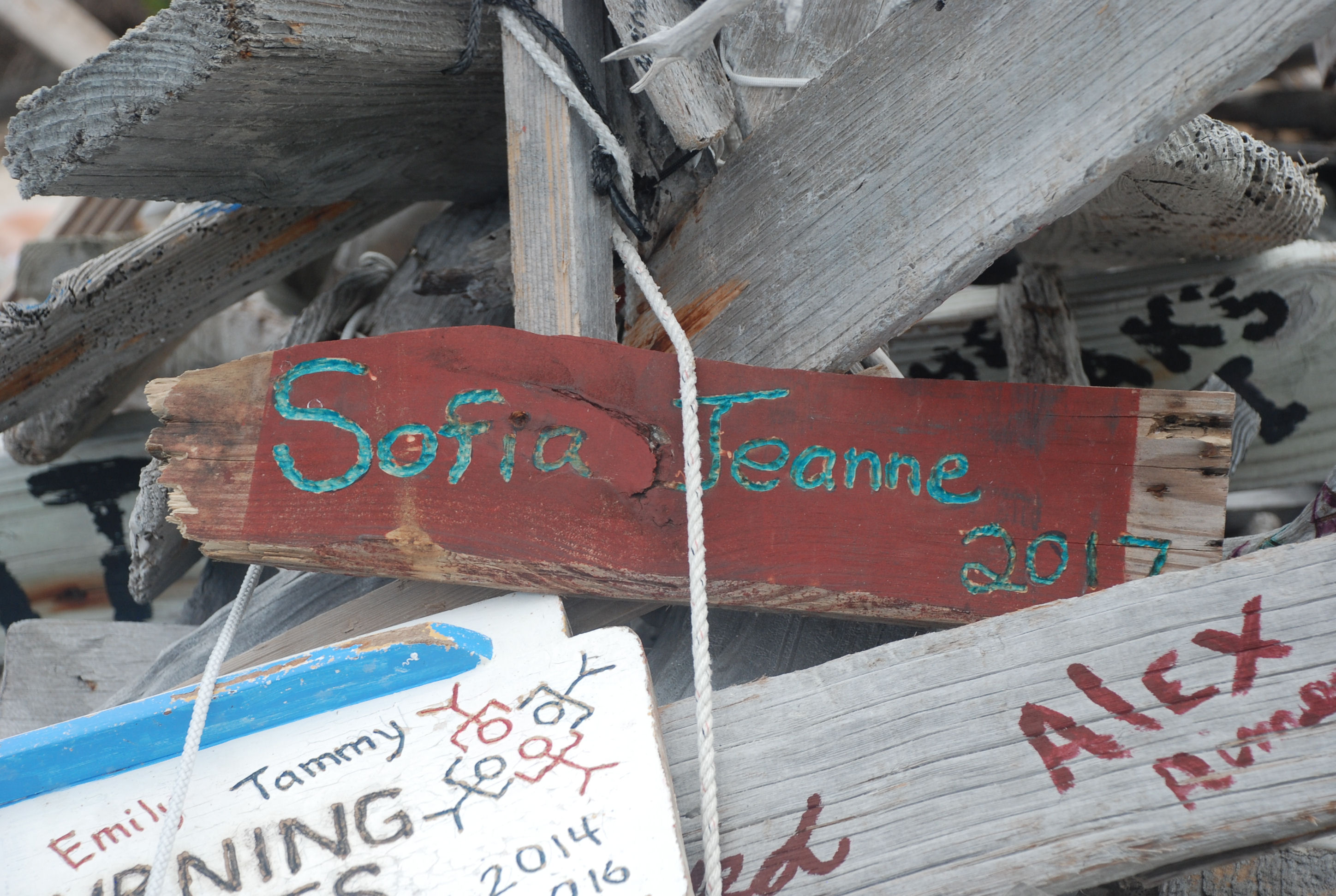
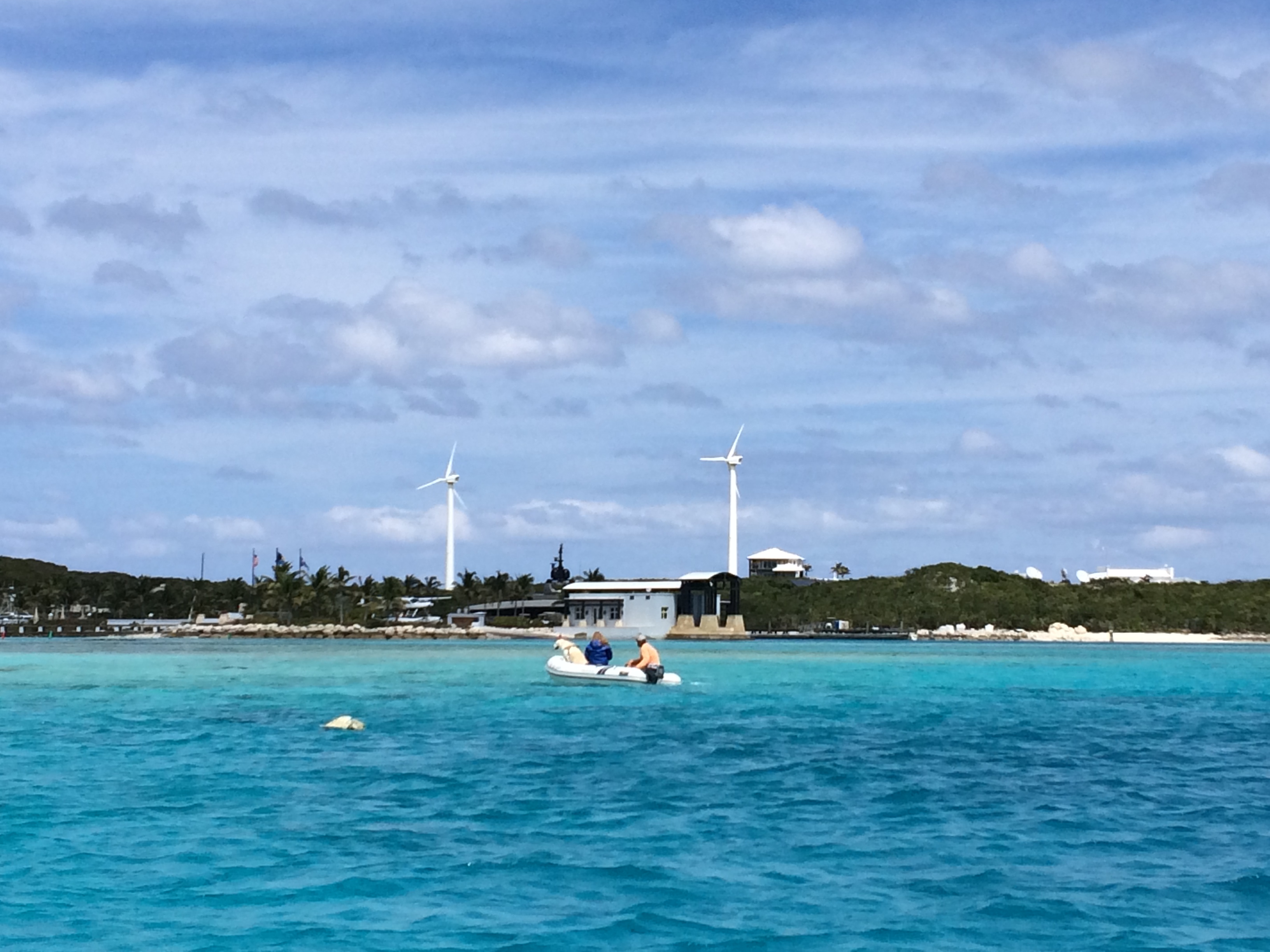
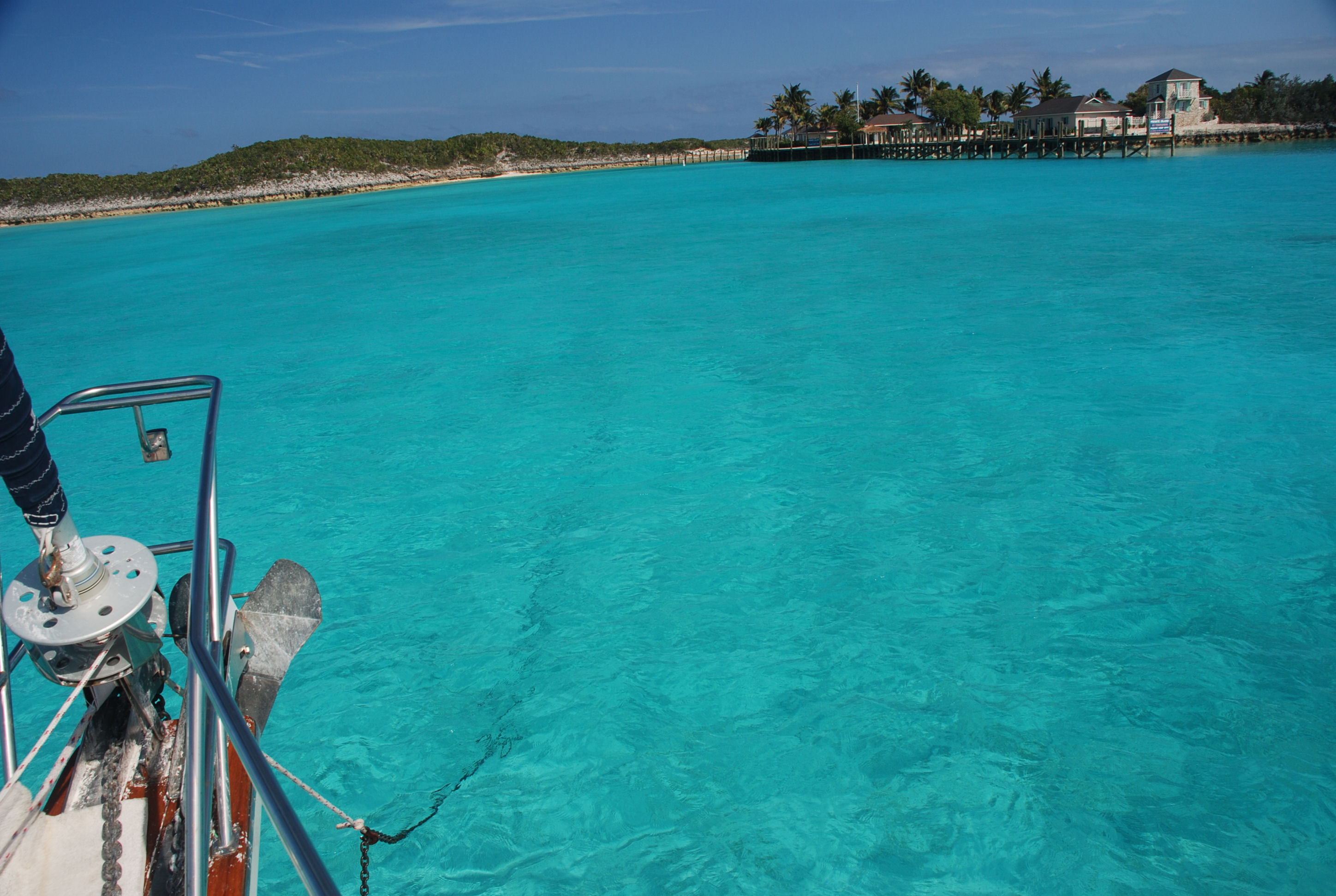
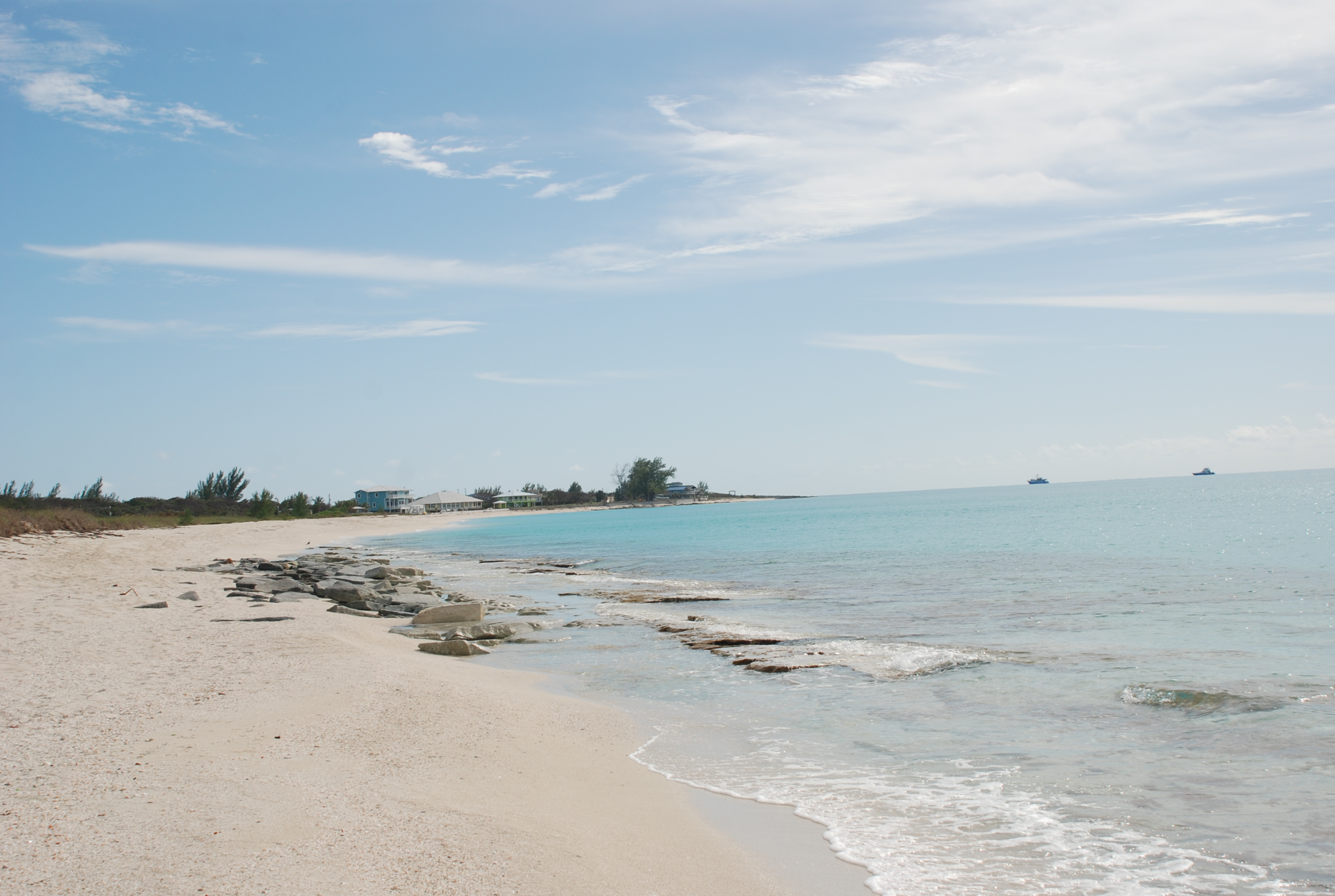
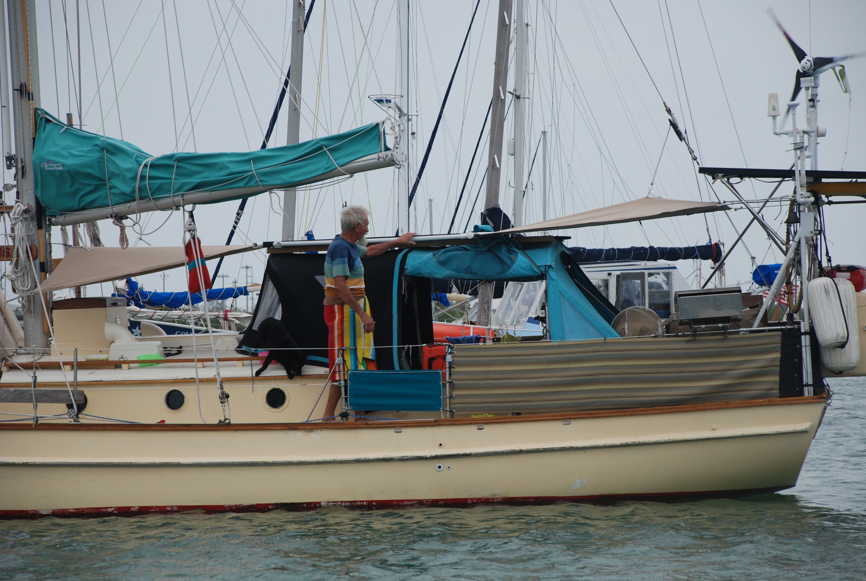
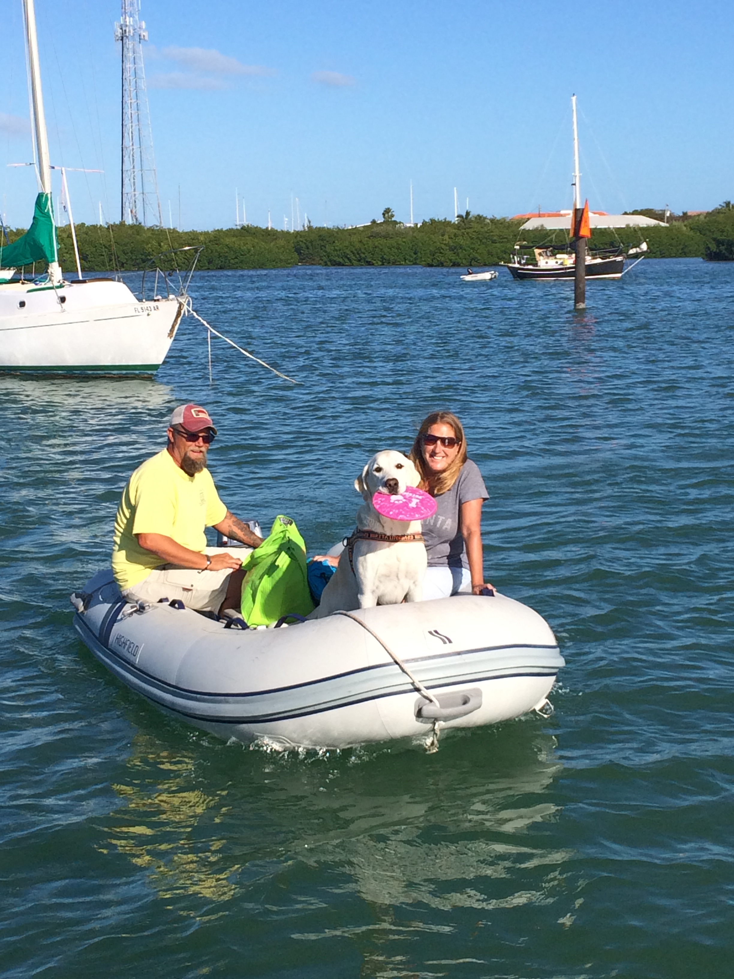
A couple of pictures of the town at our anchorage in Rock Sound (including Sophia Jeanne):
DSC_0027
DSC_0026

We had really spotty internet access in the Exumas this year. I think something was wrong with the cellular data service while we were there. We should have good access from here on out, which will help with the blog!! Thanks for following us.

Back to Cambridge Cay and on to Big Majors Spot

3/29/17
Big Majors Spot, Exumas, Bahamas
Position: 24 11.143N, 076 27.549W
Posted by Bill

Since we only stayed at Cambridge Cay one day and lucked out getting a mooring in Warderick Wells for the bad winds, we decided to go back to Cambridge for some snorkeling. One note about the weather we waited out. It turned out that it was a serious low that was being watched for tropical storm/hurricane possibilities. It was nasty winds over 35 knots for several days. Glad we were in a protected area.

There were 4 areas around Cambridge that we wanted to go see: a snorkeling spot called the Sea Aquarium, a plane wreck to dive, underwater caves at the Rocky Dundas, and a swimming hole called the Bubble Bath. We picked up the same mooring that we had the last time we were here, arriving on 3/27. The next day we hit the Sea Aquarium. It was appropriately named as it was like snorkeling in a large aquarium. More pictures courtesy Sofia Jeanne:
IMG_5803cmp
IMG_5804cmp
IMG_5808cmp
IMG_5815cmp
IMG_5816cmp
IMG_5818cmp
It was great snorkeling, until the hordes of tour boats arrived, dumping boat loads of adults and kids who did not know how to snorkel. They were splashing all around scaring the fish (who would come right up to you if you just floated there), and standing on the coral (which kills it). We ended up leaving a bit sooner than we wanted and went over to the plane wreck:
IMG_5826cmp
IMG_5830cmp
We tried to go to the caves, but the water was too rough to get close to them, so we settled for some wallowing at a deserted beach.

We left the next day and stopped at the Bubble Baths on Compass Cay. We almost missed it because we could not get the anchor to set properly. After the 3rd try we had it good enough for a couple of hours. The Bubble Bath is a tidal pool that is fed by the ocean at mid to high tide. The water splashes over the rocks and creates a frothy surface on the water. It was very cool:
IMG_5900cmp
Tricia and I enjoying the bath:
IMG_5903cmp
IMG_5912cmp

From there we headed over to Big Majors Spot. We needed to get some fuel and dispose of trash before the next leg of our trip. Big Majors is a dinghy ride to Staniel Cay. Sofia Jeanne stopped at Staniel and topped up on fuel and water and then we anchored at Big Majors. Big Majors is the home of Pig Beach and although we didn’t stop at the beach this time, Shirley got some pics:
IMG_5938cmp
IMG_5945cmp

Staniel is a hot spot for big yachts. Many anchor at Big Majors. Most people want to eat at Staniel Cay Yacht Club, so the place is usually full of tourists and big yacht people. It creates a vibe that is not consistent with the Exumas, unfortunately, many are arrogant and full of themselves. We didn’t come to the Bahamas to hang with those folks, so this is not one of our favorite places. They also launch their wave runners and power boats and buzz through the anchorage at full speed, rocking and rolling everyone…not cool. They do clean fish right outside the yacht club and there are always a lot of sharks. People were swimming with them…idiots!!!
IMG_5957cmp
I usually refer to this type of behavior as “the thinning of the herd”.

Snorkeling Warderick Wells and a trip to Boo Boo Hill

3/26/17
Warderick Wells Cay, Exumas, Bahamas
Posted by Bill

In spite of the weather, on our stay here, we have been able to do some snorkeling and some hiking . There are several snorkeling spots around Warderick Wells that are pretty good…tons of fish and coral. Matt and Shirley have an underwater camera and captured some good shots. Courtesy of them:
IMG_5379 cmp
IMG_5573 cmp
IMG_5674 cmp
IMG_5671 cmp
IMG_5668 cmp
IMG_5666 cmp
IMG_5665 cmp
IMG_5661 cmp
IMG_5660 cmp
IMG_5652 cmp

If you read the blog last year, you may remember the legend of Boo Boo Hill. The short version is that some people hear the ghosts of nearby shipwrecks at night and if you throw a piece of driftwood with your boat name on top of the hill, you can have safe passage beyond Boo Boo Hill. We hiked up to the top, updated last year’s piece with a 2017 added, and Matt and Shirley put theirs up too. Ours was next to another buddy boat from last year, our friends Bob and Cat on Sea Lyon. The view is great from up there!
DSC_0460
DSC_0453 cmp
DSC_0473
DSC_0468 cmp
DSC_0428 cmp
DSC_0378 cmp
DSC_0399 cmp
Along the hiking trail we ran in to this little curly tail lizard on a rock pile:
IMG_5544 cmp

Once again waiting out weather

3/24/17
Warderick Wells Cay, Exumas, Bahamas
Position: 24 23.796N, 076 37.937W
Posted by Bill

We had about three days of really nice weather ahead of us, followed by four days of nasty, kick your ass winds, out of the north east and east. We decided to leave Blackpoint a day early and go to Cambridge Cay, and try to grab a mooring. Cambridge is in the south extreme of the Exuma Land and Sea Park, a protected marine sanctuary. As stated in previous blogs, it is a “no take zone from both land and sea”. Their motto is “take only photographs and leave only footprints”, and is the most beautiful place by the sea we have ever been (including all of our Caribbean travels). We had never made it to Cambridge, and really wanted to go this year as it is situated by the best snorkeling in the Bahamas, and is regarded as one of the most beautiful places in the Exumas. We arrived on 3/21 and grabbed a park mooring ball at position: 24 18.103N, 076 32.351W. We had really good east protection and not bad north east protection for the coming blow. We radioed Warderick Wells Exuma Park HQ on the way there and got on the waiting list for a mooring in the North Field at Warderick Wells Cay, which we had tried to get before the last major weather event, but failed, but if we couldn’t get in the North Field in time for the blow, we knew we would be good at Cambridge. We arrived in mid afternoon and took the dinghies around and identified the best snorkeling spots, which we would snorkel the next day. We figured that we wouldn’t be able to get into Warderick Wells as the wait list gets long when weather is approaching, but were confident we could get in after the blow. As luck would have it, Exuma Park HQ called on the radio the next morning and told us we and Sofia Jeanne both had moorings in the North Field! The North Field was a 3.5 hour trip from Cambridge so we were going to hit one snorkel site at Cambridge before we left. At the last minute, I had a hunch we better get to Warderick before the park office closed at 4:00 just in case there was a mishap with our reservation, and we took off around noon. Sure enough, when we arrive at Warderick Wells, only one of our mooring balls is free. Calling the park office on the radio, they informed us that they moved us to different moorings and didn’t tell us. We got better spots and I was glad we decided to get there early to get it all cleared up. We took mooring number 9, and had enough time to mix Painkillers and do some happy hour wallowing at a nearby deserted beach:
DSC_0307
One thing we like about the Exumas is that there are secluded beaches all through the cays and islands. You can find your own personal wallowing spot.

Yesterday, we took the dinghies around to the south side of Warderick Wells Cay to Pirate’s Lair. It is absolutely beautiful there. On the way back we hit a few snorkeling sites seeing some really pretty fish and coral, and of course hit several wallowing beaches.
DSC_0358 cmp
DSC_0350 cmp
The north mooring field, where we are tied up:
DSC_0368 cmp
The winds started to pick up around sunset, as forecasted, and it has been blowing 25 to 35 knots since. We pretty much just stayed on the boat today and we are glad we are in such a protected area from the winds! It should die down to 20 to 25 knots tomorrow and then under 20 on Monday, so we will do some land based exploring and hiking.

Some more pics from the last week

3/21/17
Great Guana Cay, Blackpoint Settlement, Exumas Bahamas
Posted by Bill

I looks like my battery and internet access will hold out long enough to post some more pictures and tell a quick story. First the story. Yesterday, we were getting ready to go ashore and explore a blow hole and some beaches. I glanced at the depth sounder and it showed .1 feet below our keel (bottom of the boat). We had 8-10 feet of water where we anchored, and I checked the area that we would swing as the wind changed, never seeing anything under that, and not seeing anything but sand. I looked over the side of the boat and there was a large mass of black and brown, which is usually rock or coral. There was enough wind on the water that I couldn’t make out what it was. I first suspected some large sharks or sting rays, as they are prevalent in the anchorage, and the mass seemed to move. I grabbed Matt and Shirley’s look bucket, and it turned out to be a bait ball…hundreds, maybe thousands of little 2 inch fish, hovering in the shade of our boat. The ball was about 40 by 10 feet and so thick that you could not see through it. They moved with the boat. A number of small ballyhoo swam outside the ball, picking off a meal. They stayed all day…amazing. I have never seen anything like that before.

More pics.
A sample of the many large yachts we see traveling the Exumas. These have 25 to 30 foot center console “dinghies”, several jet skis, and lots of other toys for the guests. This one had a slide:
DSC_0252
While anchored at Sampson Cay, we explored Over Yonder Cay next to us. It is a private resort, complete with golf course. Here is a view as we approached:
IMG_2986
One of the beaches at Sampson Cay. Our dinghies pulled up on shore:
IMG_2987 cmp
A sunken plane at Normans Island. Too bad the current was too strong to snorkle:
IMG_2958 cmp
Sunset at Sampson Cay:
IMG_2978 cmp

Chillin’ in Blackpoint

3/21/17
Great Guana Cay, Blackpoint Settlement, Exumas, Bahamas
Position:24 06.177N, 076 24.082W
Posted by Bill

Well, I finally got a decent internet connection, but it is a short window. We left Sampson Cay on the 19th and sailed down to Great Guana Cay, anchoring in the bight at Blackpoint Settlement. We tucked up close to the northeast shore, expecting winds out of the north and then northeast. The winds backed to the northwest and the anchorage is very exposed to any kind of west component. We were positioned so the direct waves did not hit us, which was good, but there was a wrap around swell that hit us on the beam (side), and we rolled badly all night. Needless to say we did not sleep well at all…again! Overnight the wind shifted north and the rest of the time here, we had great conditions.

Blackpoint is a favorite stop for people cruising the Exumas. There are a couple of good restaurants…we ate at both…and a couple of bars…which we hit…a couple of stores, one of the best laundry facilities in the Bahamas…which we used, free trash collection, and free R/O water. The people are very friendly and the beaches are cool. We are leaving today and going back north to the Exuma Land and Sea Park, and Warderick Wells, some of the most scenic views in the Bahamas. We are expecting 30 knot winds for several days out of the east, so we will try to get mooring balls with east protection.

I can post a couple of pics today, but will do a “catch up” blog with more pictures as internet access allows.

Here is what it looked like coming across the Little Bahama Bank. We were in 16 to 20 feet of water believe it or not:
DSC_0207
A cool picture of our wake on the crossing:
DSC_0227

Here was us moored at Hawksbill Cay:
DSC_0243 cmp

Our secluded anchorage at Sampson Cay. See the anchor chain ahead of the boat in 12 feet of water:
DSC_0257 cmp

More pictures to come!

Cruising in the Exumas…and waiting out weather of course

3/14/17
Sampson Cay, Exumas, Bahamas
Position: 24 12.586N, 076 28.479W
Posted by Bill

Sorry it has been awhile since the last post, but we have not had decent internet access since we left Great Harbour Cay in the Berry Islands. Here is what we have been up to:

We finally got a decent weather window and left Great Harbour Cay marina on March 9th. We went around the north side of the Berrys and then down the east side to Little Harbour Cay/Frozen Cay and anchored off Frozen Cay at position: 25 32.667N, 077 43.297W. The wind had laid down but the ocean was still pretty nasty, and we took yet another beating in beam seas…ugh. The back side of Frozen Cay was really beautiful, and once we got the anchor down, and after trying to make water, we did some exploring by dinghy and beach walking. Notice I said “trying to make water”. The watermaker was producing water at just over 300 ppm water quality, and had a little bit of a salty taste to it. It usually produces water in the 150-180 ppm range that tastes great. I couldn’t figure out what was wrong, so after an hour or so, I just flushed it out and shut it down. The beach was great as well as the sunset.

At dawn on the 10th, we headed out towards Nassau on New Providence Island. The sea state was very rough for the first half of the trip. Several times I thought something was going to break! Once in the lee influence of Eluethera, the seas flattened out and gave us a nice ride into Nassau Harbor. There were several gigantic cruise ships in the harbor and unlike the US, where you cannot get anywhere near them, we went very close as we went through the harbor. The one we pass most closely had just come into a mooring and had its side thrusters on. When you went by, the thrusters would push the boat clear across the channel, and if you weren’t prepared for it, they could easily push you aground! The harbor was crazy busy and we were glad to get through the other side and head down to Palm Cay Marina. It is on the southeast corner of New Providence Island, and we took a slip there for the night at position: 25 01.260N, 077 16.485W. It was a nice marina but our slip was the tightest place I have ever docked the boat. Thank god there was no wind. We had dinner at the outdoor bar there and listened to a good band. Great people watching.

On the 11th, we fueled up and made our way across the Little Bahama Bank to Normans Cay in the Exuma chain of islands. There was no wind, and the water was absolutely beautiful. We had 15-20 feet of water and could see everything on the bottom, just like it was under glass.
We anchored at position: 24 36.145N, 076 9.252W, and did some beach wallowing and an unsuccessful search for lobsters. The next day we explored the eastern side of Normans which was absolutely beautiful!
Later in the afternoon, we moved down to Hawksbill Cay in the Exuma Land and Sea park. The park is a nature preserve, and you cannot take any fish or even shells off the beach. It includes some of the prettiest cays you can find and has great snorkeling and diving. We went to a couple of beaches and swam and wallowed (hanging in the water with drinks). A typical winter front was approaching in 2 days, so we tried to get moorings at Warderick Wells Cay, which has good protection from all compass points (a rarity in the Exumas). The next morning, we couldn’t get in to the mooring field, so we packed up and headed south to Sampson Cay. These fronts typically start with winds from the south and move west and north then east. The strongest winds are usually from the north through east, and they can last more than a week. Everyone in the islands is on the hunt for shelter when they come. The forecast showed sizable winds from the south then southwest, a lull on the west wind, and really strong winds from the north and northeast. We picked Sampson Cay because it is pretty well protected from all directions but the west, which for this forecast was only going to be at 10 knots and not last too long. We did some dinghy exploring and hit a beach for some shelling. We were sitting pretty comfortably until the winds came southwest, and then the seas picked up. It is supposed to work its way around the north around sunset today, and then blow for the better part of a week from the north and east. Needless to say, we are getting our asses kicked from the sea state until it moves north. We will stay here until it blows through, making this a home base of sorts. We can dinghy to many places from here, in protection from north and east winds.

The internet connection is so bad that I can’t post any pictures. I will update the blog with some of the great pictures we have been able to get, as soon as I get a better connection.

Weather, weather, weather…

3/6/17
Great Harbour Cay, Berry Islands, Bahamas
Position: 25 44.822N, 077 51.519W
Posted by Bill

While waiting out the high winds in South Bimini, we enjoyed the infinity pool and the beautiful beaches there. We also took the dinghies over to Radio Beach on North Bimini, did some swimming and harvested sea shells and sea glass. Infinity pool and beach:
DSC_0007
DSC_0008
We were definitely ready to get moving. Like last year, so far we have had a couple of days of a decent weather window sandwiched by 5-7 days of high winds and rough seas. We took advantage of a 2 day window and left South Bimini on March 2nd. We were originally going to go straight to the Exumas, which required a 3 day window and a series of 3 day hops, one anchoring on the Great Bahama Banks, two anchoring in West Bay on New Providence Island, and three to the Exuma chain. We only had a 2 day window, and the end of the window was a rapid front approaching from the north, ramping winds to over 30 knots very quickly on March 3rd. Winds in the mid to high 20s were forecasted for a week following the frontal system, so we needed a place to go to that had good protection. We opted to go to the Berry Islands, Great Harbour Cay, and take a slip in Great Harbour Cay Marina, a very well protected harbor. We stayed here two years ago, so we knew it was a good place. We left South Bimini at first light and dropped the anchor about 6 miles from the Great Harbour entrance at 8:30 that night, at position: 25 45.115N, 077 55.739W. The next day we pulled into our slips at 8:00 in the morning. The front hit us in mid afternoon, and we have been having winds in the 25-35 knot range since then. It also got cold…mid to high 60s…brrrrr! We took the dinghies out one day on the calm side of the island, to see if we could do some lobster and fish hunting in spite of the high winds, but it has just been too cold to go. Kurt and Sharon on Byrd Ketcher bought a condo here last year, so we also have been helping them put up pictures and mount TVs, and the detour to here has given us more time to spend with them…so that has been one good outcome of our change in plans. Their condo is on Sugar Beach, which is one of the nicest beaches we have seen in our Bahamas adventures. It faces the east, where the high winds are coming from, and here is what it looked like the other day:DSC_0047
Look closely at the waves breaking on the barrier island in the background. They are pushing at least 10 feet in the air.

Crazy. Believe it or not, we saw a sailboat out there sailing south! It may be hard to tell, but the waves are probably 8 or 9 feet! Not for us:
CSC_0050

So we are stuck here for a few more days. Initially, the forecast showed a 2 day reprieve from the winds before it ramped back up over 25 knots for another week. We still need 3 days to get to the Exumas, so we thought we were going to be stuck for a long time here, but yesterday’s forecast showed a 3 to 4 day window of reasonable wind and seas, starting this Thursday. We will hope for this to hold true, so we can make the run. There is really not much to do here, and the weather is too crappy to enjoy the beaches and waters. We are anxious to get back to the incredible beauty of the Exumas, but the weather determines our lives in this lifestyle. We have had bouts of outages of our internet access and cellular service, so it has been difficult to communicate back to the States, and to post blog entries. Such is life in “da Islands mon”.

Back in ‘da Islands mon

2/27/17
South Bimini, Bimini Islands, Bahamas
Position: 25 42.634N, 079 17.984W
Posted by Bill

We left Marathon on the 23rd and cruised up to Tarpon Basin (Key Largo area). We had good wind and wind direction, and got to turn off the motor and sail a good portion of it. As we neared the entrance to Tarpon Basin we had a visitor swim right beside us for about 15 minutes:
IMG_2909 cmp
We love it when they do that! We anchored in position 25 07.174N, 080 25.849W and enjoyed a quiet evening.

The next day we were up at dawn and cruised up Biscayne Bay to No Name Harbor on Key Biscayne. It is a convenient departure point to the Bahamas with close and deep access to the ocean. It is not a very big harbor and gets really crowded with Miami locals on the weekends. Since it was a Friday, we didn’t expect to get into the harbor and figured we would be anchoring outside the entrance. We had just enough room to get all 3 boats inside, and we all got together for dinner on Sofia Jeanne. Our anchored position was 24 40.633N, 080 09.821W. The forecast called for light winds and a 2-3 foot swell from the north, caused by a low pressure system off the Carolinas. The wave period (time between waves) was supposed to be 9-10 seconds, so we figured the swell would be tolerable even though it was hitting us on the beam, which makes our boat roll unless we are sailing. Along the way from Tarpon Basin, we ran into some 30 speed boats that were participating in a race from Miami to Key West. They came in groups, sometimes with long time periods between groups. Here is a picture of one that passed us in Key Biscayne:
DSC_0045
DSC_0050
They were moving at around 70 MPH, maybe more. We intersected a large group of about 30 of them in a channel that is 3 boat widths wide. The channel is lined with mangrove trees and has several blind curves. We have often encountered small fishing boats sitting in the middle of the channel fishing. These guys came by a full speed, about 15 feet from our port side, water spraying us…one right after another! I couldn’t believe that they didn’t slow down, especially in the blind curves. It is a miracle that they didn’t hit anyone, and fortunately there were no fishing boats in the middle!

Saturday, we woke before first light so that we could leave as soon as we could see. Unfortunately, we had dense fog, which wasn’t supposed to lift until 9 AM. We waited until we had a little daylight, and decided we could still depart. There were several sport fishing boats that passed us in the channel at full speed, which was nuts! After we got into the ocean, the fog started to lift and we increased our speed. The trip started out pretty calm, but quickly became 3-4 foot beam swells with occasional 5 footers, and a 6 second period. That lasted most of the trip. Sofia Jeanne and Byrd Ketcher seemed to be taking the swells much better than us. I think it is a function of boat design, and ours is very susceptible to rolling side to side in a beam sea. We were getting thrown from one side to another and I could hear stuff being tossed around in the storage lockers below in the cabin. I tried going slower (which was way worse), faster, different angles to the seas, using sails (which didn’t work because there was very little wind), all to no avail. I finally found a speed that minimized the effect, but it was a miserable passage. We will NEVER again travel in beam seas like that unless there is enough wind to put up sails (the boat does not have the roll problem under sail). After 9 hours we arrived at South Bimini and pulled into the marina at Bimini Sands Resort. Here is Tricia hoisting our Q flag as we approached the island (island in the background):
IMG_2931 cmp
When visiting a foreign country, it is protocol to fly the Q (meaning quarantine) from the starboard side of the boat, until you clear customs. You then fly the country flat in place of the Q. We took a taxi to the airport and cleared customs, and came back to the boat, all of us getting together for dinner. This is a really nice marina by Bahamian standards, and we enjoyed the beach and infinity pool yesterday. I’ll post some more about it in the next days. We are waiting out weather until Wednesday, and will then depart to move east…either the Exuma Cays, or the Berry Islands, depending on weather.

Movin’ on

2/22/17
Boot Key Harbor, Marathon FL
Posted by Bill

Well, Tricia made it back from Ohio on the 20th, and the family event went very well. I got up early that day, walked 3.5 miles to the Marathon Airport, and rented a car for a day. I picked up Shirley, from Sofia Jeanne, and Sharon, from Byrd Ketcher, and we went to Miami to provision at Walmart and Costco. It took longer than we expected, and Tricia’s flight was a half hour early into Fort Lauderdale, so mid-shopping, we went and picked her up. Then we finished off provisioning and escaped the insane “real world” and beat it back to the Keys. We then spent the last 2 days finishing the boat prep for the Bahamas, as there is a decent weather window to cross over coming up. It has been a crazy couple of days, but we are ready!

I always find it true that things happen for a reason, and since I didn’t get to go north with Tricia, I was wondering what the reason was going to be. While she was gone, I came back from the grocery and found that our refrigerator was not on and had defrosted. It does that about once a year for some unknown reason, and all I have to do is switch it off and back on, and it works fine again. So I did the normal off and on and all was fine, but, had I not been here to catch it, we would have lost all the food in the refrigerator, which is a lot of food!

Marathon is a nice stop, but we are ready to move on. There are some crazy, as well as shady, people here living in the harbor on boats. The guy next to us is a great example. Here is the boat:
DSC_0041
And here is the guy in a crazy outfit:
DSC_0038 comp
His is by himself on the boat. He has a little black dog that attacks him, and he yells constantly at him. He also talks to him, and if you closed your eyes, you would think he is having a 2 way conversation with someone answering. The other day he was, as Matt says “slinging buns in the air” at the gulls and pelicans. They were mooching and cawing at him when they wanted more. He talks to them like the dog, and finally says, “You all are lazy beggars. You don’t have Obama any more….you need to get a job!” What a hoot! He is very entertaining. So are the many people that do not know how to anchor properly. The anchorage is a constant source of entertainment.

So the plan is to leave tomorrow, travel up the inside (Florida Bay side) of the Keys, stopping at Tarpon Basin, and anchoring Friday at No Name Harbor on Key Biscayne. Then cross to south Bimini on Saturday. It may be more difficult to get blog posts posted while in the Bahamas, but I’ll keep you posted.

A couple of other pics from Boot Key, our friends Matt and Shirley taking Grady for a Frisbee excursion ashore, and a great sunset:
IMG_2878
IMG_2895