Monthly Archives: November 2018

Taking a break in Stuart

11/27/18
Stuart FL
Position: 27 11.716N, 080 15.720W
Posted by Bill
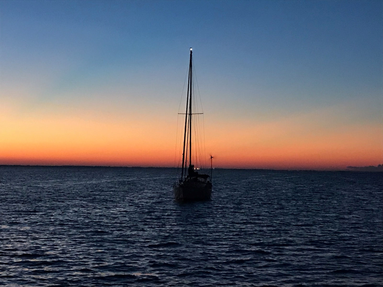
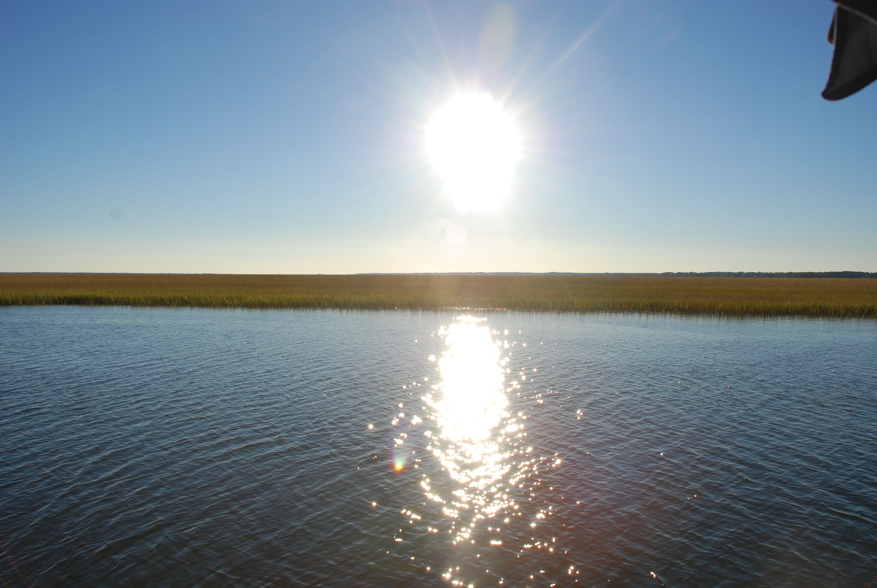
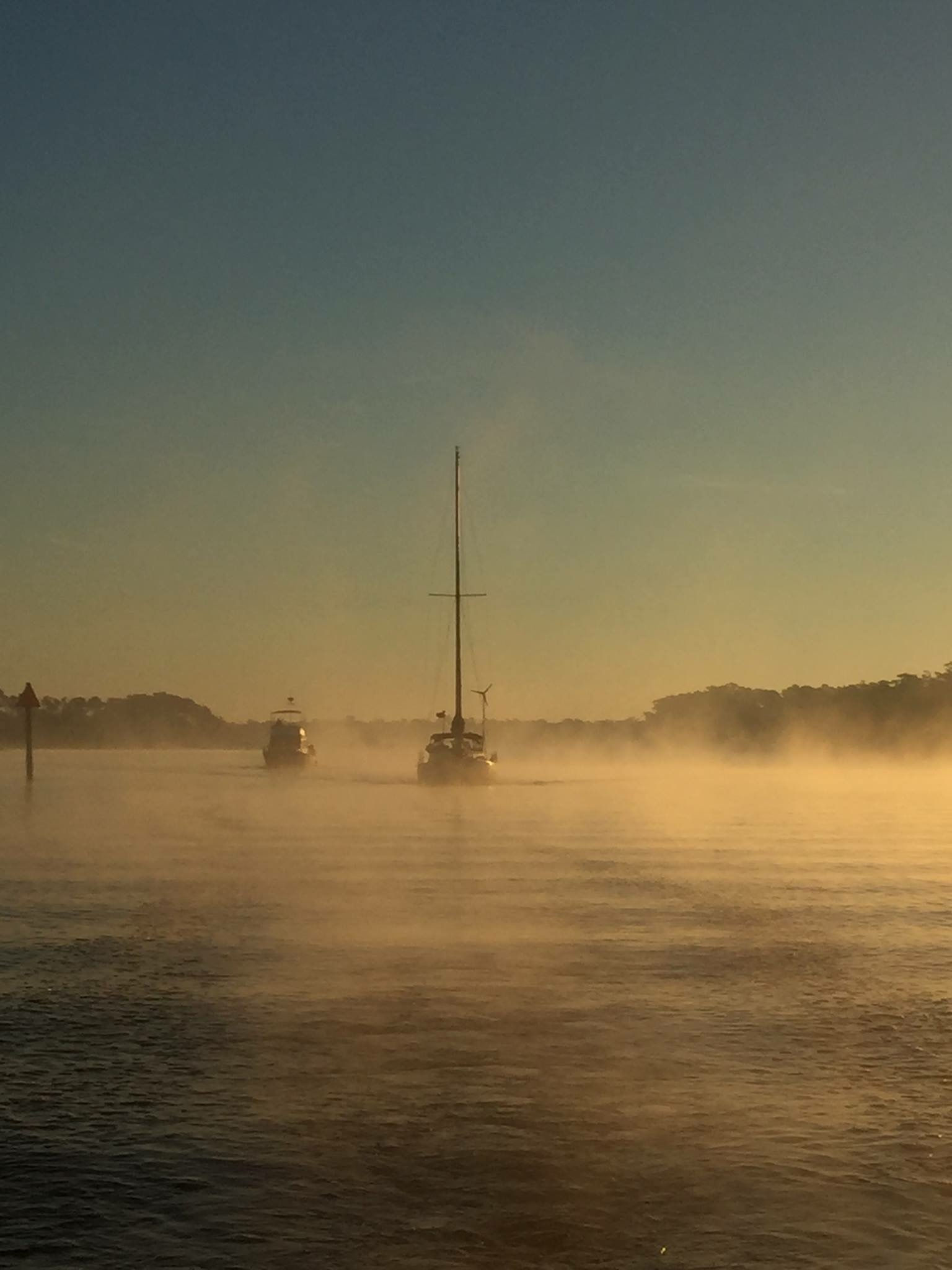
As you know from the last post, we waited a day to leave Cocoa because a gale warning was up, and the days afterward showed light winds. Well, we left Cocoa on the 24th expecting light and variable winds…suckers! We didn’t get gale force winds, but we had them in the 20-30 knot range the whole day. I can’t believe they can’t forecast winds any better than they have been. It sure makes passage planning difficult. At least it was warm, highs in the low to mid 80s…yay! We left around 7 AM and were treated to a beautiful sunrise:
IMG_2635cmp

We cruised to Vero Beach and all of us were able to get a mooring ball, the sailboats tied together and the trawlers tied together. We went ashore long enough to check in and pay, and then back to the boats for dinner. We really like Vero and it has appeal to the general cruiser community with the bus system, close proximity to provisioning, restaurants you can walk or dinghy to, and a 20 minute walk to the beach. It is known in the cruising community as “Velcro Beach” because people get comfortable there and don’t want to leave. We opted to stay only one night and move on to spend more time in Stuart. It was a warm night and we sat out in the cockpit and chilled after dinner. We also got destroyed by mosquitoes and no-see-ums, which really sucked the days after!
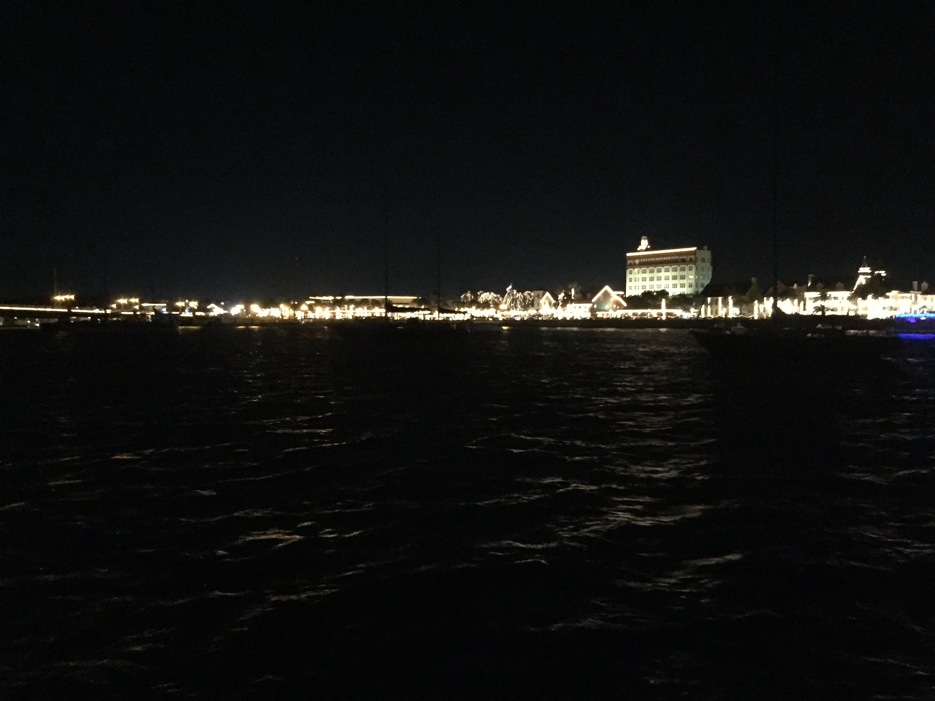
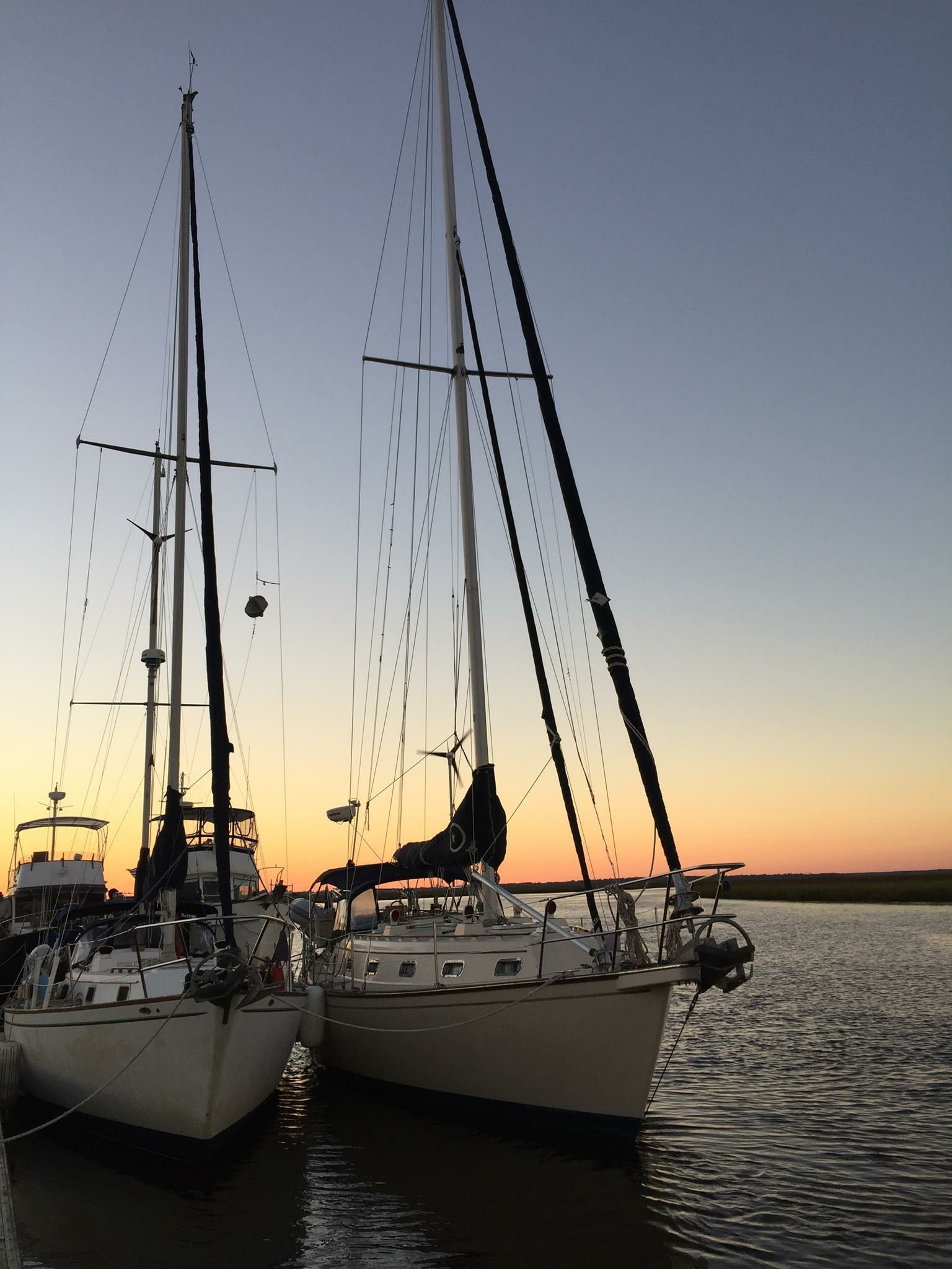
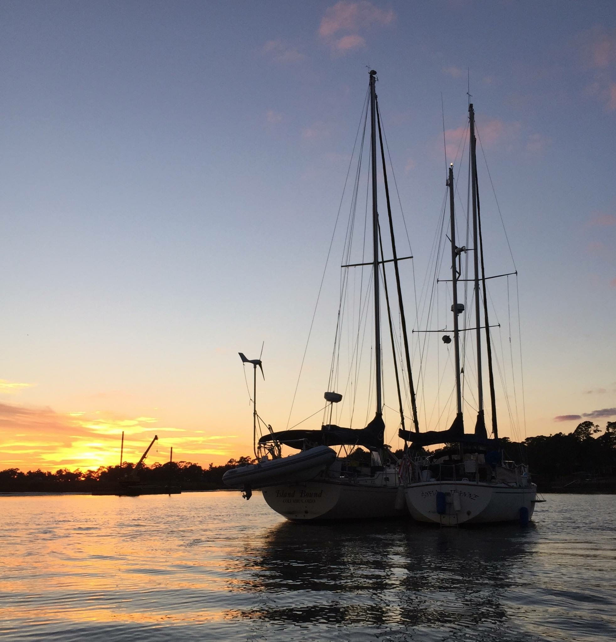
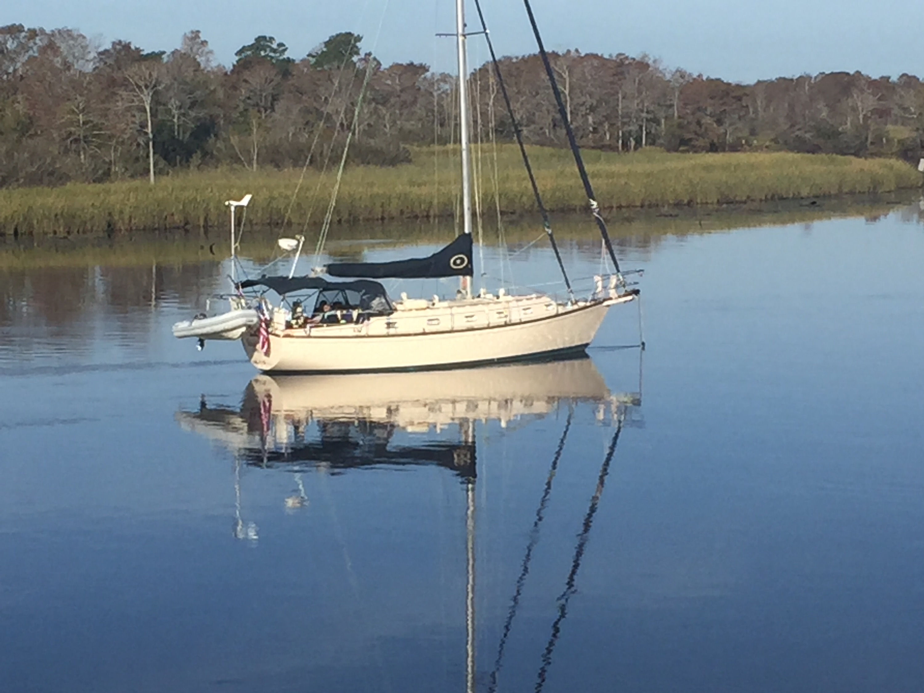
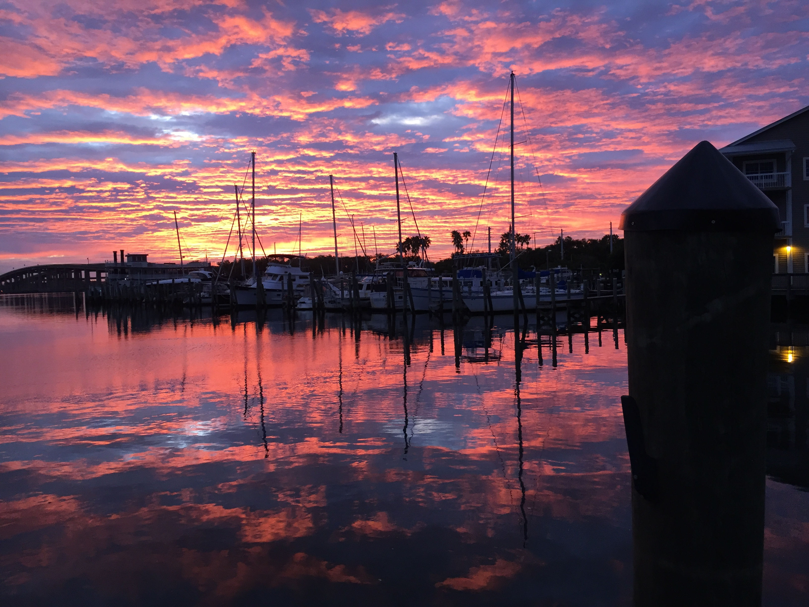
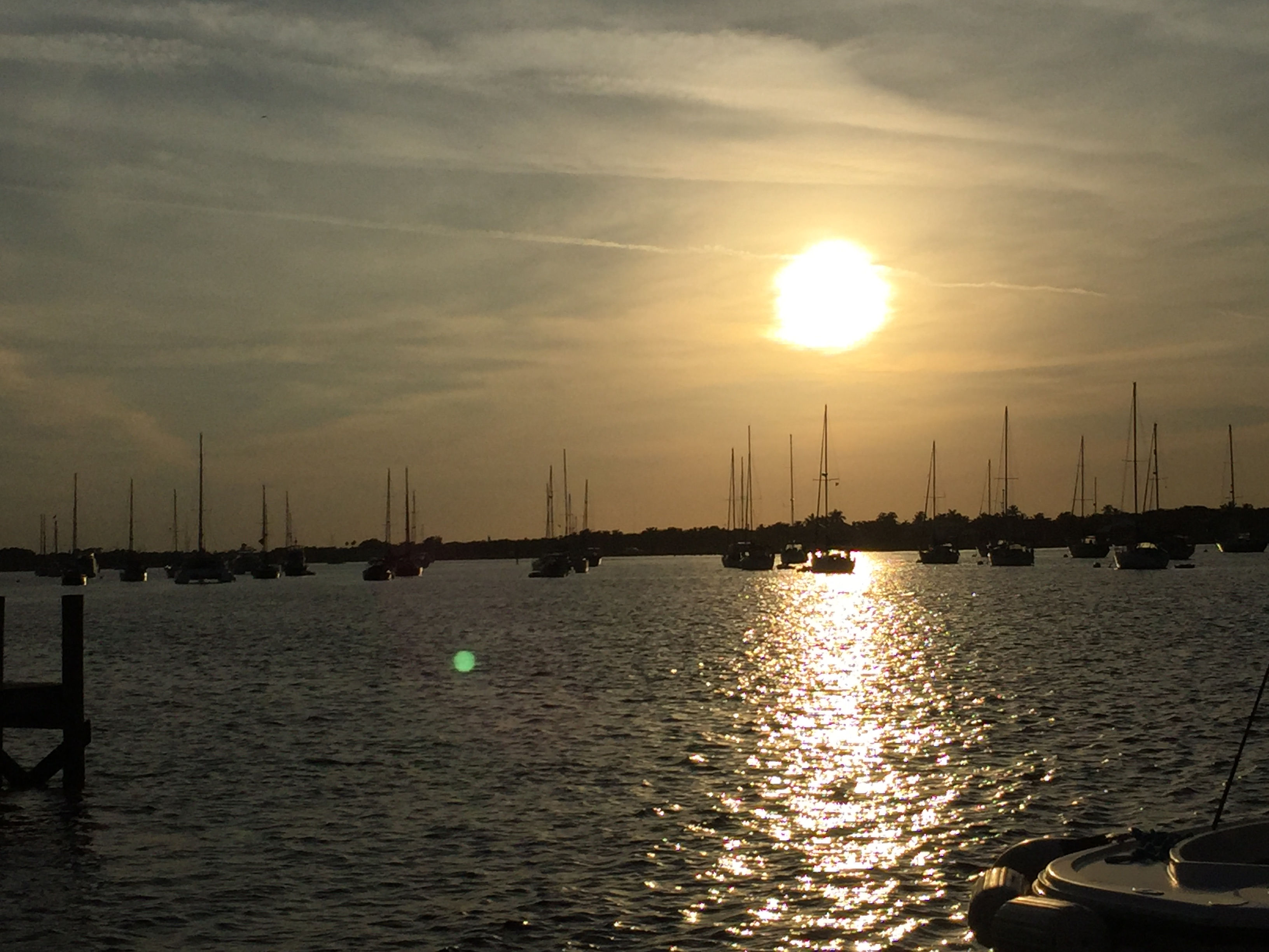
We left the next morning and cruised the ICW to the St Lucie River, then turned right to go up the river to Sunset Bay Marina where three of us we were able to grab mooring balls (a difficult feat for 3 boats this time of year), and Kurt and Sharon opted for a slip so they could move stuff from their old boat stored in Indiantown to this new boat. Prices have gone up at the marina, probably because their popularity has increased dramatically the last 3 years. It is 8 miles off the ICW, but the marina is very well kept, has a shuttle service that runs every day, is a short walk to downtown Stuart, and a short walk to restaurants, Publix, and liquor store. It seems like it has become “the” place to go, and many cruisers stay for extended time periods, some the entire winter. We are spending at least 4 days here and will consider staying as long as a week. Here is a picture of the mooring field around sunset:
IMG_2636cmp

People often ask, “what the hell do you do all day when you stay for days at a time?” Usually, we go ashore and explore, provision, or do boat work. Today I had to clean out the bilge as it was starting to smell rank! One of the only things I don’t like about the typical Island Packet sailboat, is that the anchor locker drains to the bilge. We anchor in all kinds of mud and sand as we move south, and although we have an anchor wash down pump, and use it religiously, ultimately some muddy water with all of the living creatures gets into the bilge. It doesn’t take long to start to decay and stink the place up.

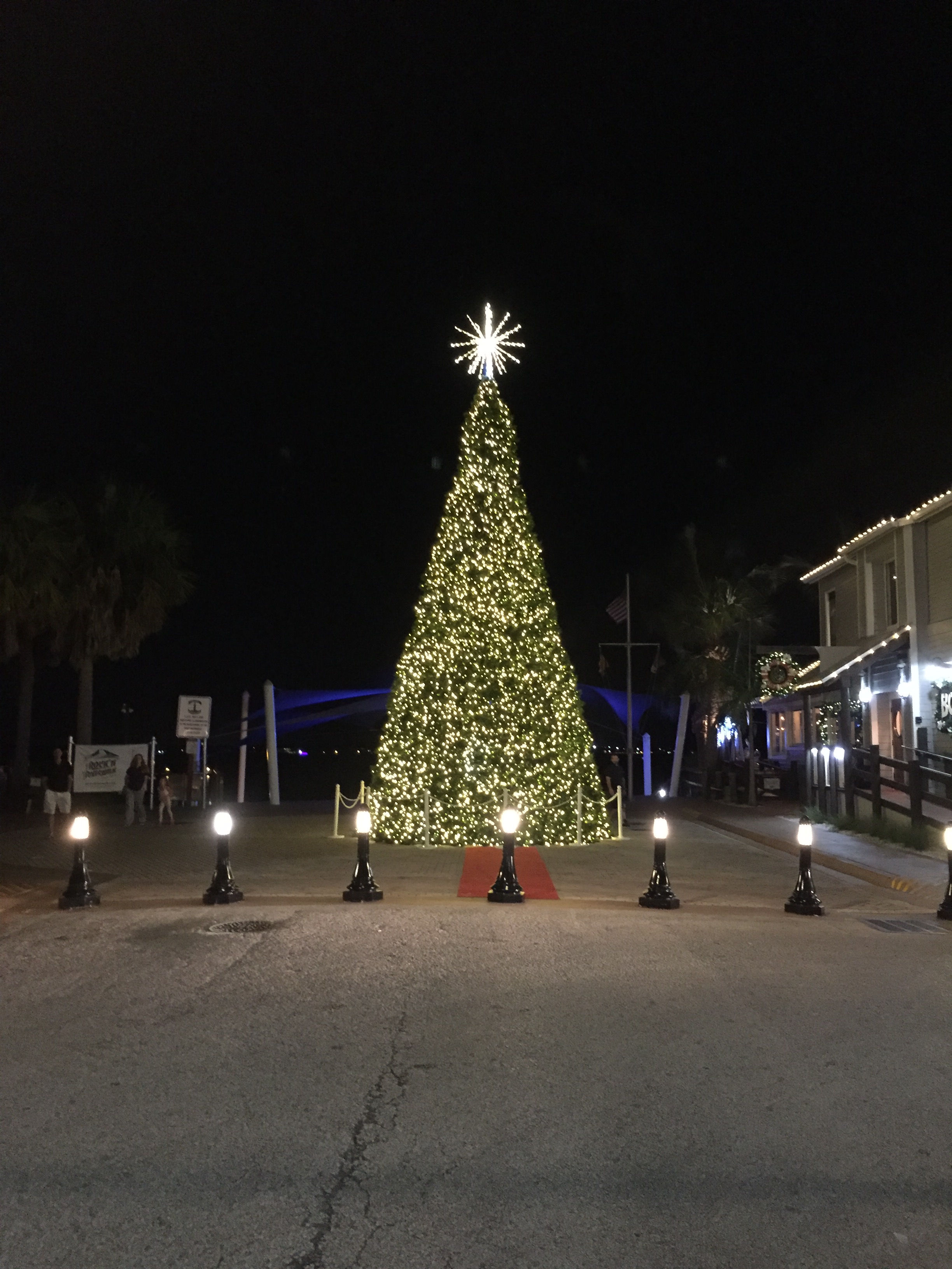
Here is the Christmas tree in downtown Stuart…it sure doesn’t seem like Christmas yet, in spite of all of the decorations!
IMG_2638cmp

Giving thanks…and pigging out!

11/23/18
Cocoa Village Marina
Cocoa FL
Posted by Bill

Well, we hope everyone had a great thanksgiving! I have always liked thanksgiving, getting together with friends and family, pigging out on great food, and none of the pressures of gift selecting, shopping and giving that Christmas brings. It is always a good time to reflect on the many blessings in your life, and I spent a lot of thought time on it this year. We are so blessed to have been given our lot in life, with great families, wonderful children and grandchildren, and the opportunity to make your own life with the freedoms this country offers. We have been given many opportunities in this life and we worked our butts off to achieve the lifestyle we have enjoyed. The many setbacks and challenges in life are also blessings in disguise, as they strengthen you and also lead you in different directions. We have certainly had our share of those too. There are so many people to thank along the way, especially parents and the people who sacrificed to give us the freedom and opportunity we have, but I especially thank God for all that has been given to me, especially all of the opportunities to earn the life I have. In cruising mode, we miss our family and friends back home very much this time of year. But, we have also been blessed with close friends that we travel with, and the cruising community. Our little flotilla had a great feast yesterday…each boat cooking different portions of our meal, and then getting together to eat and enjoy our friendships on Kurt and Sharon’s boat, Steel Away. Yes, we all have Lilliputian ovens and stoves but you can still cook one hell of a feast!
IMG_2634
IMG_2632

Here is a shot of the marina. It is very nice and the people who work here are amazing! One of the best marina experiences we have had in our years of traveling.
IMG_2631cmp
We were going to leave today, but a gale warning was posted for today, and we decided not to get our asses kicked and stay one more!

St Augustine and into Cocoa

11/21/18
Cocoa Village Marina
Cocoa FL
Position 28 21.468N, 080 43.545W
Posted by Bill

On the 17th, we rolled into St Augustine and took a mooring ball in the north field at position 29 53.700N, 081 18.553W. Thankfully, the winds died down below 15 knots and temps were in the low 80s…yay!!! We came into town on the day that the Christmas lights are first turned on and the downtown was packed with people and festivities. We had a great view of the lights along the waterfront from our boat:
IMG_2608cmp
IMG_2605cmp
The next day we went to the grocery to get food for Thanksgiving dinner. It was a 2 mile walk, but a few of the group Ubered back with the big items. On the 19th we ended up anchoring just south of the Memorial Bridge in Daytona at position 29 12.467N, 081 00.402W.

On the 20th we anchored in the Titusville South-3 anchorage at position 28 37.166N, 080 47.675W. It was supposed to be calm but the wind blew up to 20 knots again. At least it has been warmer. We all took food over to Kurt and Sharon’s boat and had a feast. It was a good time. Here is Island Bound in front of a beautiful sunrise this morning:
IMG_2626cmp
We tried to get into several different marinas to spend Thanksgiving, but the only one that had openings for us was Cocoa Village Marina. That made it a short day today which was good. Once again, winds were supposed to be light, but it blew up to 20 knots again! I am damned tired of dealing with the weather already and we have been gone less than a month! This is a nice marina, and we are set up to have Thanksgiving here, cooking on our boats. At least it is warm and sunny!!

We have been putting in long days and leaving early most of the way, and we are worn out. Gonna sleep in tomorrow!! Have a happy Thanksgiving!

Freezin’ our ass through Georgia

11/16/18
Jacksonville FL Free Dock
Position: 30 23.892N, 081 18.553W
Posted by Bill

On the 11th we anchored in Turners Creek, GA at position 32 00.856N, 080 59.366W. This was day one in the Georgia ICW and is one of our favorite anchorages along the way. The creek is very narrow and has a tricky entrance with a huge rock below the surface that must be avoided. The reward for making it in there is an anchorage with one of the best dive bars overlooking the boat. Cheap drinks, free popcorn and very strong pours…what else could you want? There is also a Publix grocery store, hardware store and several restaurants within a tenth of a mile of the anchorage. That set us up for traversing the 3 major shoal areas in the Georgia ICW, Hell Gate. The next day we went through Hell Gate at near high tide! Yay!!! We anchored at the Crescent River anchorage to set up for shoal area two…Little Mud River, and we were plagued by no-see-ums again…even worse than Mosquito Creek…sheesh! We timed the tide at Little Mud River just fine and then had a decision to make. Could we get through the third shoal area, Jekyll Creek and get anchored somewhere before dark, or should we lay up before Jekyll. The winds were unrelenting most of the day, and it was cold, and the next couple of days were bringing a frontal system with more rain and NE winds…come on man…we need a break. So we decided to divert to Brunswick GA and wait out the weather in Brunswick Landing Marina. We docked at position 31 09.055N, 081 29.993W. The marina is well protected, is close to a great bar, has free laundry, and free beer. Yes, you read that right…free beer…PBR on tap 24 by 7! We took a 2 day break from traveling and did boat work, laundry and beer drinking. It howled all the time we were there with bouts of rain. This also allowed us to wait for better winds to get through St Andrews Sound. You have to go into the ocean to get through this sound and with any kind of east wind component you get large rolling waves for more than an hour that have kicked our asses soundly! It looked like the 15th was light west winds, so we planned our departure accordingly. Of course, as soon as we left the marina the winds kicked up in the mid to high 20 knot range and temps were in the low 40s to boot! We got through Jekyll Creek with enough tide to keep from grounding, but as we started into the sound we were battered by the sea state. We made a decision to take an alternate route around the sound which had better protection from the seas, but it is not a well known route and it plagued by shallow waters. We had a rising tide, so Matt led the group through. It was the right decision. We pushed on and took a mooring ball in Fernandina Beach FL at position 30 40.227N, 081 28.129W. Winds still howling and cold as hell, but we finally made it to Florida!

On the 16th we had to wait for the tide to come up to transit yet another shoal area, so we left later than usual and targeted to stop at the free dock at Sister’s Creek by the St Johns River. We have never stayed there because it is always full when we passed by, or we were pushing to make St Augustine in one day. This time there was only one boat there so we lucked out. Here are a couple of pics:
IMG_2596cmp
IMG_2598cmp

Freezin’ our ass through South Carolina

11/10/18
Broad Creek, Hilton Head SC
Position: 32 10.775N, 080 46.697W
Posted by Bill

We enjoyed Charleston as always and hit most of our usual places to eat and drink. There is a grocery ¼ mile from the marina, so we stopped and stocked up on a few things. Here is a picture of all of us at our slips with the Ravenel Bridge in the background:
IMG_2571cmp

We left Charleston on the 7th and anchored in Mosquito Creek at position 32 33.422N, 080 27.050W. Mosquito Creek should be renamed No-see-um Creek. As soon as we got there we were attacked by swarms of the cussed things, all of us madly waving our arms as we dropped anchor. We went below and never came back up…it was nasty. On the way there, we went through a common shoal area called Watts Cut. We transited the cut a near low tide. The depth sounder showed 7 feet of water but we slowed to 3 MPH through the whole thing (for about 30 or 45 minutes). We were plowing through 2 feet of muck!

The next day we stopped in Beaufort SC and took a mooring ball at position 32 25.694N, 080 40.894W. We love stopping at Beaufort, and we had dinner at our favorite, the Old Bull Tavern, and breakfast the next day at Blackstones…also a favorite. We stayed 2 nights and went to leave early on the 10th. Everyone pulled away from the moorings except Larry. He was having trouble starting his boat. We circled for awhile and finally went and tied back up to the moorings, dropped the dinghies and went over to help Larry. We even called a couple of our buddies to tap their expertise. After failing to resolve the issue, Larry hired a mechanic who found the problem. We had planned to go to Turner Creek in Georgia, but it was now about noon, so we decided to stop at a new to us anchorage in the Hilton Head area. The wind was ripping in the mid to upper 20 knot range, so we picked Broad Creek for its protection. It was a great choice. Matt and Shirley tied to us and we enjoyed a nice anchorage.
IMG_2584cmp
IMG_2585cmp

I think we waited too long to leave Southport as the weather has been horrible…cold, rain and wind. Matt and I don’t have side curtains in our cockpits and we are exposed to the weather and have been freezing our asses off!

We made it…one of our favorite stops

11/5/18
Charleston SC
Charleston Maritime Center
Position: 32 47.345N, 079 55.464W
Posted by Bill

The trip from Georgetown to Charleston requires special planning skills if you travel the ICW. First you have to go through McClellanville which has a nasty shoal stretch for about 3 miles…depths reported as low as 2 feet. Then there is a shoal stretch for a couple of miles along Isle of Palms, with depths reported at 3.5 feet. Then you have to get through the Ben Sawyer swing bridge, which has restricted openings on the weekends. Finally you need to arrive at any Charleston marina at slack tide (no current for you land lubbers). The ebb currents in Charleston rivers can run faster than 3.5 knots, which makes it impossible to dock a boat like ours. Our boat draws 5 feet, so we needed to time all of these factors in our passage making. We left Georgetown on the 3rd during an ebb tide. That meant we would have favorable current down Winyah Bay until we hit the ICW entrance. None of us had notes that told us if the current in the ICW would be favorable or unfavorable from the entrance to McClellanville and we figured it would best to err on the unfavorable side to calculate the timing into the shoals there. That meant we needed to be underway around 8 AM. We were, and the current was mostly favorable all the way to McClellanville (note to self…take better notes), so we took the last hour or two very slowly, arriving just after low tide. When we got to McClellanville there were already 4 boats aground through the shoal area, so we idled the boats for about an hour until we could get through. Because of the factors for the next day, we decided to get closer to Isle of Palms than originally planned and stopped at a new to us anchorage, Whiteside Creek. We anchored in position: 32 52.387N, 079 42.984W. It turned out to be a great anchorage and we all got together for dinner on Steel Away.

Whiteside Creek:
DSC_0358cmp
DSC_0359cmp
DSC_0368cmp

We were about 10 miles from the shoals along Isle of Palms, and again not remembering what the currents would do, we took the worse scenario, forcing us to leave at sun up. We arrived at the shoals and the swing bridge much earlier than planned which made both of them uneventful, but now had to wait 3 hours for slack tide to get into the marina. We decided to anchor across the river from the Maritime Center just off Patriots Point and just wait for the slack tide. While anchored, several large container ships slid by us…damn they are intimidating when you are this close!

Early morning motoring:
IMG_2558cmp
Big boys!:
IMG_2562cmp

We got into our slips at 12:13 and hit the town of Charleston. If you follow the blog you know this is one of our favorite cities in the US and we always have a good time. We will be here a few days enjoying the city.

We broke our land based ties

11/1/18
Georgetown SC
Position: 33 21.958N, 079 17.405W
Posted by Bill

We departed on 10/30 and made a short run 35 statute miles to Calabash Creek at the Little River Inlet. We were a little late getting started as one of the boats had a starting issue. We all convened on the problem and eventually found a lose wire, and off we went. We anchored at position: 33 52.357N, 078 34.203W. It is a small anchorage and we discovered 2 boats there when we arrived. I proceeded to anchor next to a large Fleming, and immediately the guy comes out on deck and says “I have 60’ of anchor chain out. You shouldn’t anchor there because your too close to the channel, among other things.” For those of you that are not cruisers, it is good practice to discuss how much chain everyone around you has out because you will swing with current and wind and want to swing without hitting anyone around you, which is much more likely if one boat has a larger or smaller swing radius than the others. Now we have anchored in Calabash Creek several times and I have records of where we have anchored, so I am aware of the channel and what spots are safe. So I ask Mr Flemming “I am not in danger of swinging in the channel, but what ‘other things’ am I too close too?” He says “well…you are too close to me.” I am about 2 ½ boat lengths from this guy, and I am thinking about all of the anchorages in the Florida Keys and Bahamas where we have been right on top of other boats, which is very normal in crowded anchorages, and I’m thinking this guy must be new to this. I was going to ignore him and settle in where we were, but I thought…there is another spot over there that would be ok and I wouldn’t have this guy chewing on my ass all night, so we move. He suggested we go further up river, which I DID ignore. We thought about taking cocktails over to his boat and imposing happy hour along with an uncomfortable conversation, but hey, this is our first night…let’s just chill. We certainly could have talked about how you don’t come into an anchorage and take a spot that leaves multiple other spots unusable for someone else, which he did, and how the courteous thing to do is select a spot that allows as many boats as possible room to some in. He obviously didn’t want to share.

On the 31st, we picked up Kurt and Sharon on Steel Away, motored past the flood stricken area of Socastee (what a mess it still is…those poor people), through the Waccamaw River (one of my favorite stretches of the ICW (Intracoastal Waterway), and up Thoroughfare Creek to an anchorage called The Hill. We anchored in position: 33 30.905N, 079 0869W. As always, the anchorage was delightful. We all went ashore, let the dogs run, and took a dinghy ride through the canals until the sun set.

All of us at The Hill:
IMG_2556cmp
Island Bound anchored at the Hill:
IMG_2554cmp

We departed the next day and road the Waccamaw River to Georgetown. Along the way we awarded an Ass Captain Award to a boat called The Big W. We weren’t sure if the W stood for “wanker” or “weeney” or “wake”. If you are familiar with the blog, you know of the Ass Captain Award, inspired from the movie Office Space, where asshole behavior earned the label Ass Clown. We adapted it to cruising and boating asshole behavior…thus Ass Captain. This guy passed us with a huge wake, never calling on the radio to request a pass. The wake his us so bad that it rearranged the interior of our boat. Stuff went flying everywhere, even off of our secured “bar”. He must have done it to everyone ahead of us because we could hear people on the radio screaming at the asshole most of the day. We decided to stay another day here in Georgetown as there is heavy weather hitting tomorrow’s anchorage near Isle of Palms, and that anchorage is very exposed to bad weather. We will just chill and enjoy the shore line of Georgetown with bars and restaurants.