Monthly Archives: November 2016

Happy Thanksgiving

11/27/16
Stuart FL
Posted by Bill

I hope everyone had a great Thanksgiving. As I said in the last post, it is always a time that we especially miss our family and Ohio friends, as we always had get-togethers with all. That being said…we had a delightful time with our cruising family here in Stuart. Hayden and Radeen on Island Spirit scored a great table at the marina sponsored Thanksgiving dinner. In addition to Hayden and Radeen, we had Matt and Shirley on Sofia Jeanne, and Kurt and Sharon on Byrd Ketcher, and a couple that we just met…from Travelin’ Light. There were over 100 people in attendance, and the marina provided turkey, dressing, mashed potatoes, gravy and cranberries. Everyone attending brought a side dish or dessert. It was really good and we had fun at our table!
img_2642
img_2636
img_2638
img_2639

On Friday, we walked to the historic downtown area of Stuart to browse the many shops and restaurants, and check out the tree lighting ceremony..complete with acrobatic elves:
15202774_1737924826457086_2797465050323121497_n
Even Grady and Bart got to come, all dressed up for the occasion:
15109494_10208449957074638_3443914638727925675_n

Yesterday, Matt and Shirley rented a car and we all went shopping for provisions and some general stuff that we needed, then had a cookout and sing-a-long around the fire with several others here at the marina. It was a great time hanging out. Looking forward, we are going to stage overnight at the Lake Worth Inlet and run offshore to Biscayne Bay/Miami later this week. We are watching the weather and so far it looks like Friday is the next best day for an offshore run. In the meantime, we will continue to enjoy Stuart, the great weather we have been having, and the great sunsets:
15253565_10208457094373066_2861708870770407074_n

Stuart Florida

11/22/16
Stuart, FL
Position 27 11.820N, 080 15.740W
Posted by Bill

We left Vero Beach on the 20th and went down the Indian River in some high winds all day. They were out of the north and the river flows north-south, so we had some rapids-like waves most of the day. At the Saint Lucie Inlet, we turned and went up the Saint Lucie River and went 8 miles up to the town of Stuart. Friends Kurt and Sharon on Byrd Ketcher were there and said that there was a great mooring field with lots of places to eat and shop in walking distance. We decided to change our plan of spending Thanksgiving in West Palm/Lake Worth and check out the mooring field. This place is really nice. Not only did we have a union of the 2015 Keys/Bahamas travel group, but we found friends Hayden and Radeen from Island Spirit! We booked a mooring for a week, the first time we have stopped for more than a couple days since we left. It is difficult to keep moving every day without a break we were ready for one. Yesterday we slept to almost 9 AM, and then walked to the grocery store, took a long dinghy ride to check out the shoreline. Today we caught the marina shuttle and went to the liquor store and West Marine, then came back to the boat for a nap in the cockpit. It was a beautiful day, warm with a nice breeze, and we have a fantastic water view. The marina here is extremely clean and well appointed. There is a great captains lounge with a popcorn machine, and really nice sitting areas surrounding the marina. Tomorrow we expect to make another run to the grocery (you can only carry so much stuff on foot…lol). The nearest grocery is a Publix and is just less than a mile. The liquor store is about 2 miles and West Marine is 3. The marina shuttle only runs a couple times a week, but you can use their bikes any time, and it is not really that far of a walk to any of those. I also took a 2 day break from boat work…wow, is that nice! Back on it tomorrow. We hear that the Thanksgiving feast at the marina is really nice and we are looking forward to checking it out. This is one of those times of year that we really miss our old family traditions, and seeing everyone, so we need something to keep our spirits up!!! Here are some pictures of our view from the mooring we are on:
dsc_0208
dsc_0213
dsc_0212
dsc_0210

Marineland to Vero

11/19/16
Vero Beach FL
Position 27 39.600N, 080 22.244W
Posted by Bill

On the 17th we departed Marineland and motored the ICW to Rockhouse Creek at Ponce Inlet, anchoring at position 29 03.701N, 080 55.878W. It is just south of Daytona Beach. We have anchored several times before in this creek. There is a great beach there and a beautiful view of Ponce Inlet and the lighthouse there. We all took the dinghys to the beach and let Grady run and swim. He is like a furry kid, and it is so much fun to travel with him. He had a great time. The next day we motored to Cocoa/ Cocoa Beach and anchored in position 28 21.122N, 080 43.160W. We have also stopped here every trip north and south. We checked out the really cool hardware store they have and had some Jurassic appetizers at a local restaurant. The trip through New Smyrna Beach was another round of boats tossed up on shore, tarped roofs on houses and damaged docks from hurricane Matthew. We have seen this damage all along the route from South Carolina through New Smyrna. More pics:
img_2635
img_2632
img_2634
Many of the boats were clearly “live-a-boards” and people that did not have a lot of money. We feel for them. We also saw tons of dolphins and manatee along this route. We have been seeing dolphin regularly since the Georgia/South Carolina border, but they have been very prevalent since the Florida border. The manatees were in herds of dozens, many in the channels that we traverse. We have not seen manatee in the channels like this ever before. It was crazy, and we had to dodge them for hours. Very cool.
dsc_0181
dsc_0185
dsc_0177
It was also cool to see the sun rises over the last several weeks. I can count the number of sun rises I saw in my dirt dwelling life with my toes and fingers, and it is amazing to me to see them every day, most rising above the water with dolphins, pelicans and various wildlife filling the scene. Very cool, despite the fact that we have to get up at the butt crack of dawn while in this travel mode.

Today we motored to Vero Beach, one of our favorite stops along the Florida coast, and took a mooring. It ended up being a crazy day on the Florida ICW, especially since it was a weekend day. You all know how much I hate the Florida ICW on the weekends if you have been following the blog. Today was not much different. Vero was pretty full, as it always gets for Thanksgiving. This year we have decided to stay one night here and move on to a mooring field and marina in Stuart Florida. We are meeting up with Kurt and Sharon on Byrd Ketcher, and it will be a major reunion!!! Just after dark we watched a rocket launch from Kennedy Space Center. It was very cool!!! We are going to miss spending some time in Vero but are looking forward to a new place in Stuart. There have been many stops along the route south this year that are new stops for us, and that has been really fun. We have found many cool anchorages that we will definitely return to. We will chill in Stuart until after Thanksgiving and then begin the trek through the Keys. The last couple of weeks has been fun but very tiring. We are looking forward to some down time and enjoying the nice weather now that we are in central Florida.

Finally back in Florida, but looking for warm weather

11/16/16
Marineland Marina, Palm Coast FL
Position: 29 40.140N, 081 12.887W
Posted by Bill

On the 14th, things had calmed down enough that we could transit St Andrew’s Sound just south of Jekyll Island. If you remember, last fall we got our asses kicked going across the sound in high winds out of the north. Smarter this year, we waited until the weather calmed down. We made our way into Florida and past Fernandina Beach, one of our usual stops. The marina and mooring field are still closed from hurricane Matthew damage. We started to see much more evidence as we got into southern Georgia and continue to see it through Florida, mostly damaged docks and boats.
img_2622
img_2623
img_2620
img_2621
dsc_0158
dsc_0164
dsc_0172
dsc_0170
dsc_0168

We pressed on and tried to get a spot on the free dock outside of Jacksonville FL, but it was full. We doubled back to the Fort George River, one of our favorite anchorages, but we arrived at low tide and found the river entrance to be shoaled over. After running aground and backing off, I was able to find a deep spot in the entrance to get us in to the river and anchorage area. Sophia Jeanne followed and we rafted off to them after they set their anchor in position 30 26.600N, 081 26.489W. That night we ate dinner together and enjoyed the Beaver Full Moon over the water. It was spectacular!

On the 15th we upped anchor and made it to St Augustine, taking a mooring in the south mooring field. We went ashore and enjoyed our favorite happy hour in St Augustine, then partied with Matt and Shirley on our boat for several hours. Great fun!! Picture of the mooring field:
dsc_0175

Today we did a short day run to Marineland marina on the Palm Coast. We did some boat maintenance and walked the beach.
img_2630
img_2629
It was finally a warm day. The last 5 days we have been freezing our asses off in low 50s temps at night and mid 60s in the day. Funny how your perspective changes after you live in the south for a few years. It was nice to take a short trip and enjoy the beach as we have been running pretty strong.

The next 3 days will take us to Vero Beach where we will meet up with good friends Kurt and Sharon on Byrd Ketcher. We also expect to see many other friends that will be gathering there for the Thanksgiving festivities that are very popular. We really enjoyed it last year and will be looking forward to seeing people that we have met and catching up with them.

Layover in Jekyll Island

11/13/16
Jekyll Island, GA
Position:31 02.690N, 081 25.366W
Posted by Bill

On the 10th, we departed Beaufort and cruised into Georgia, anchoring in Turner Creek at position 32 00.900N, 080 59.363W. We debated on several alternatives to position ourselves for the first of 3 major shoal areas in Georgia, Hell Gate. Neither of us had anchored in this creek and we heard mixed reviews about it’s viability as a good stop over. We were pleasantly surprised. The creek is very narrow, but the holding was excellent, and there were several shopping and eating options within a short walk of the anchorage. You have to pay a fee to bring your dinghy ashore at the local marinas, but it is worth it. We checked out the hardware store and the Publix grocery store, and then found a dive bar right on the water that was tucked away behind the surrounding commercial real estate. You really had to know that it was there, and after one look, you first thought…I think I’ll steer clear of this place. It was fantastic! No need for happy hour, the drinks were incredibly cheap, and strong! Plus free popcorn!! The place was packed with locals. One guy asked us “How did you find this place? No one but locals every comes here.” We told him we were anchored 150 feet off the back of the place, and he was very welcoming. This was a major find, and we had a great time!!!! A view of the anchorage:
dsc_0145

The next day we moved on to the Crescent River to stage for the next shoal area, Little Mud River. We faced a major current for the first several hours and we were worried that we would not pass Hell Gate with enough tide to keep us off the bottom, but we made it without incident. As soon as we slowed the boat to put the anchor down in the Crescent River, the no-see-ums swarmed like a plague. If you have never had to deal with them you are lucky. We ducked down below and missed a great evening and sunset because of those pests!! You can barely see them and they bite like mosquitoes. The bite itches something fierce…more than mosquitoes. We anchored in position 31 29.334N, 081 19.703W.

Yesterday we upped anchor a little later than first light because we needed to time the tide through Little Mud River and target Jekyll Creek for later in the day…both major shoal areas. We had the current with us most of the day and actually had to put the boat in neutral for several hours…still drifting at 3 to 5 miles per hour. The currents in Georgia are crazy, and the tides are 8 to 9 feet! A cold front was moving through and the wind was gusting over 35 knots for most of the day. We moved through several open water areas called sounds that provided little protection from the wind, and coupled with lower temperatures (in the low 60s), the day was horribly miserable. We have had more than a month of great weather and it made it more difficult to deal with the mess that Mother Nature dealt to us on this day. I had 3 sweatshirt/fleeces and foul weather gear on, including ski gloves, and I was shivering cold while driving the boat. The wind and current made it very challenging to steer the boat, especially through the shoal areas. We had originally planned to anchor in the Jekyll Creek area, but when we got there and tried to anchor, we changed our plan. There were about 7 or 8 boats in the anchorage struggling to keep from dragging, and the sea state and wind really made us think twice. We called the marina at Jekyll and took the last 2 spots on the face dock. We were so thankful to be able to tie up to a slip. Afterwards, we watched the boats in the anchorage struggle all night, and one power boat dragged into a sailboat. Another sailboat dragged about 300 yards overnight and was sitting just off our port beam (left side) when we awoke this morning. It was crazy and we were glad we weren’t in the anchorage!!!! Today’s forecast was more of the same, and we have had our asses kicked in the next sound on the southern route, so we stayed an extra day and explored Jekyll Island. We have always wanted to check it out but never have. The marina had a free golf cart so we drove around and checked it out. Jekyll was home of the Millionaires Club back in the late 1800s, Jekyll Island became an exclusive hunting club for families with names like Rockefeller, Morgan, Vanderbilt, Pulitzer, and Baker. They established a millionaires club and built a “Disneyland” type atmosphere for the members to enjoy. When German submarines were discovered off shore in the mid 1940s, they freaked out and donated the island to the state of Georgia. The once private retreat is now part of The Jekyll Island Club National Historic Landmark District, one of the largest preservation projects in the southeast. Here are some pictures of the historic area with the millionaire’s mansions:
img_2619
img_2610
img_2612
img_2614
img_2617
Some of these are “cottages” of Rockefeller, Goodyear, Vanderbilt, Flagler, etc… You can go inside some of them and some are now museums, but we didn’t really check that out. It is a cool island and we are glad we stayed another day to see it. As it usually turns out…fate was involved. This morning about 7:30, the shore power went out, just as I was making coffee. At first I thought it was a problem with our boat because other people had power on the dock. Through my troubleshooting, I found that we only had 60 volts coming from the shore power connection, clearly a problem with the marina, but I also noticed that we had some burn marks on the receptical where the shore power goes into the side of the boat…not good! Last summer I had to replace the air conditioning receptical for the same reason, so I swapped out that receptical for the burned one. Now I will have to replace the other before we use air conditioning or heat. These types of problems are the leading cause of fire on a boat, so I am glad I found it before we had a problem. It turned out that a fuse had blown in the marina, and that was the real problem, but had I not gone through the troubleshooting process, we may have had a major problem, and somewhere other than a dock, where the problem is easier to deal with. Now if I could only fix the problem I have with our newly installed wind generator…but that is the subject of another post!! Tomorrow we get back on the “road” again, pushing into Florida!

Ready for Georgia

11/9/16
Beaufort, SC
Position: 32 25.704N, 080 40.871W
Posted by Bill

We departed our slip in Charleston around 7 AM on the 7th, timing the slack tide because the current is so difficult to deal with in the Charleston rivers. We moved across the Ashley river and dropped anchor to wait out a bridge closure on Wapoo Creek. The bridge there is closed from 6-9 in the morning and again from 4-7 in the evening to deal with rush hour. We opted to anchor for a few hours versus drive around in circles. That day we ended up in Mosquito Creek, in position 32 33.403N, 080 26.866W, about 2/3rds of the way to Beaufort. We found out why the creek got it’s name…no-see-ums and mosquitoes the size of small birds! It was a gorgeous anchorage in spite of the bugs:
dsc_0140
In the middle of the night, I got up to check on the anchor and was treated to a sky full of so many stars that it looked like a TV screen with bad reception.

The next day we used the tide to get through a notorious shoal area called Ashpoo/Coosaw Cutoff and made way for Beaufort, which we had considered skipping. About an hour after we were underway, Matt called on the radio and reported that he had a major oil leak on Sofia Jeanne. He was able to make it to Beaufort and get a spare part delivered a day later, so we hung out for a few days on mooring balls, enjoying the downtown area and doing boat maintenance…of course. He got his part and made the repairs today, and we did some passage planning over happy hour drinks. We are now ready to push south in to Georgia. For the trip thus far, the tides have been very well aligned for us to traverse the shoal areas. Not so much for Georgia. We have 3 major shoal areas facing us and high tide is late in the day. It will be a little slower for us in this next week timing the tides and our stops. Also, the days are getting shorter. We will try to make it to St Augustine Florida by the 15th, and Vero Beach by the 19th. It will be a tough week of traveling.

The Beaufort mooring field:
dsc_0143

Since we hit Charleston, we have been seeing more evidence of hurricane Matthew, docks destroyed and boats up on land like this one:
dsc_0144

Finally, a picture that I forgot to post a few days ago. This was the sunset from the Awendaw Anchorage on the 3rd:
dsc_0135

Finally on the move and chillin’ in Charleston

11/6/16
Charleston SC
Position 32 46.722N, 079 57.228W
Posted by Bill

Well, the last 2 weeks have been pretty crazy. After the hurricane we headed to Cincinnati to my Mom’s memorial service. It was nice to see all of the family, but a sad time for everyone. Then we headed back with 1 week left to finish all of our boat projects and get the boat provisioned (liquor, groceries and spare parts). The good thing was, the weather has been absolutely beautiful since the hurricane. I kept running into set backs with the boat projects, not having the right tools or all of the parts, and I found several other projects that needed to be done while working on the list. The weekend before we left, I finished installing the wind generator, changed the oil in the engine, changed the fuel filter, rebuilt the head (toilet) in the bathroom in our cabin. During the install of the wind generator I found 3 other things that I also got done. 1) The packing gland needed to be adjusted where the prop shaft comes through the hull. This is a normal maintenance item, but requires working in a very small area with corroded hardware. It took forever! I realized after several hours that I had to replace the packing material. This is usually done with the boat out of the water because the packing keeps water from coming in to the boat where the shaft comes in. Having never done this in the water, I wasn’t sure how much water would rush in before I could complete the process, so I was apprehensive. I talked to the maintenance manager at the marina to make sure he could rescue us if something went wrong, and then took it on. It was a manageable amount of water and other than the difficulty of working in the small area the project went well. It took much longer than expected on a project that wasn’t even on the radar. 2) While working on the packing gland, I noticed that the bolts that hold the prop shaft to the transmission were all very loose. This is not good at all and could have resulted in a major issue had they come completely loose or sheared off, so they got tightened up. 3) While running wire for the wind generator, I noticed that the hose which drains the propane locker was cracked and leaking water directly on to the battery charger/inverter…NOT GOOD!!! Fortunately I caught it before there was any major damage or a fire. Replacing this hose was a major pain in the ass. You have to crawl under the chart table and work through a door that is about 18″ square, in an area that is full of wires. Doing most of the work requires you to contort yourself in positions your body doesn’t bend, and feel blindly through the process because you can’t look while you work. In the mean time, Tricia was re-inventorying everything stored below, getting groceries, and organizing everything. She is amazing at doing that, and it is extremely important to be organized and have everything stowed properly. The week before shoving off also included a run to Myrtle Beach for liquor and groceries, and a run to Wilmington for Costco, Trader Joes, and Harbor Freight. Those took one day each. I don’t know how we got it all done, but we were exhausted.

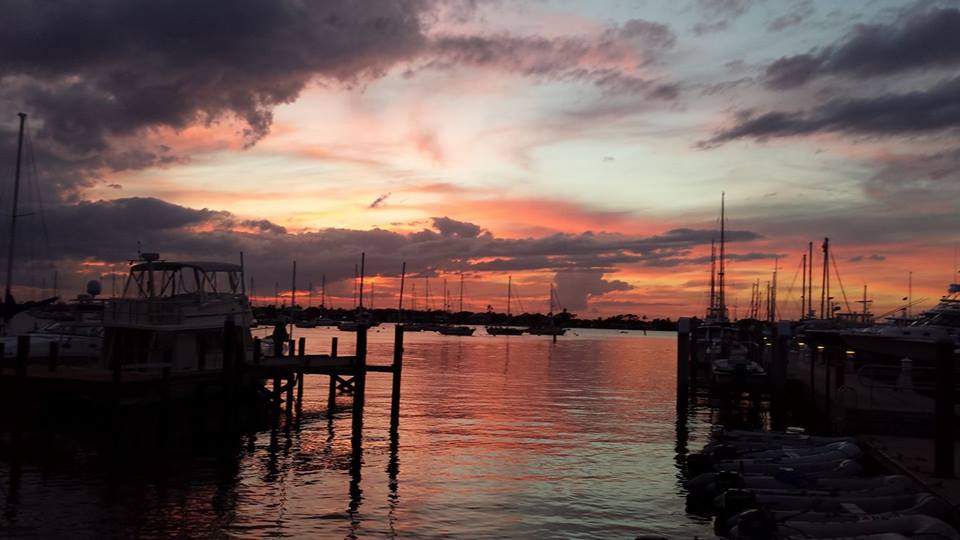
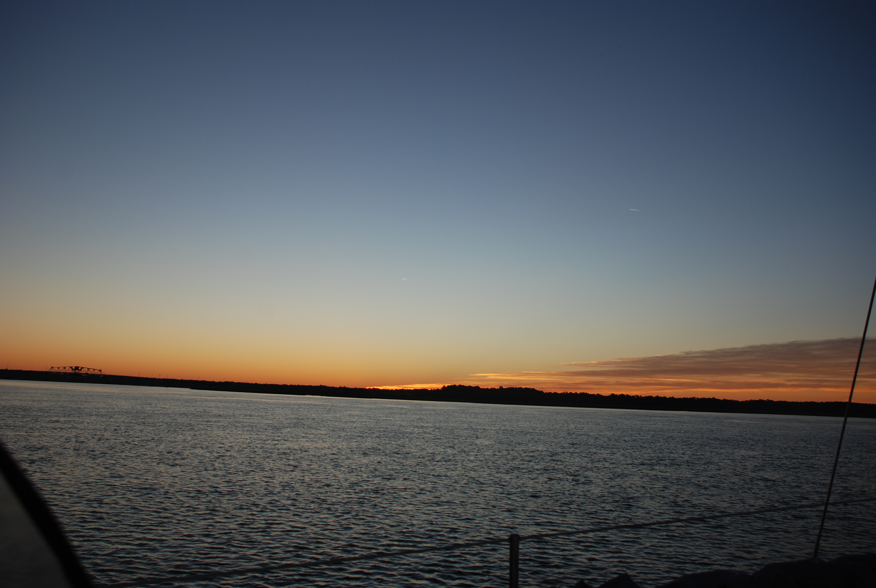
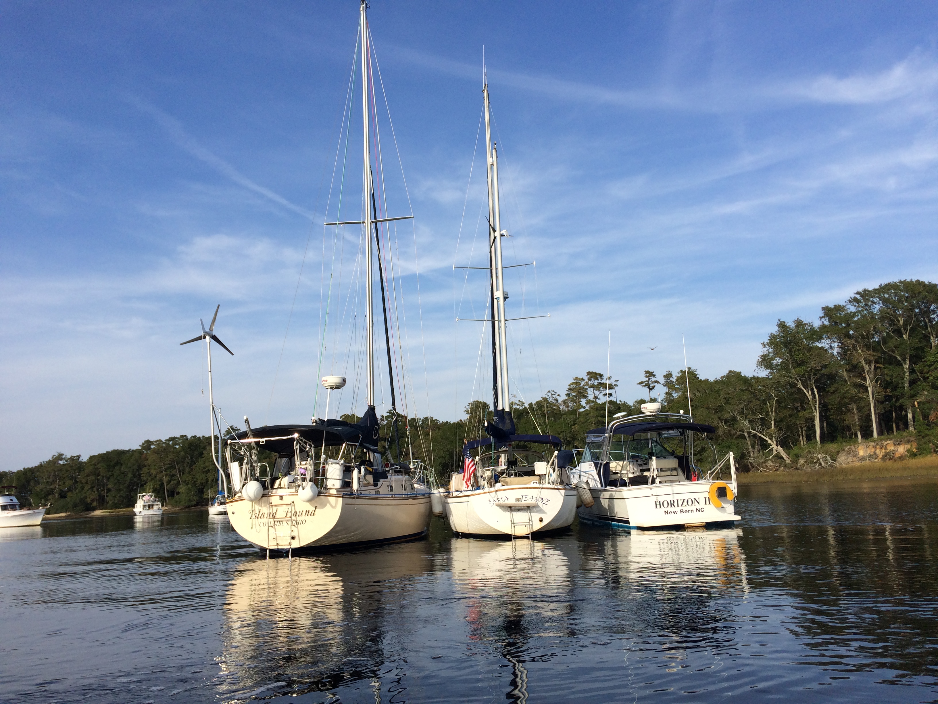
We took on fuel and shoved off on 11/1, and stopped in the Little River inlet for the first night, position 33 52.321N, 078 34.191W. We are traveling with Matt and Shirley on Sofia Jeanne, and Larry and Diane on Horizon 2. We rafted together on anchor and had a great time making dinner and enjoying cocktails on the hook. We rafted to Sofia Jeanne because they now have the best anchor…a Rocna. That anchor is amazing, sticking right away, resetting quickly in a tide change, and holding all 3 boats. We took turns making dinner for the first 3 nights and the first night was Matt and Shirley. When they started to make dinner, the propane solenoid stopped working, which stops the flow of propane to the stove…go figure. Fortunately, Tricia insisted we buy a spare, and after much difficulty Matt had it in place and started dinner. At the same time, I noticed an engine hose starting to show signs of a leak and had to borrow their rescue tape to keep it from developing further. This is the benefit of friends and traveling together!
Us at the anchorage:
img_2591

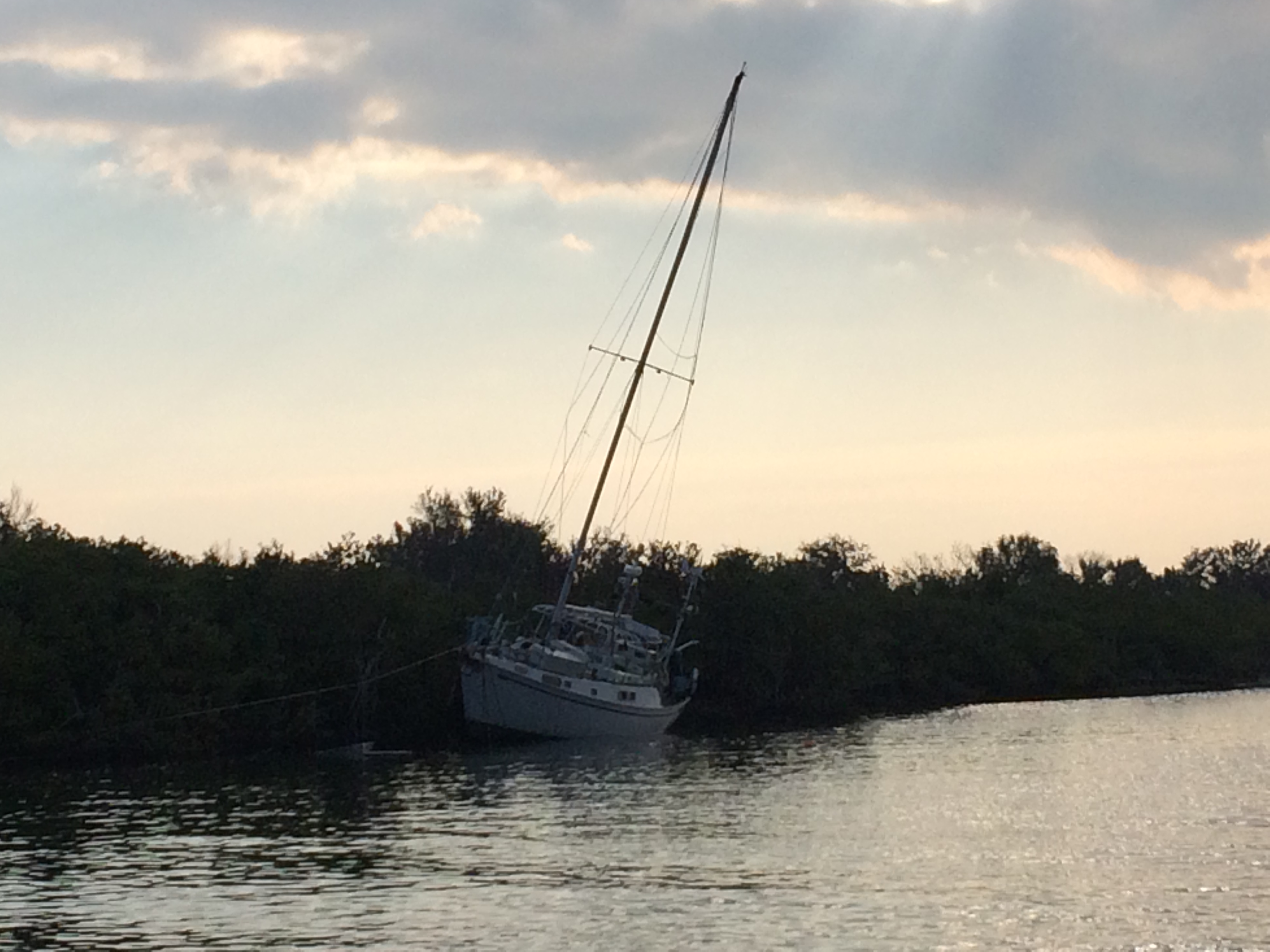
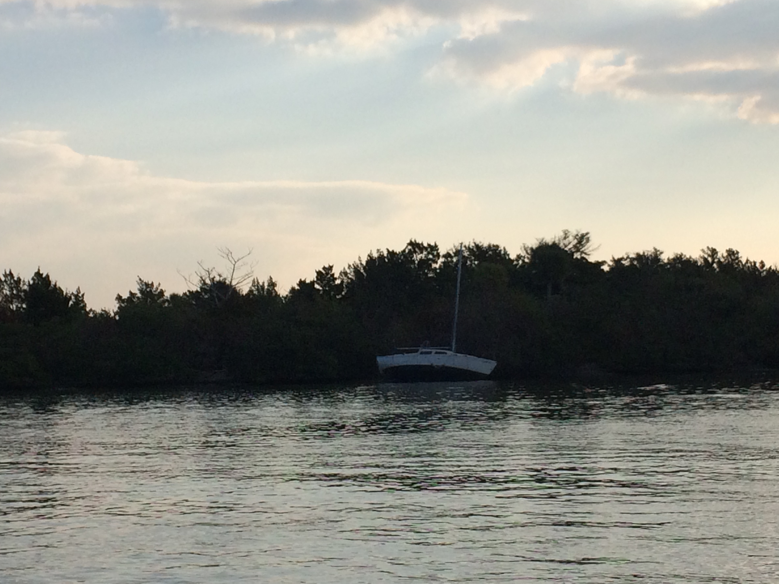
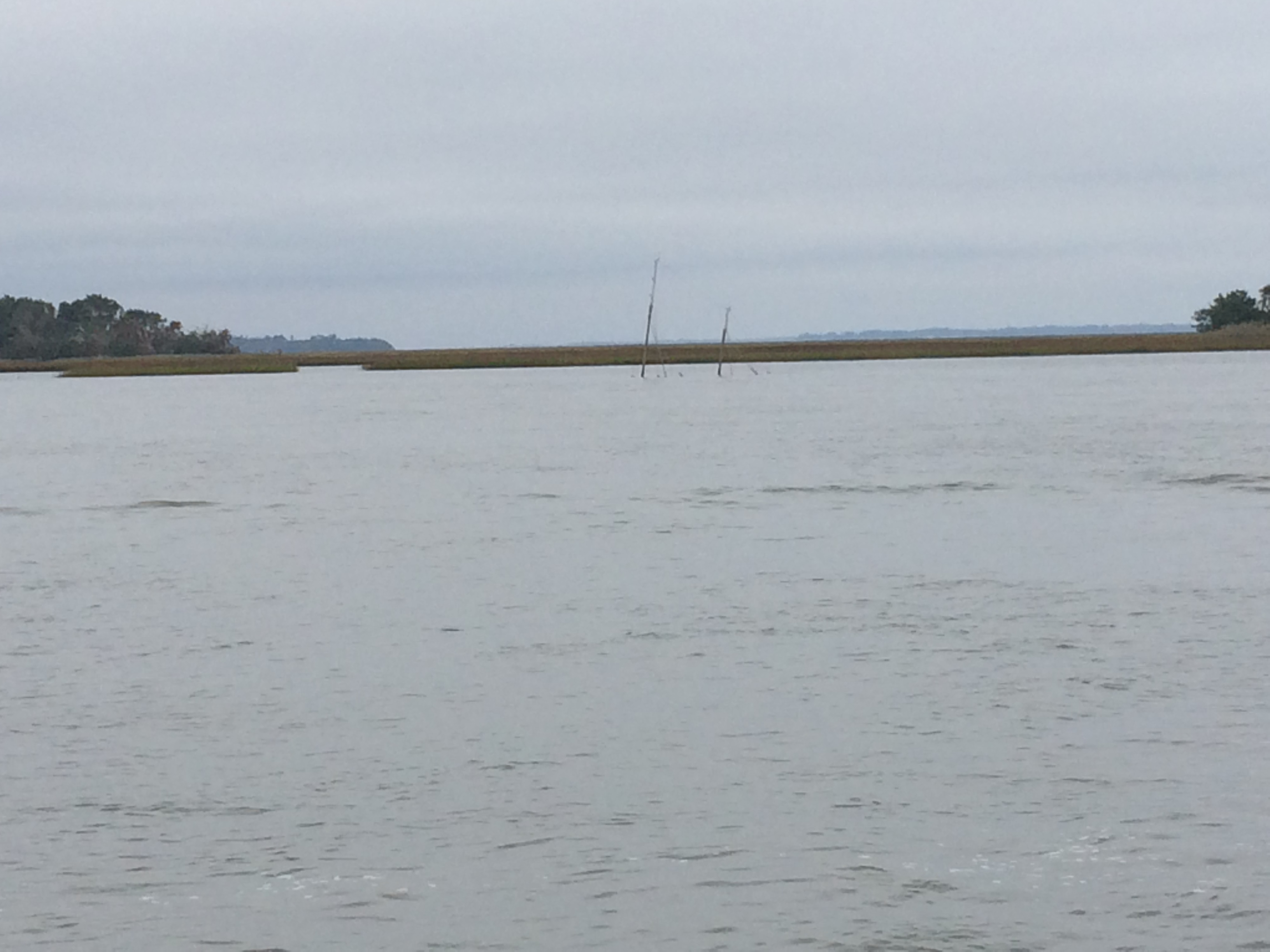
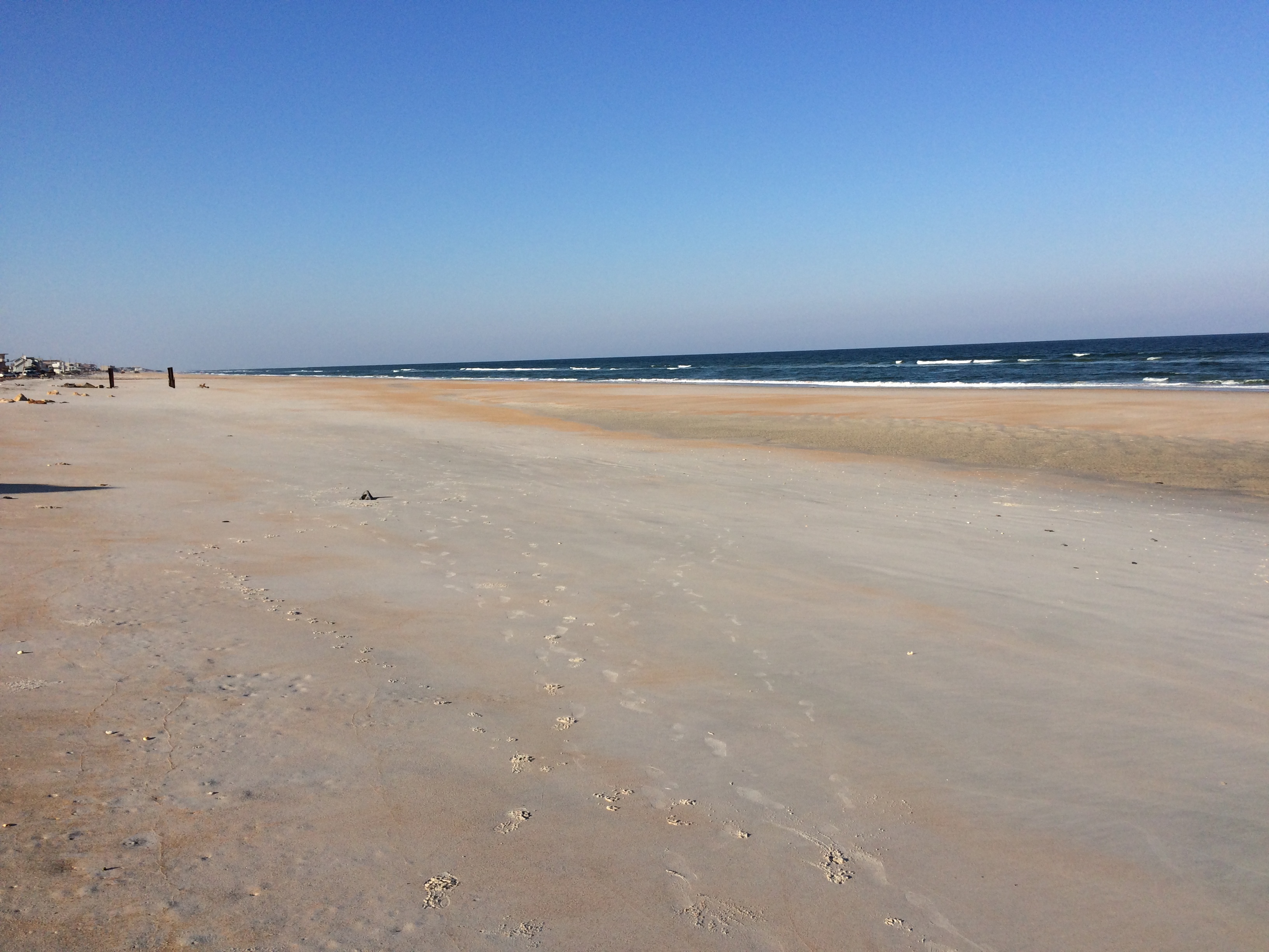
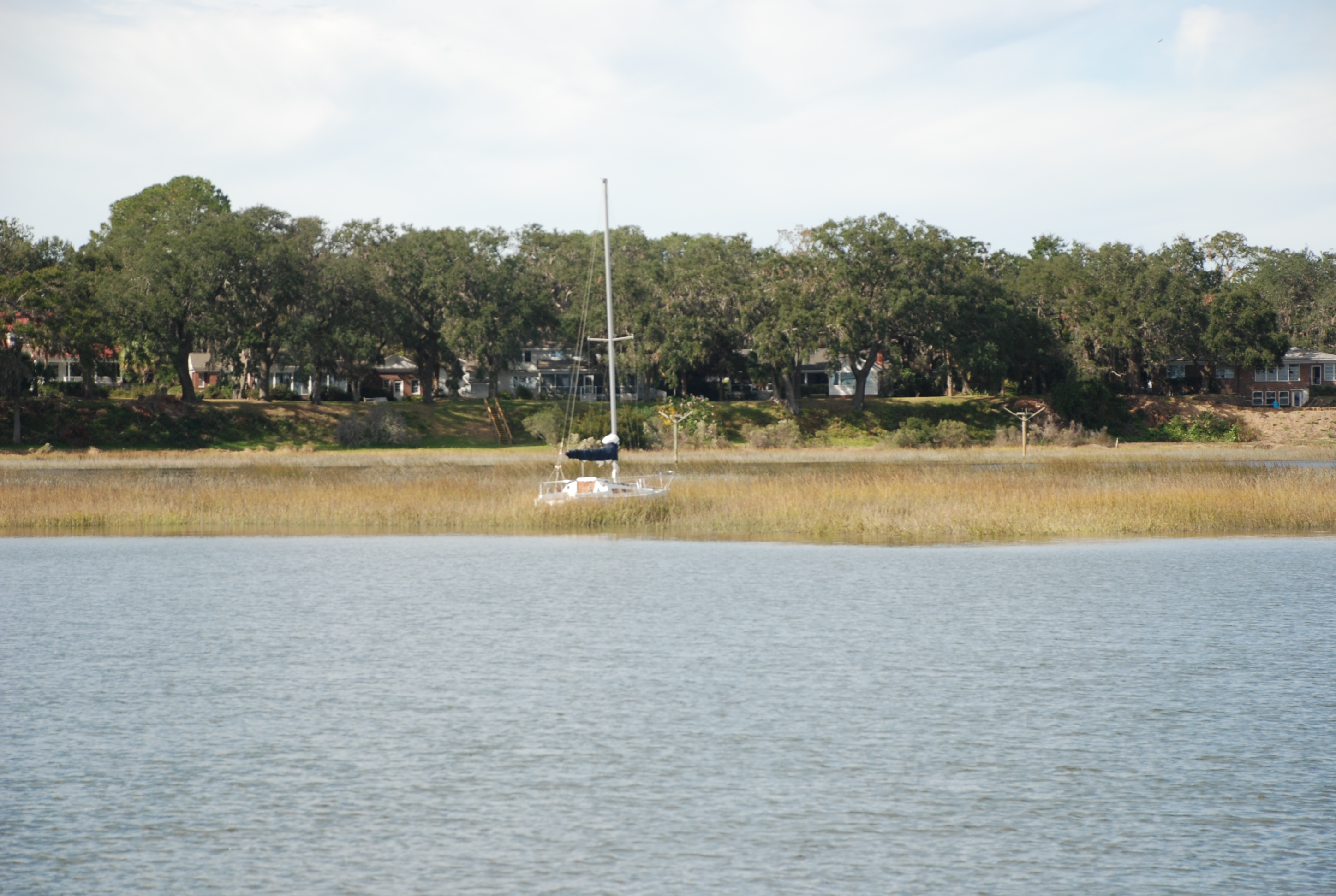
The next night we stopped at a really nice anchorage called “the hill” which was about 3/4ths the way to Georgetown SC. It was really beautiful. Position 33 30.887N, 079 08.625W. Here is a picture of the hill:
dsc_0123

On the 3rd day we anchored in Awendaw Creek, at position 33 02.069N 079 32.403W.

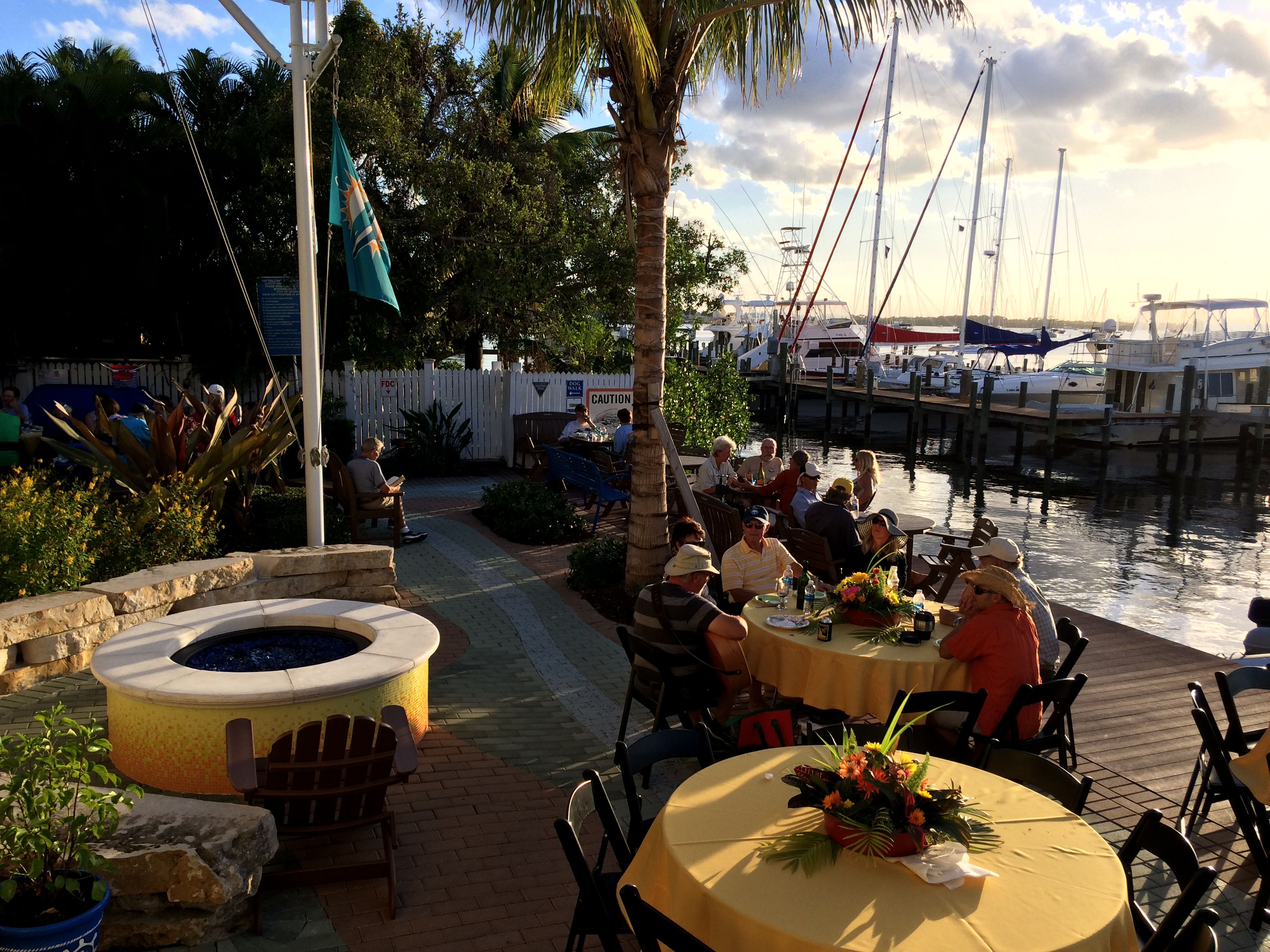
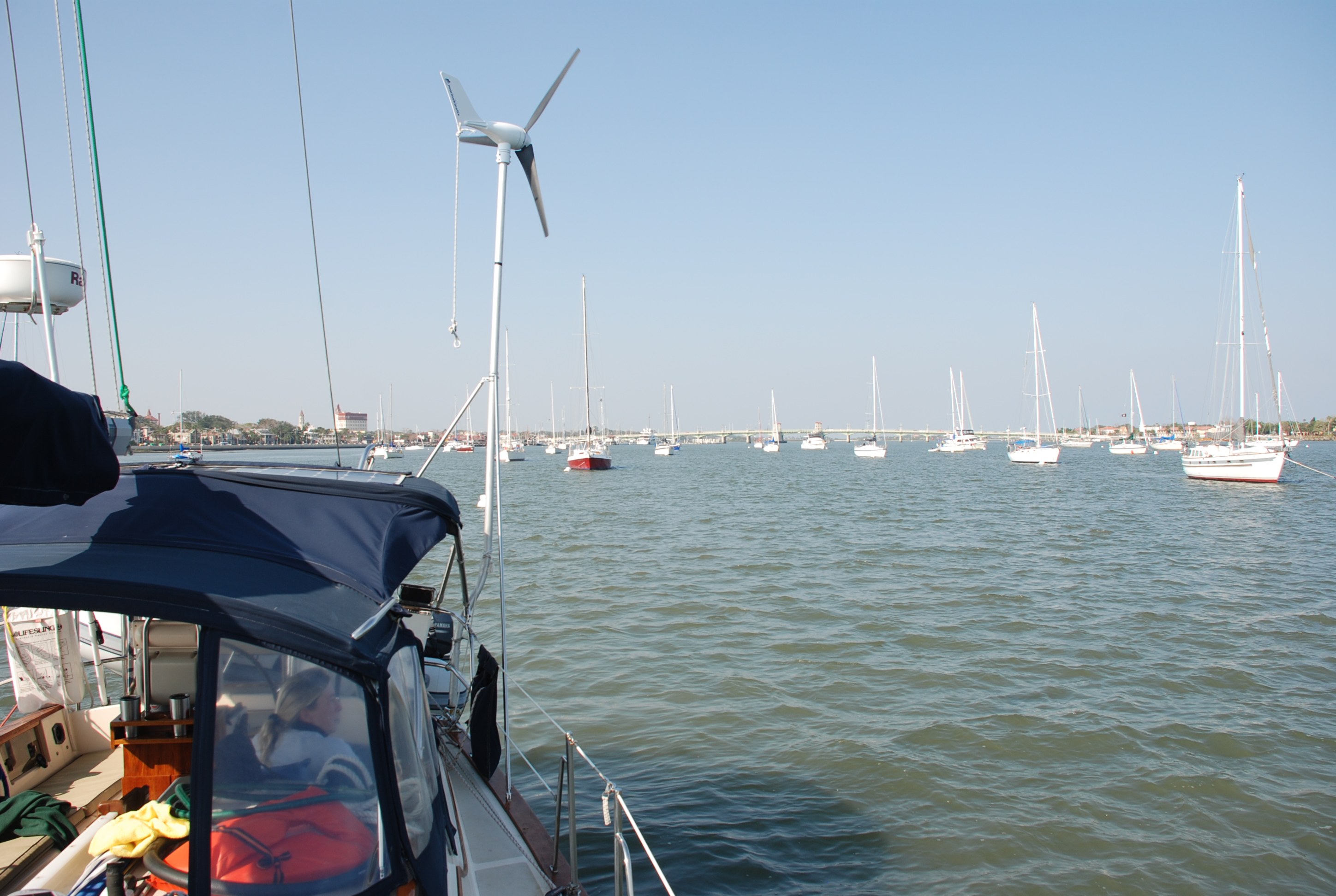
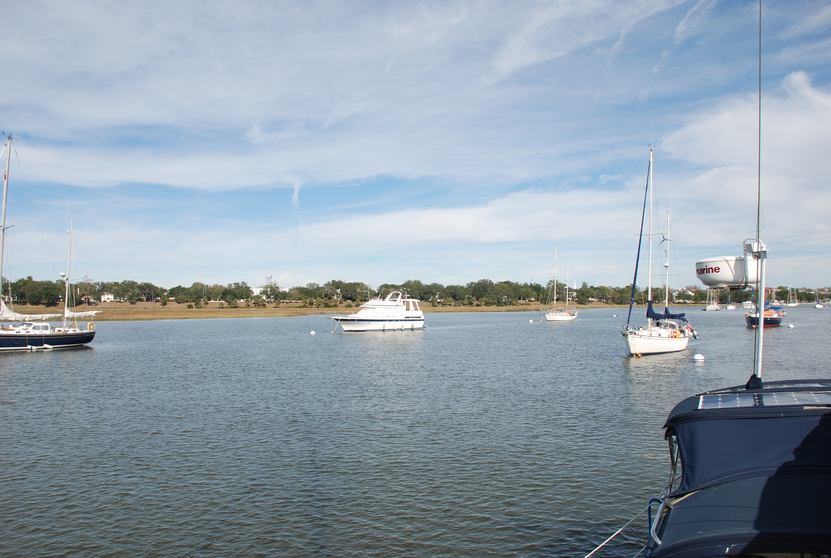
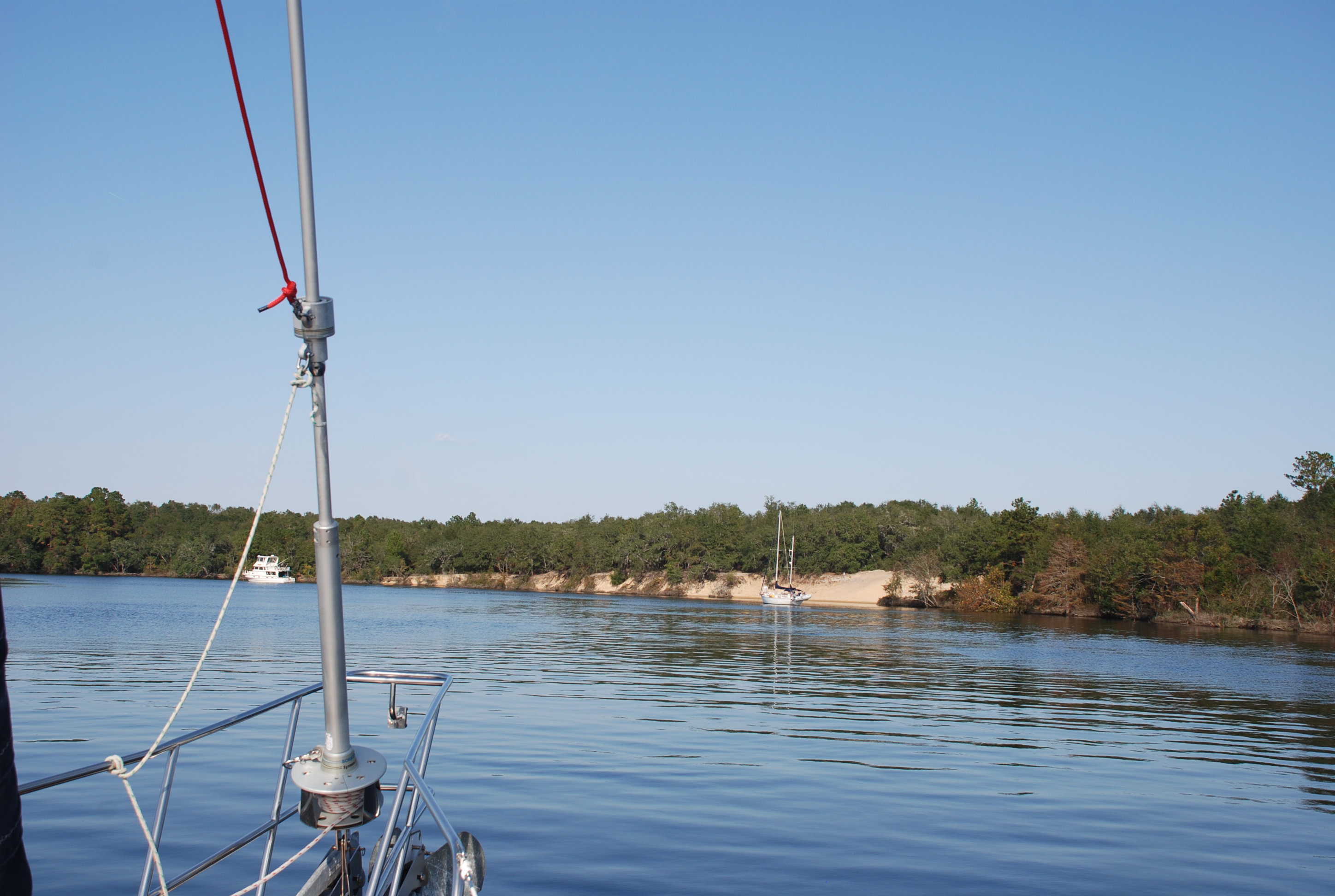
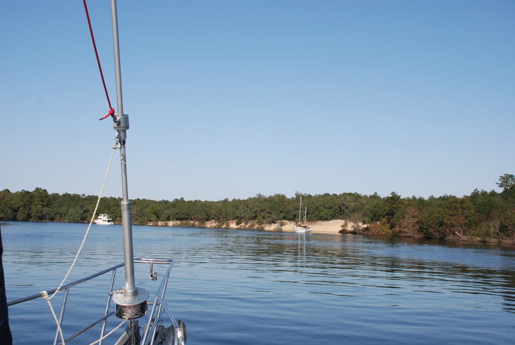
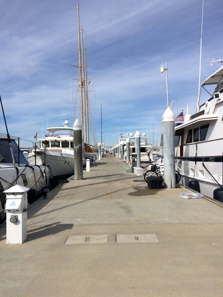
On the 4th day we stopped at Isle of Palms Marina just outside of Charleston, at position 32 48.379N, 079 45.618W, so that we could arrive the next day in Charleston during slack tide. The currents in the rivers in Charleston are wicked and very difficult to dock in, so we always try to get there and leave at slack tide (no current before the tide change). We partied with our friend Terry who lives there and enjoyed being in a marina after 3 days on the hook (this means real showers!). Yesterday we came in to Charleston City Marina close to slack tide, position 32 46.722N, 079 57.228W, and then went downtown for happy hour, hitting several of our favorite spots. If you follow the blog, you know that Charleston is our favorite city on the east coast. We are never disappointed! We usually dock at the Charleston Maritime Center on the east side of downtown, but the hurricane caused enough damage that it is still not open, and we got reservations at the city marina. This is called the Mega-Dock and rightly so. It is around 40 acres of dock on the west side of the city. Look at it in satellite mode of Google Maps. It is a little further away from the places we normally go but still not too far. They also have a courtesy shuttle. Here is the view from one end of the Mega-Dock:
img_2596
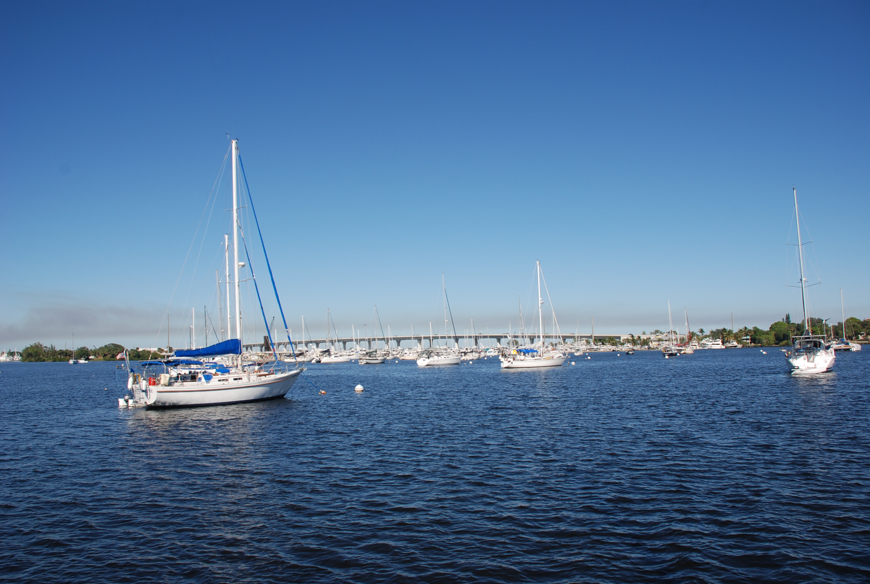
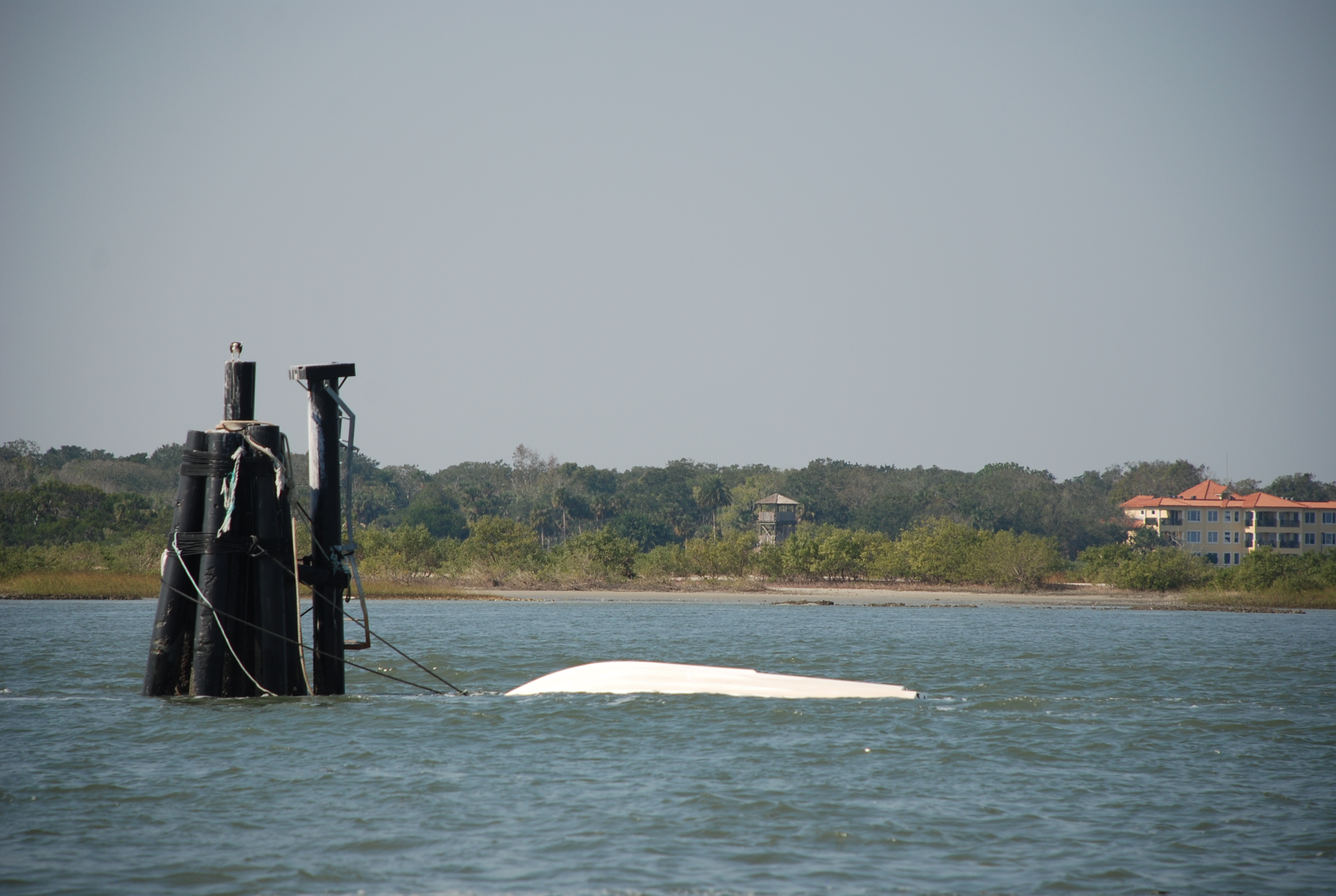
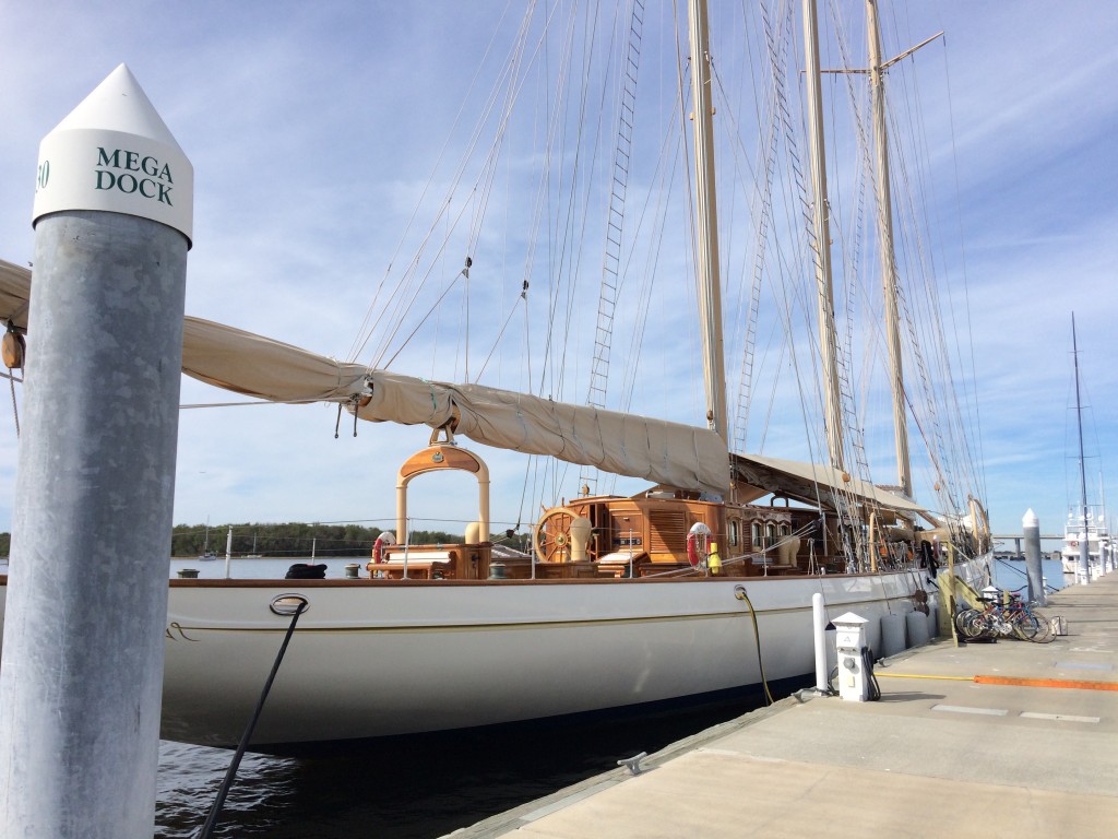
There are dozens of huge yachts here. The amount of money on the docks boggles your mind. Here is one of the cool sailing vessels:
img_2595

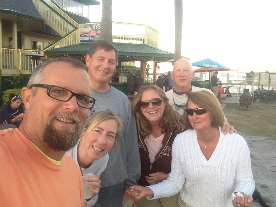
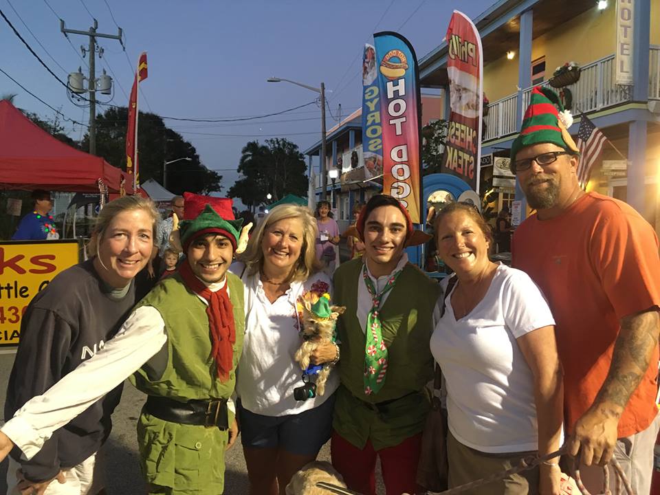
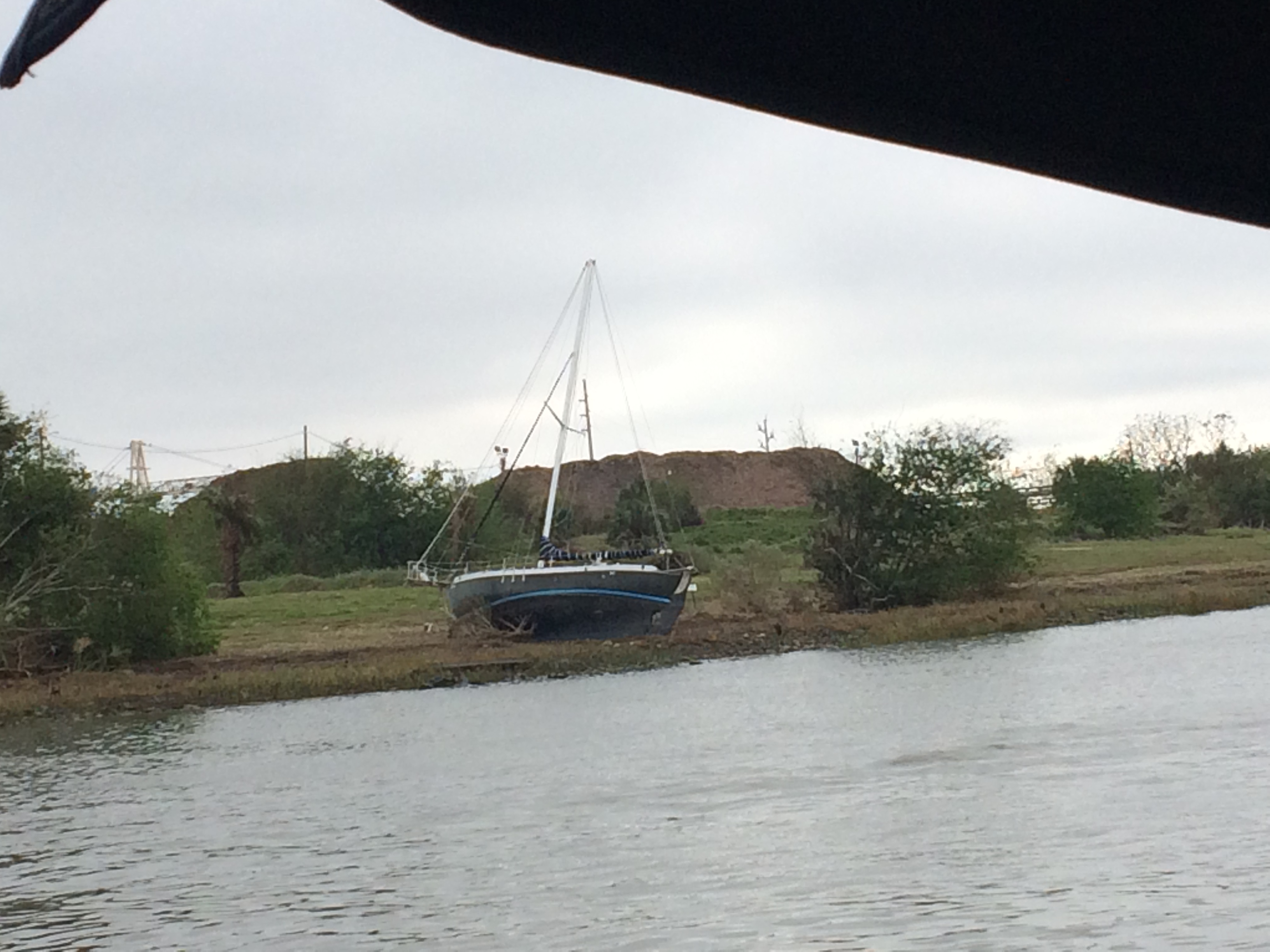
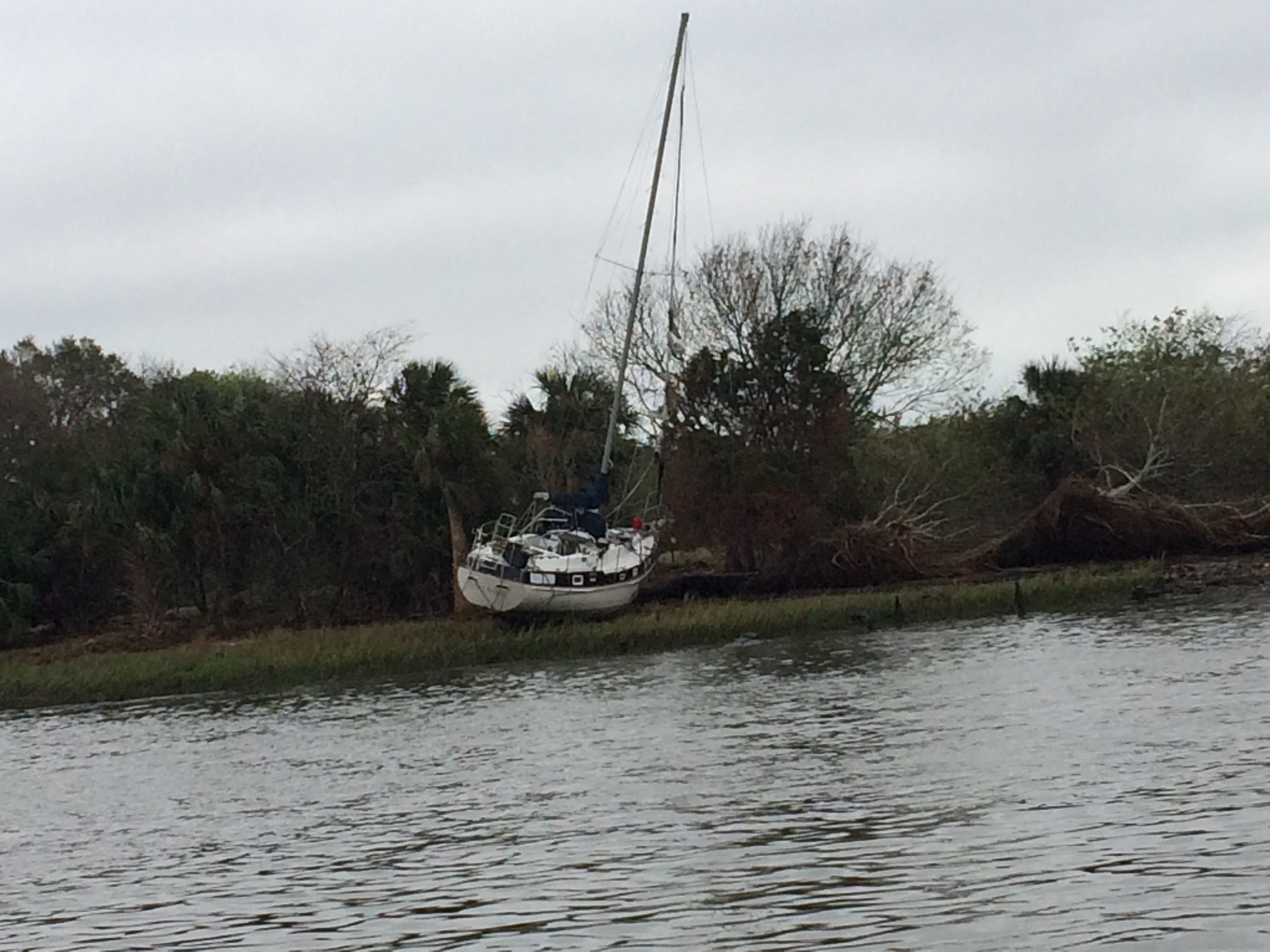
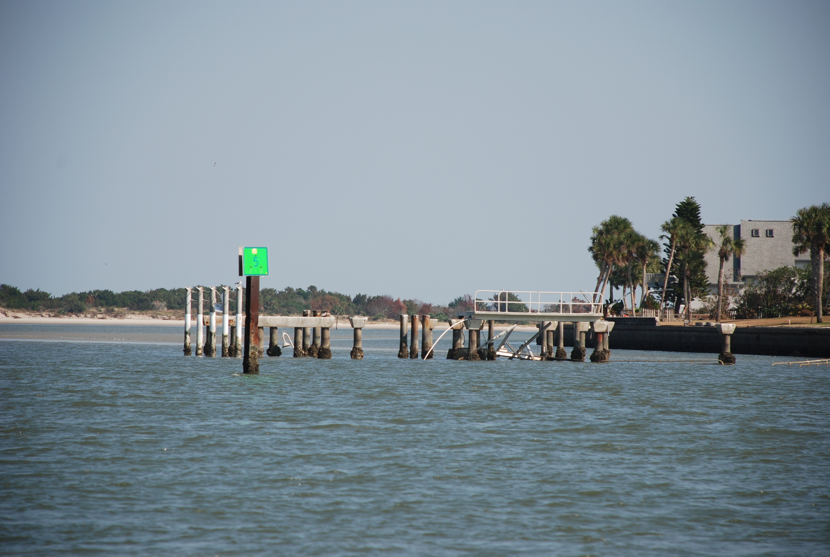
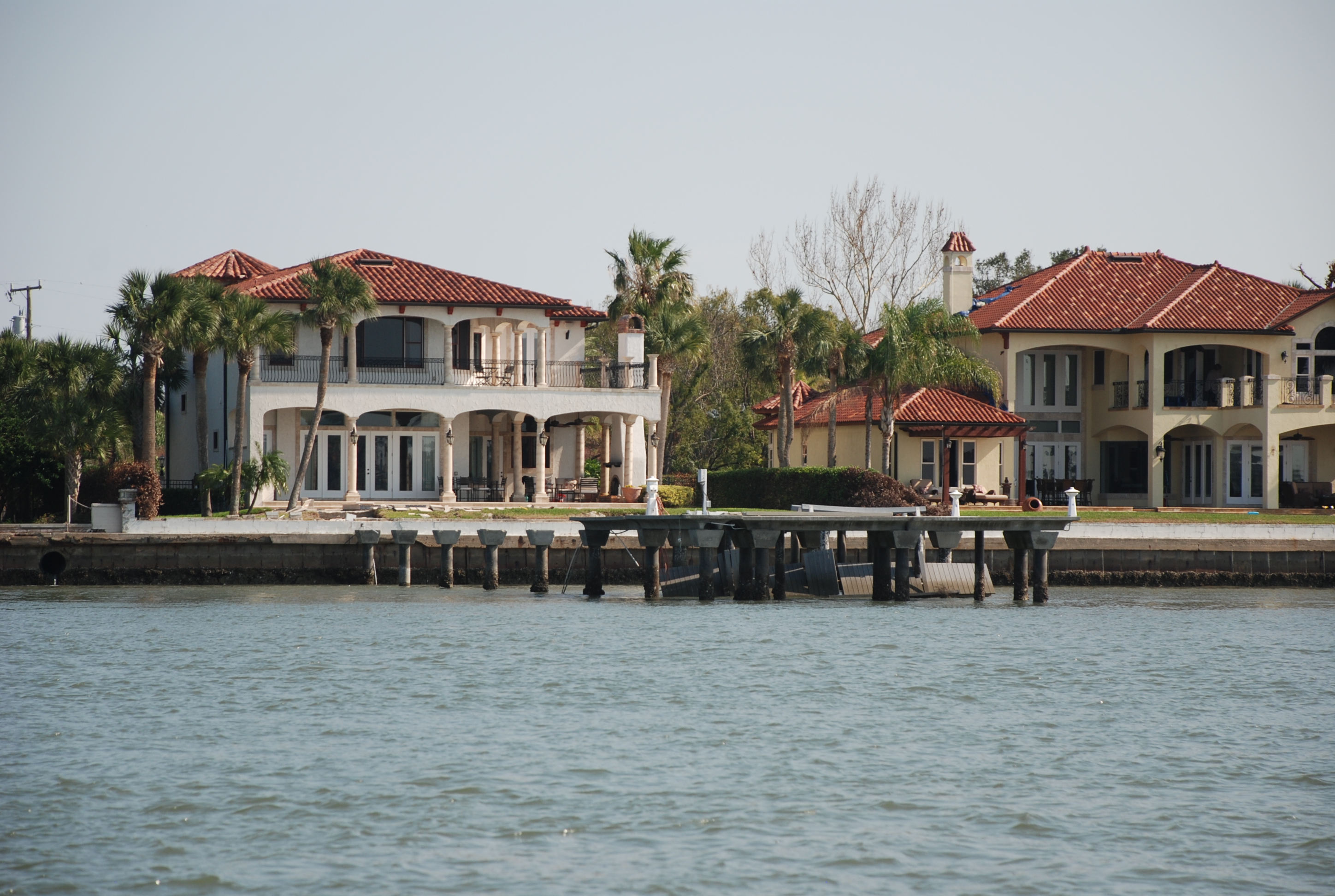
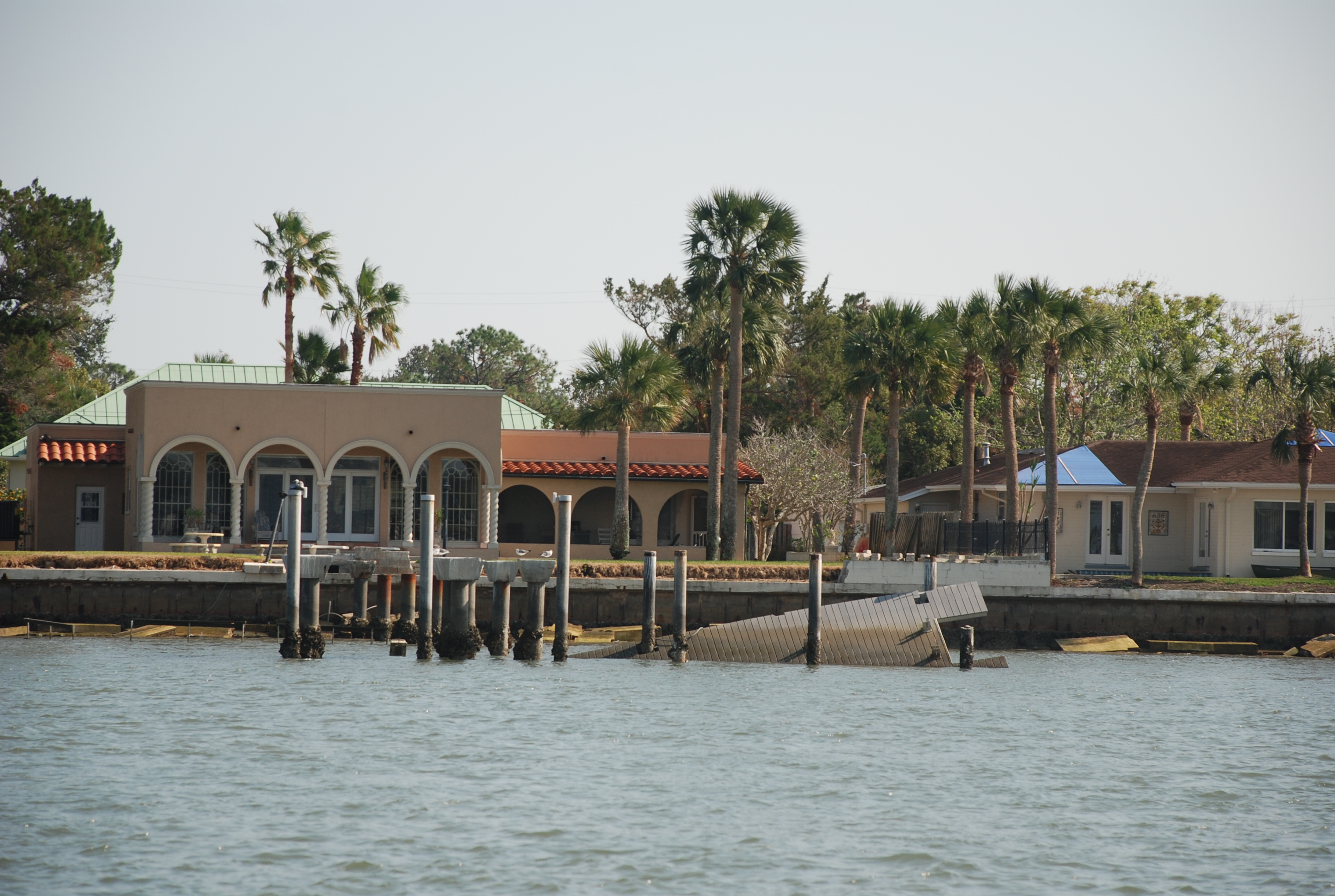
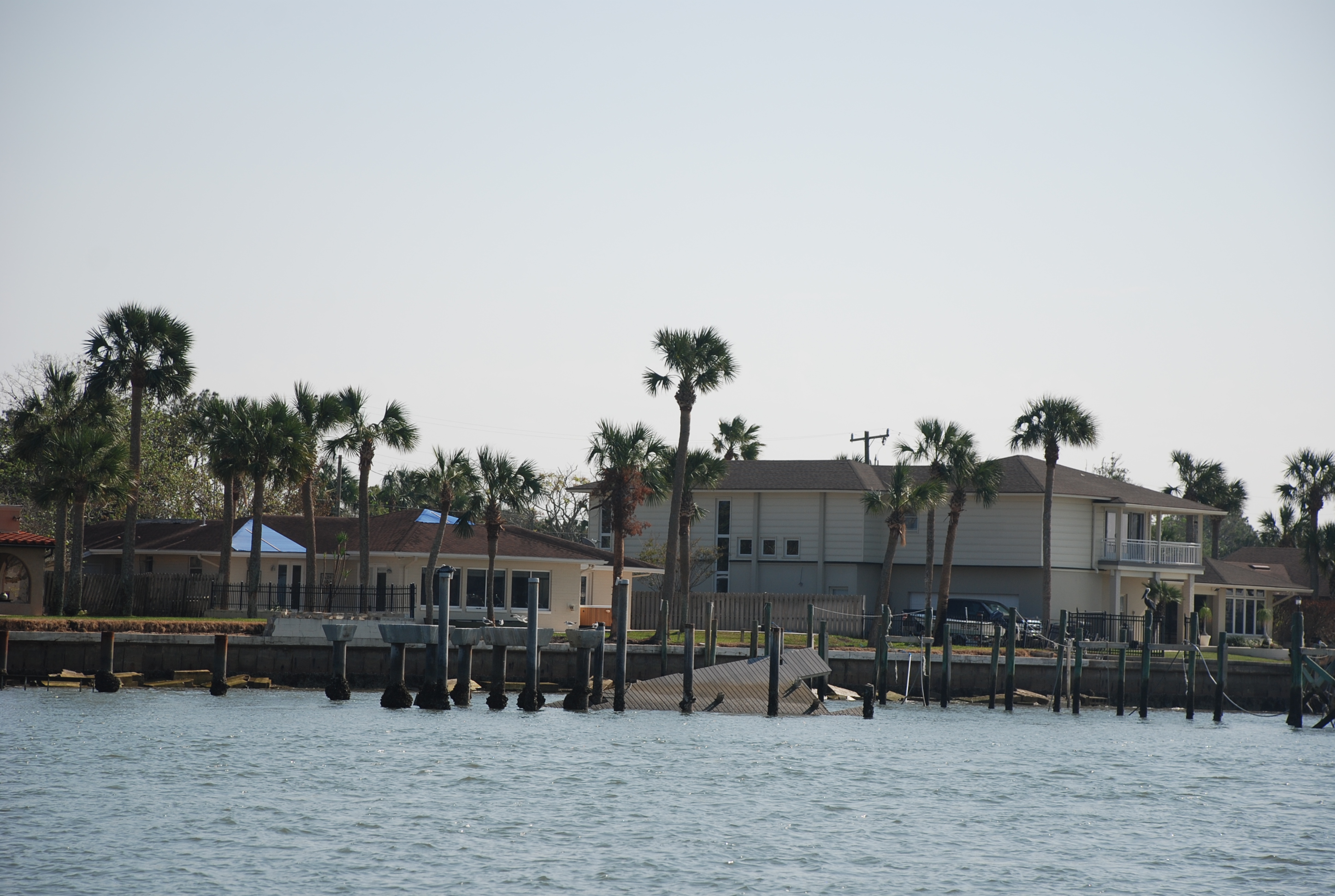
We have seen quite a bit of hurricane damage as we get further south. It will be interesting to see Hilton Head and the surrounding area, as they were particularly hit hard. Today we work on boat maintenance and tomorrow we start south again. We are taking it easier than normal and traveling around 40 statute miles per day instead of our usual 50 to 60 miles. It has been nice getting to an anchorage late afternoon versus dusk and relaxing more. Unfortunately Larry and Diane are heading back to Southport and not continuing south with us. They are fun and we will miss them! Here we all are at Isle of Palms:
14947826_1729144574001778_2721795988301840145_n