Category Archives: Uncategorized

Finally a window of weather to the Bahamas

2/28/16
Key Biscayne, FL, Outside No Name Harbor
Position: 25 40.371N, 080 09.930W
Posted by Bill

We left Tarpon Basin on the 26th and took a short hop up Florida Bay, anchoring off of a well known bar called Gilberts. It is on the road that runs from the mainland to Key Largo, and has a reputation for insane parties on the weekends. We took our dinghies in to take advantage of the rib dinner special. Gilberts has a great waterfront setup. A small beach and several large tiki huts, and tables all over, both outside and inside the tiki huts. We chowed the rib special (not very good ribs, but acceptable) and really enjoyed the drink specials for happy hour. As we departed to return to our boats, the wind had kicked up and we got pretty wet riding back. Here are some pictures.
Gilberts:
IMG_2023
The gang at Gilberts:
IMG_2025
Our boat, Island Bound, at anchor off of Gilberts:
IMG_2024

Then yesterday, we motor sailed up into Biscayne Bay, into Dinner Key marina and took a mooring ball. Dinner Key is in the town of Coconut Grove on the south side of Miami, and is a great place to go ashore. One of our favorite restaurants is there…Flannigans…and we enjoyed a great meal. Our buddy boats, Island Bound, followed by Sea Lyon, sailing up Biscayne Bay:
DSC_0074
Miami skyline coming into view:
DSC_0081

Today, the winds shifted and kicked up some nasty waves in our mooring field, so we decided to move across the bay to Key Biscayne and No Name Harbor to get some protection from the winds. This is also a popular place to stage to jump to the Bahamas, so we figured we would hang there and watch the weather for a few days. Any of the weather windows that looked good in the forecast seemed to fall apart, but the week ahead held promise. We went ashore in No Name Harbor and had dinner at the small restaurant there. The harbor was packed with boats and people, more than I have ever seen in there. The latest weather shows a good crossing to the Bahamas tomorrow, so we will plan on a departure at first light, checking again in the morning before we go. The plan is go head to Bimini, and if the weather is good, continue on to New Providence Island. If the weather is not good, we will stay in Bimini until it improves.

Picture of the mass of boats in No Name Harbor:
IMG_2031

Last day in St Augustine

11/19/15
St Augustine FL, Hidden Harbor Marina
Posted by Bill

We have enjoyed being in a slip for a couple of days. Usually, I prefer to anchor out or pick up a mooring ball as marinas tend to be like RV parks on the water. Anchored or moored, you have more space between your neighbors and a 360 degree view of the water! That part is cool. The down side is that you have to generate your own power, you have to take the dinghy ashore to get off the boat (in less than comfortable weather and wave conditions some times), you don’t have a fresh water hookup, and it is a LONG way to the restrooms other than what you have on your boat. Marinas offer convenience. We have been anchoring or mooring for a week prior to arriving here, so this was a nice change. This is the first time we have stayed at this marina. It is smaller than most and has mostly clients that live aboard their boats. It is pretty far up the San Sebastian river and is a designated hurricane hole, so it is well protected from severe weather. It is also a close walk to downtown St Augustine, just a few blocks from a great farmers market, and just across the street from a huge liquor store. The people who run this marina are really nice, and the restrooms and showers are some of the cleanest we have seen…a huge plus. They only have a couple of slips for transients like us, so it is set up mostly for people that are full time clients.

It is interesting to see the boats and people here in the marina. Everyone is friendly for the most part. Many of the boats never leave the dock and are in really bad shape. There is evidence that there are some people living here with meager incomes and some health issues. For a 40 foot boat, which is quite a bit larger than what most of these people are living on, you can live for $500 a month, including all utilities. For St Augustine, FL, that is probably a major bargain. Smaller boats would cost less. Seeing the boats that some of them are living on kind of gives you a different perspective on what some people do to survive. Here are some pictures of the marina and looking down the San Sebastian River:


And here is our Island Bound at dock:

We have hit most of our favorite spots in St Augustine while here, including the liquor store and the farm market. In addition, I have checked off a few boat projects. One was to change the spark plug in the generator, and in typical boat project fashion, it took 25 minutes to get the spark plug and all of the tools out. Then 5 minutes to change the spark plug. Then 25 minutes to put everything away. Sometimes that can be downright frustrating. Another one was to troubleshoot the AIS system and the GPS, which have been a little flakey lately. I had to take all of the crap out of the cockpit locker, filling up the cockpit, and then spend some more quality time in my favorite dungeon…the cockpit locker. I did resolve both issues after a couple of hours of work, so I guess it was a good time!!

Tomorrow, we will work our way to Vero Beach, arriving on Sunday to spend Thanksgiving there with some of our friends from last year, including Kurt and Sharon on Byrd Ketcher. They are going to catch up with us there on Wednesday! Looking forward to that.

We got out asses kicked, but we made it to Florida

11/15/15
Fernandina Beach, FL
Position:30 40.264N, 81 28.143W
Posted by Bill

On the 13th, we left our anchorage at sun up and motored through the next major shoal area; Hell Gate. No issues. We caught the tidal current very favorably and made great time, overshot our intended anchorage and ended up anchoring in the Darien River; position: 31 23.015N, 081 20.175W. It was a great anchorage in the middle of nowhere.

Yesterday, we left the Darien River at sunrise:

Our stretch goal was to try and make it to Fernandina Beach FL, but we really needed the tidal current to help us. It was a real stretch. We made it through the last two bad shoal areas with plenty of water beneath us and we were moving great…until we came out of Jekyll Creek and rounded the tip of Jekyll Island into St Andrew Sound. Winds were forecasted to be out of the north at 10 to 15 knots, and it was pretty windy inside the ICW, but when we came out into the sound we got hit with 25 knots, 5 foot seas and a 4 second wave period! Caught by surprise, the boat was getting tossed all over the place, and stuff was flying around in the cockpit and down below in the cabin. We had to go way out into the sound to get around a shoal area. The picture below shows our intended path with a magenta line. We were going from top to bottom and the wind was coming in the direction of the big red arrow:

It was a long slog through a washing machine. After 30 minutes or so of getting slammed, I cut the shoal area short (it was high tide and I took a calculated risk), which put us on a course with the waves behind us. That helped significantly, but it was a good hour and a half before we got back into more protected waters. It was a good lesson to make sure you are always ready for bad seas and winds, even in the ICW. This area is atypical of the usually protected waters of the ICW, but from now on…we will secure the boat better.

The tidal current helped us and we made it into Fernandina Beach before 4:00 PM! Glad we are out of Georgia! We will probably stay another day here and then work our way to St Augustine where we intend to wait out the next weather system that is coming Tuesday through Thursday.

Passage planning

11/8/15
Charleston, SC
Posted by Bill

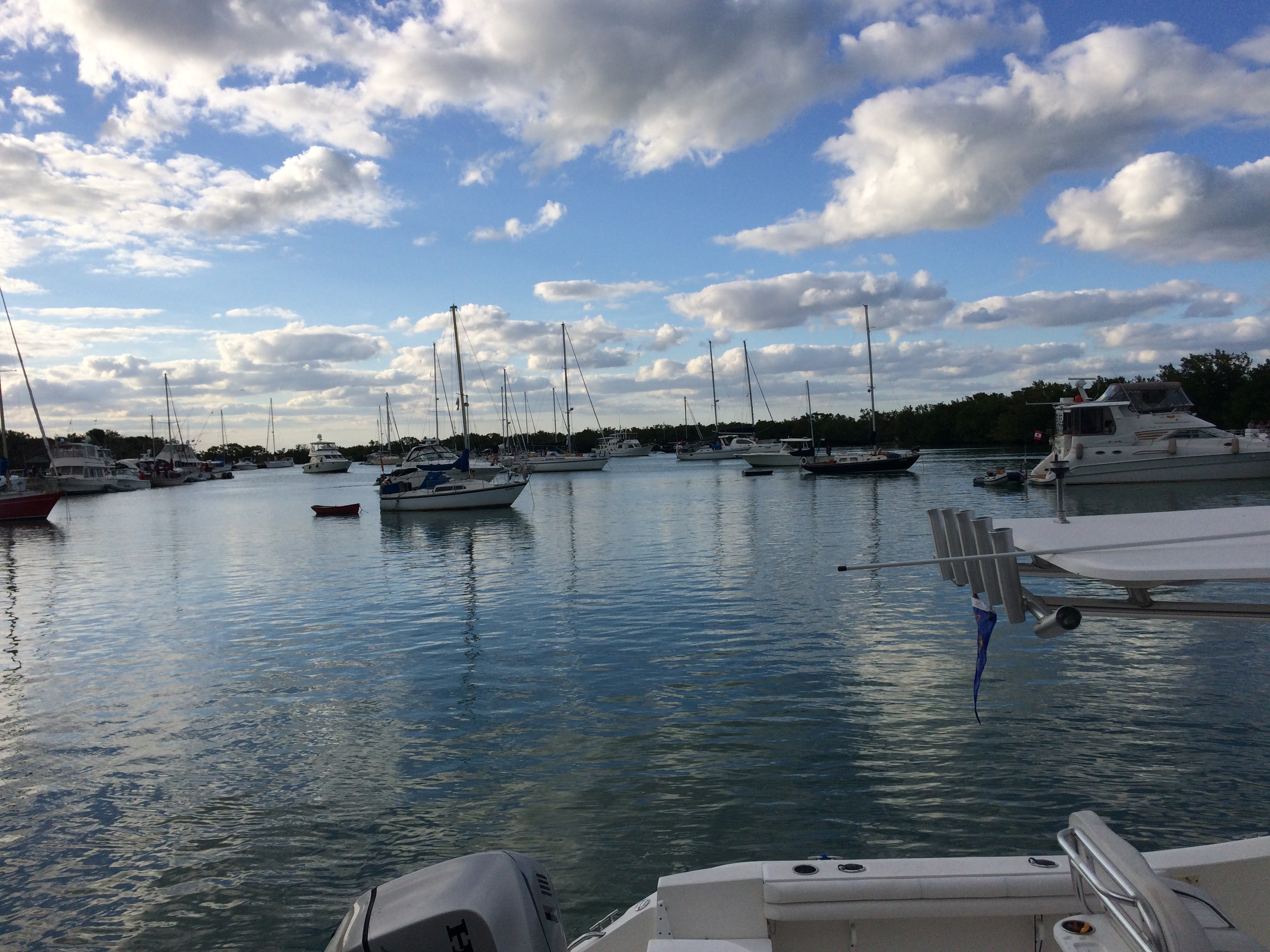
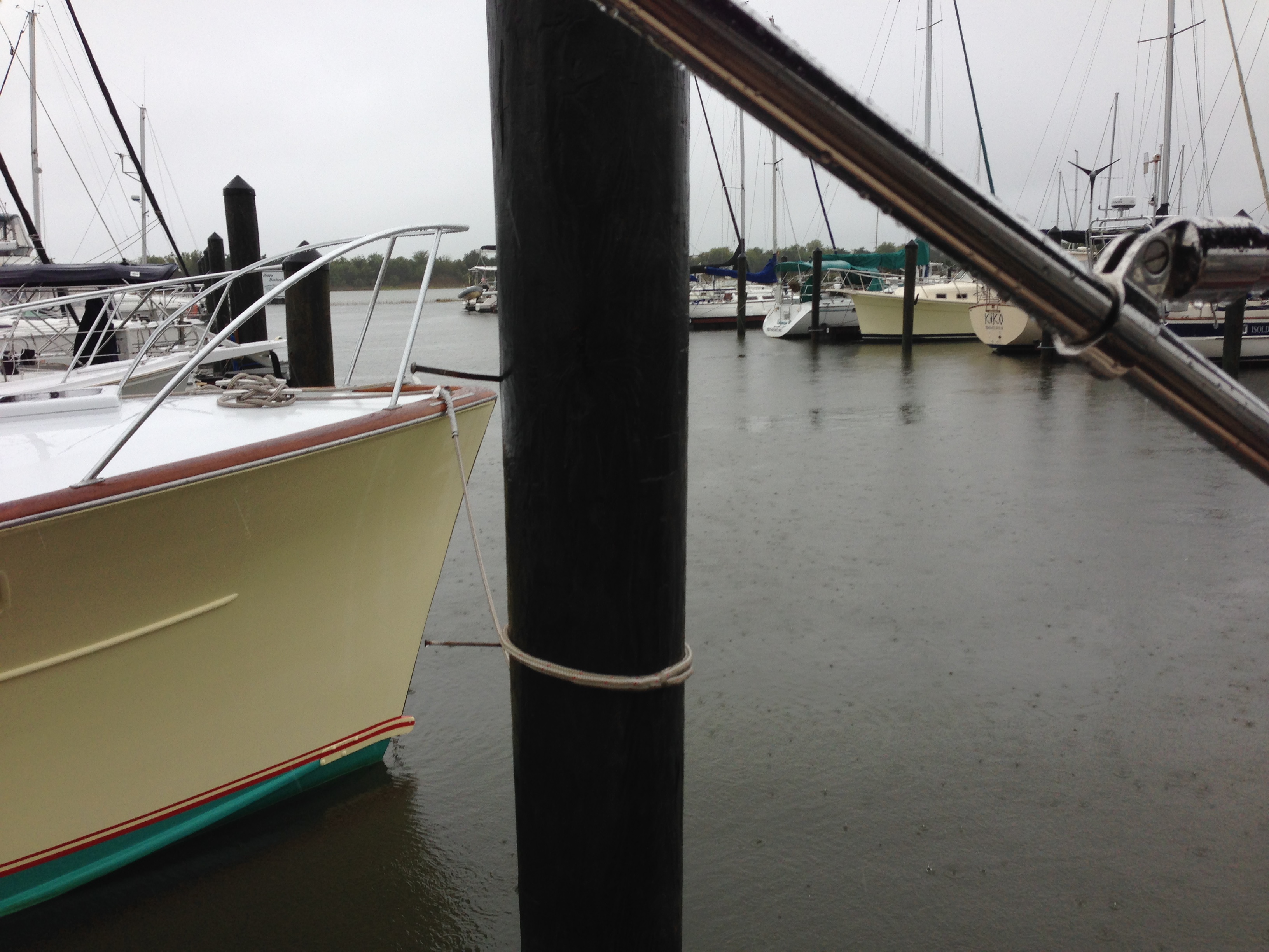
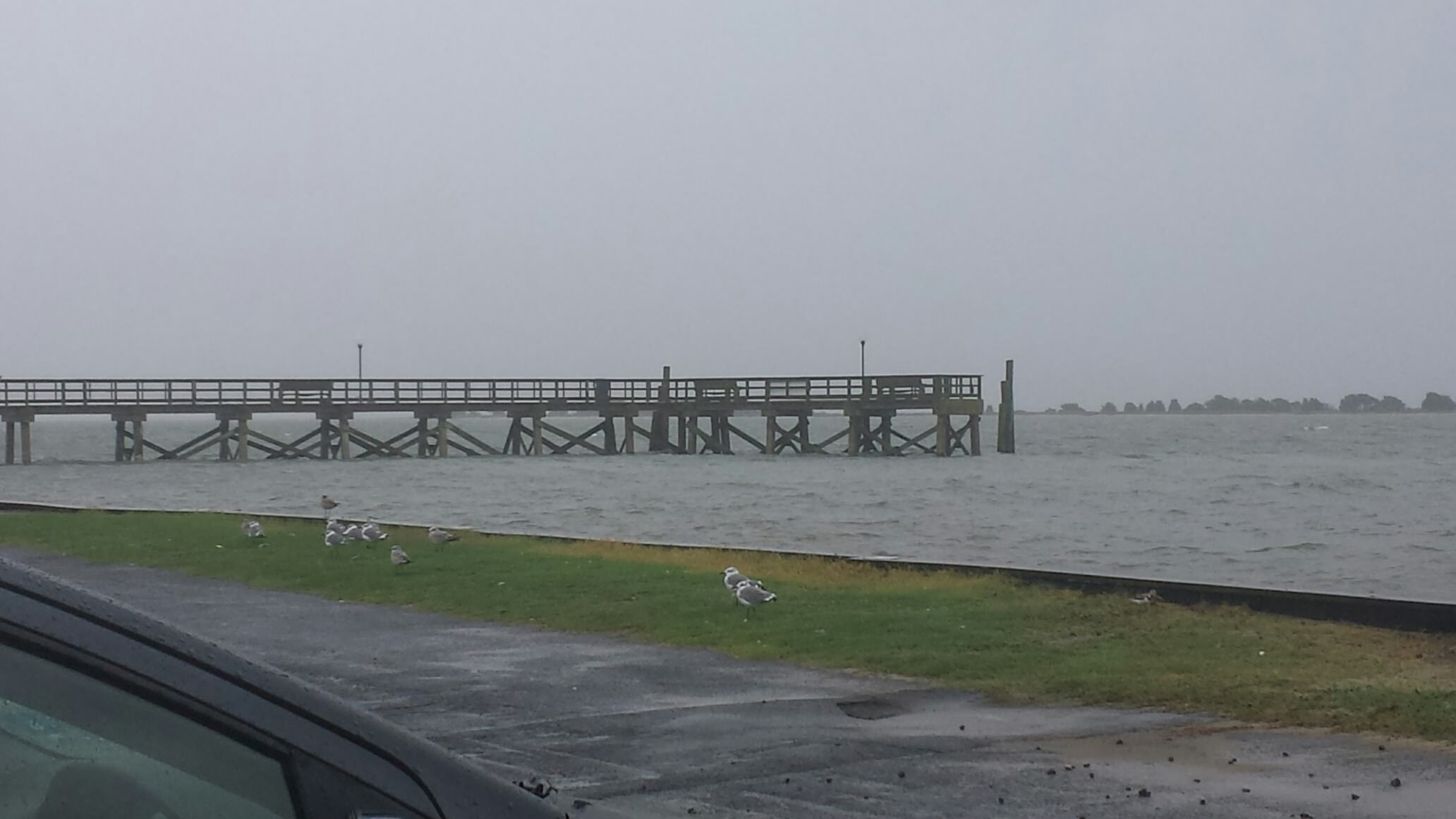
It is blowing up to 30 knots today and starting to rain here in Charleston, and we are rocking and rolling in the marina. The Cooper River is not looking too nice:

We walked to the grocery store a couple of hours ago, but otherwise we are stuck inside. Based on that, I decided to share our passage planning process. Several people have asked about it and I also thought that it might also help someone who is new to traveling the ICW.

The major components that go into the process are as follows:
1. Kettlewell Guide to the ICW – this is a publication that has nautical charts for the Atlantic ICW. Each page is about a 5 mile segment of the ICW, and in the margin there is information about marinas, anchorages, bridges, etc… We didn’t have this on the way south last year, but used my friend Matt’s copy on the way back. It has made tracking and planning much easier than the standard charts and chart books. One caveat, they stopped updating the charts and information in 2006, but it is still the best publication we have found.

2. Active Captain – this is a web site and associated database that has electronic nautical charts that highlights marinas, anchorages, local knowledge points, and hazards on the map. On top of that, people provide comments and can add/delete/maintain the data in a crowd sourcing fashion. Kind of like Yelp for the cruising community. Since it has grown in popularity, many marine navigation vendors have incorporated the database in their products. It is a valuable resource. www.activecaptian.com

3. Weather – we primarily use Weather Underground (wunderground.com) for weather forecasts and radar. In addition, we use NOAA Marine Weather (marine.weather.gov), Passage Weather (passageweather.com), Wind Finder (windfinder.com), Mikes weather page on Facebook or spaghettimodels.com, and for tropical storms…tropicaltidbits.com. These are all internet resources but in addition we use the following apps for iphone/ipad: Marine Weather (tides, marine weather, currents), Pocket Grib (similar to Passageweather.com data), the Wind Finder app, and the Weather Underground app.

Tides and Currents – we use the NOAA tides and currents website and/or apps: Ayetide, Marine Weather, Garmin Blue Chart Mobile

Here are some screen shots of some of the above resources to give you an idea of the information that they provide:
Windfinder:

Passage Weather:


NOAA marine forecasts:

AyeTides:

Pocket Grib:


Active Captain:

The colored boxes denote marinas (red), local knowledge (blue), hazards (yellow), and anchorages (green). You click on a box to get more info, including comments and ratings.

The process:
We plan on 50 – 60 statute miles per day generally. Looking a the Kettlewell guide, you can see how far that takes you. Then using Active Captain, you look at available anchorages and marinas in that general area so you know where you might want to stop for the night. I usually look at 40 miles and 65 miles as alternatives in case the currents work for or against you.

Next, look at the hazards in Active Captain, which tells me what shoal areas are going to impact us, and how other people dealt with them successfully. I do this with the web site or using Garmin Blue Chart Mobile on the iPad. Garmin has Active Captain data integrated and also tides and currents. I go page by page on Kettlewell and look up the area in Active Captain, writing the results on a post it note that goes in the Kettlewell page as an instruction of how to deal with this area of the charts. I use tide and current information to formulate the plan as well. After all is considered, I write up a plan in my passage composition book as to when to leave, when to hit certain mile markers/areas and pertinent information. While underway, I use this book and the Kettlewell charts with my sticky notes to follow in the cockpit.

Sample of the Kettlewell book with my notes:

Some people just write in the margin of these pages, but the conditions change all the time and I opted to use the post its so they can be swapped out.

Off shore passages require a different type of planning which is heavily dependent on data about wind speed, wind direction, wave height, wave period, wave direction, tides and currents. We use NOAA nautical charts and Maptech Chartkits for off shore. For the Bahamas, we use Explorer Charts.

You are never quite sure what the speed of the boat will end up being, so you need to have alternate plans for both ICW and off shore that take into account multiple scenarios.

For weather forecasting, I use all of the resources mentioned and develop my own idea based on all of them as input. They are never the same, so you need multiple sources and have to interpolate. You also need to watch the sky…duh! As for weather…we don’t plan to go out in anything uncomfortable, but plan to get surprised for the worst while we are out there.

It is definitely more of an art than a science.

False start

11/3/15
Southport NC
Posted by Bill

Well, we worked our butts off getting the boat ready for the trip south the last couple of days, and we were all set to leave today. Then the forecast imploded and we got a day of unexpected solid rain and higher winds than we expected. It was nothing drastic, but it was going to be uncomfortable, and since we have a few days of slack in the schedule we decided at the very last minute to delay a day. It’s too bad because the tides aligned very well to transit the shoal areas and bridge openings all the way to Charleston SC, but a day delay should not hurt us except it will keep us in Charleston a few days longer than we wanted. This primarily due to a strong system that is expected this coming weekend that is going to bring winds over 30 knots, and with a delay of a day, we will need to weather it out in Charleston. As usual, traveling via boat requires putting together the best plan based on available daylight, weather, tide schedules, bridge openings, available anchorages and available marinas. It is like a big puzzle, and if one thing changes, the whole plan can get screwed up.

So for now, the next 5 days look like this:
Tomorrow 11/4 – Myrtle Beach
11/5 – anchoring in Georgetown SC or some back creek further south (which ever we can make)
11/6 – Isle of Palms SC
11/7 through 11/9 – Charleston SC

It has been emotionally difficult leaving Southport. We love this area and we have made so many good friends here. We will miss everyone badly. To be honest, it is one of the things about this lifestyle that is really hard for me. It feels like everywhere we go, we are leaving someone who is special to us. Family and friends in so many places now…we need everyone to come south, ’cause I ain’t doin’ cold weather if I can help it!!

Ass captains abound

10/30/15
Southport NC
Posted by Bill

The US Open King Mackerel Fishing Tournament started today, and Southport Marina is a prime check-in/check-out location for the fishermen. As a result the marina is packed with boats that are participating. The total lack of respect for others that some of these people display is beyond me. Trashing of bathrooms, hijacking dock carts and not bringing them back, disregard for their wake causing an almost constant roll in the marina, are some primary examples. At 5 AM this morning there were several groups throughout the docks carrying on at an annoying decibel level until dawn, waking everyone else who was trying to sleep. The Ass Captain awards were issued at a feverish pace. The real question that tugs at me is: Why are these boaters different than the general boating population? Generally speaking, there is a mutual respect between members of the boating community. People look out for each other. There is consideration for the impact of your actions on others. Somehow, these folks just didn’t get the message…or is it that they just don’t care. I am really not bitchin’…just trying to understand these socially retarded jack-legs.

2 weeks away

10/18/15
Southport, NC
Posted by Bill

It has been about 10 days since our last post. We have been enjoying a period of beautiful weather until today. Today it is going to be a high of only 62 and will get down to 42 tonight…brrrrr. After Monday it is supposed to get back to normal, highs in the mid 70s and lows in the upper 50s. At least the sun is out and we are not supposed to have rain for another week.

We have been taking advantage of the nice weather and have our teak stripped, sanded, and ready to clean and stain. There is a lot of teak on this boat and it has been a big project. We are 2 weeks away from our intended departure date, and we have also been getting the boat ready for passage. Tricia has been spending time cleaning out lockers and storage spaces, and re-inventorying all of the stuff we have stored. We ordered and received all of the spare boat parts we needed to get, and we have also received cloths and misc. items that we wanted to get before we leave. There are only a couple more small boat projects and we are ready to go!

Another thing we did was get all of our fishing gear so we could catch some more flounder. We have been borrowing gear from our friends, but finally got it all for ourselves, and my buddy Matt taught me how to throw a cast net. He also taught us how to make a Carolina rig…which is used to fish for flounder. We will become fishermen if it kills us!! Problem has been that since the major rain event, all of the fish have flown the coop. The rain changed the water salinity, chasing away all of the fish, including bait fish. They are finally starting to appear again, so I’ll try to catch some bait and some shrimp.

I have also spent a few days helping Matt with their house. If you don’t remember or don’t know, our good friends Matt and Shirley from Sofia Jeanne have been building a house all summer. They have been doing most of the work themselves, but sometimes Matt needs a hand with unloading wood, working on walls and ceilings with long boards (all of the walls, floors and ceilings are wood – no dry wall), or like yesterday…getting landscaping plants. I have learned quite a bit in the process and I really enjoy working with them. It seems like we always have fun with them no matter what we do, and yesterday was no different. We took three trucks to the nicest nursery I have ever been to. It was huge, and the plants were top quality plants. We got to buzz around in golf carts and pick out what they wanted:


We loaded up the plants:


After dropping them off at the house, they planted and we headed back for more teak work.

Last weekend we also had a mega party on D dock. It was supposed to be a progressive appetizer and drink party, where people migrated from boat to boat to experience what the boat owners concocted, but it poured rain. We executed plan B and moved the party to a couple of picnic tables on the covered porch of the marina office. Everyone enjoyed the food, drink and company, and also got pretty lit up! It was a good enough party to get complaints from other people in the marina!

We decided to stay here until after Halloween. There is an event that weekend called the Stead-Bonnet race. It is a sailing regatta (race) and everyone dresses up like pirates. We were here in Southport eight years ago and stumbled upon it, and it was great fun to watch. This year our friend Ben asked us to crew his boat for the race. It is the same boat we won 2nd place in for the Lone Palm Regatta in the spring. Looking forward to it. Also looking forward to seeing our friends Kurt and Sharon on Byrd Ketcher. They are arriving this Wednesday to prepare their boat to head south. Hopefully we will get to travel together again. This recent blast of cold air has me wanting to get going south again. Bad thing is…we have made many good friends here that we are really going to miss, especially Matt, Shirley and Grady.

Another typical boat project

10/7/15
Southport NC
Posted by Bill

After spending most of 3 days inside the boat waiting out the record rains it was nice to get out in the sunshine! Fortunately for us we did not have any issues related to the floods, wind and rain, other than a few nights of poor sleep. The temps and humidity have been fantastic as well and we have had the air conditioning off and hatches open.

So now that the hatches are open and the weather is nice, I decided to tackle a long running boat project… fix the broken hatch hinges. The hinges that hold the hatches open are attached to the hatch frame in the deck by pop rivets. After 20 years, the original rivets started breaking, rendering the hinge useless. In the last 8 months we had 3 hatches fall victim, and we have been propping them up with wood sticks or using a bungee chord to hold them open from above. It hasn’t been a huge deal since we have them closed with the A/C running since May, so it hasn’t been a top priority. We weren’t able to find out what size rivets we needed from any of our internet resources, including Island Packet forums, so I took the pieces of a broken one and determined the size based on that. I must first confess that I don’t know too much about rivets except the general physics of how they work, and I have only used a rivet gun a couple of times. This is the perfect setting for a typical boat project.

After the initial trip to Lowes to procure the rivets, I took apart the first hinge. Step two is to clean out the holes where the rivets go, as I had temporarily plugged them with silicon so we didn’t have water leaking in every time it rained, and there are remnants of the broken rivets that can be in the way. On this hatch, that material gets trapped by a metal bracket that appears to be screwed to the deck frame. No problem right…just remove the screws and pull the bracket off…clean up the fragments. NOT! The bracket is welded to the frame. Ok…rebed the deck screws so they don’t leak, then try to use probes to fish out the stuff you need to remove through a tiny slot and the rivet holes. Thanks to Tricia’s help we cleared most of it out in 30-40 minutes. I basically had to rivet this plastic piece to the frame:

Then re-assemble the hinge and attach it back to the hatch lid. You will see that the holes in the plastic piece are rough around the edges. The next challenge we hit was that the rivet gun was not deep enough to reach the rivet collar through the recess. My first approach was to go back to Lowes and buy some washers that would fit over the rivet mandrel and in essence, extend the rivet collar to the gun:

In the second attempt, the washers shortened the rivet mandrel to the point that it was too short for the gun to work. Taking some measurements, I needed 12mm to reach the rivet in the recess of the plastic piece, and the die in the gun was only 6mm. I tried to knarl out the recess holes (hence the rough edges in the picture) to gain more depth with the gun, but to no avail. Plan B…tap out the holes in the hatch frame and fasten with machine screws. I have a tap and die set, but I have never used it and I was concerned about learning on the hatch frames due to the high cost and labor required to replace them if I screwed up. After a couple of hours of research I decided to call a place that sells the hinge repair kits, and I found someone who told me the trick to using a rivet gun to do the job…grind the end of the gun to make it fit the recess. That ain’t happening on this boat. After another hour of research and thinking, I figured that maybe I could pull the rivet mandrel half way through the motion of the gun, open the gun to re-position it against the washers again, and repeat until the mandrel was long enough to be gripped by the gun to complete the process. Not working as the rivet is not gripping the back side of the frame. After a couple of more attempts, research and thinking, it looked like the rivet may not be long enough. Learning more about rivets, it seems that you need about a quarter of an inch longer than the real length needed to sufficiently mushroom the end of the rivet. We were just a little shy of that. Back to Lowes to get longer rivets. Using the same process as before and the longer rivets…Viola!! Success!! The biggest hatch had two hinges and the next bigger on had one. After completing those, and feeling pretty good, I get to the last one that needed repaired…a small hatch. No access behind the holes to get the previous rivet remains out and they are blocking the holes. I figure I can drill them out. It takes 10 minutes to dig the drill and bits out of storage only to find out that the drill and bit combined are too long to fit in the hatch opening, thus keeping me from the task at hand. I dig out my other drill…no luck. What I need is a right angled drill. So I take two out of three as success for the day and call it quits until I find a right angled to borrow, and as usual, it takes almost a full day to fix two hatches! Typical boat project.


Catching up

10/2/15
Southport NC
Posted by Bill

With the threat of a hurricane upon us, we have had many calls, emails and text messages asking if we are ok. We really appreciate the concerns and everyone checking in. Along with those, there were several questions about the lack of blog entries in the last couple weeks, which may have prompted the communications. So here is a catch up blog!

The last 10 days have been pretty much uneventful other than the weather and Tricia catching a flounder. We usually have happy hour at the end of D dock next to our friends Matt and Shirley. We watch the dolphins and pelicans feed, the bait fish run through the marina, and boats going up and down the ICW. Sometimes we fish while we sit and drink. A couple of Sundays ago, Tricia throws a line in the water and hauls in a 17.5 inch flounder:
IMG_1820
IMG_1821
Our friend Greg, a master fisherman, showed us how to filet it, and Tricia cooked it on our grill. Man, was it good!!
IMG_1822

A couple of days later we had a visit from our good friend Greg, from Columbus. He and his girlfriend were here vacationing on Oak Island. They came over for cocktails on the boat and then we walked to the waterfront for dinner. Great to see them!!

This last weekend we went to breakfast in Wilmington with some new friends, Jimmy and Beverly. They just bought an Island Packet 38, similar to ours, which is docked in the marina just up the waterway. They are getting ready to cruise south and Tricia connected with Beverly through the “Women Who Sail” group on Facebook. We compared notes and offered to help them get more familiar with Island Packets nuances, as well as cruising in general, if they needed it. Great meeting them. They were nice people.

That is when the weather started to get crappy. Besides being hot as hell, the weather has been phenomenal here since we arrived…very little rain and lots of sun. The last week or so has changed, bringing rain, especially the last couple of days. We watch the weather in the tropics every day while we are in the summer months, and we started to watch several times a day with the formation of Joaquin. I use a whole bunch of weather sources, most from the internet, but my two favorite ones for tropical weather are www.spaghettimodels.com and www.tropicaltidbits.com. You can view the European models in tropicaltidbits.com, which are usually the most accurate. This turned out to be true once again with Joaquin. We didn’t get too excited as we saw things develop, but would have sprung into action if it was looking like big trouble within a three day period. We are in a hurricane rated marina. As of this post, it looks like we are going to get an ass-load of rain until Monday or Tuesday, but only winds gusting to 30 knots. We have dealt with that wind level many times and are ready to go (fully prepped including a case of vodka…lol). This is a shot of some of the rain today from our boat:
IMG_1827
This is the ICW in front of our marina today at 20 minutes after high tide:
IMG_1828
The water is never this high unless there is a full moon and extreme tide, and it is going to get worse. We took this shot of the Southport pier two hours after high tide and it looks like a normal high tide…going to be interesting as there is a flood warning until Monday:
20151002_135921_resized

I can’t believe it is October already. You can tell by the number of transient boats moving through the marina and the size of them. Southbound activity has picked up, and we are seeing boats like this one coming through almost every day:
IMG_1823
We are also seeing some of our cruising friends moving south from further up north as we follow their blogs and Facebook posts. The weather has been particular menacing for those in the Chesapeake Bay, and not getting much better any time soon. We wish them all safe passage and hope to meet up again this cruising season. We are almost ready to go. Anticipating a departure in the third week of October.

4 days in the hole

9/20/15
Southport NC
Posted by Bill

The heat finally broke and we started to attack the to-do list in preparation for our trek south. One of the biggest to-dos was to install a new autopilot. The old one, a Raymarine ST7000 is of 1995 vintage. The autopilot is a really nice instrument. You engage it, telling it to keep the current course, or steer to a direction based on the wind (i.e. 45 degrees off of the wind direction), or you can steer to a waypoint via the chart plotter we have (think Garmin map like you have in your car). It is especially nice for long passages to get a break from steering, but we also use it for short periods of time to run and get a drink, or to eat something, or to turn the page on your chart book (maps), you get the idea. The ST7000 started acting up in 2013 when it wouldn’t stay engaged, and flash LOW BATT on the screen, indicating that it wasn’t getting sufficient amperage to operate. After much cursing and troubleshooting, I found a loose ground wire, promptly fixed it, and viola…Otto (what we nicknamed the autopilot) is working again! The people at Raymarine told me that there was no way to repair this unit because it was so old that there are no longer repair parts, so I kept watching for a deal on a new one, knowing it was just a matter of time. I found a great deal months later, which included a Seatalk conversion kit (more on that in a minute) and a free wireless remote, so I grabbed it and stashed it away, trying to get every last bit of time out of the ST7000.

Seatalk is a proprietary network for Raymarine electronics, essentially the language that all of the devices speak when they are connected to something from Raymarine. Our boat electronics are all Raymarine devices: Depth sounder to monitor water depth, speed meter to measure speed through the water, wind to monitor wind speed and direction, GPS (I am sure everyone knows what that is), autopilot, marine VHF radio, chart plotter for electronic maps, and AIS – Automatic Identification System – most ships have this and it shows us on our chart plotter where ships are, how fast they are traveling, the direction they are traveling, and will alert us if we are on a collision course. All of these devices are connected together and share information via Seatalk. The new autopilot is a Raymarine EV200 which uses Seatalk NG (next generation), as do all of the “new evolution” devices on the market today, and of course is not backword compatible with Seatalk. Thus the need for the Seatalk conversion kit.

So on our way back north from Florida in the spring, I put Otto to work one day, and out of nowhere he takes a quick right turn, heading for the river bank. I tried re-calibrating the gyro compass that it uses to know what direction we are going, and it works for a bit, then starts going crazy again. Once we got to Southport, I did more troubleshooting and research, and pinned the problem down to the gyro compass, so it was time to install the new EV200.

I was also putting this “little” project off because I knew the major pain in the ass that it was going to be. I cannot adequately describe the maze of wires that runs through the boat, mostly in inaccessible spaces, to connect and power all of this stuff. Most of it is not labeled. Most of it is tightly bound by zip ties and screwed to bulkheads, making it a real treat to track down what it goes to and what it comes from. I have had to deal with our wiring many times since we got the boat, and it still took a full day to track down the old autopilot connections and plan the new install. To top it off, the area we needed to work in was primarily in the cockpit locker and the quarter berth (guest bedroom…aka – our garage), both packed to the hilt with crap. It took several hours to pull it all out, cockpit locker stuff going up on deck and garage stuff stacked elsewhere inside the boat. Here is a picture to give you the idea:
DSC_0018
There was more stuff too, and we had to walk around it for 4 days, as if the limited space of a boat isn’t enough.

The base stations of the electronics are primarily installed in the cockpit locker on the starboard (right) side of the boat. Here is looking down at the empty locker:
DSC_0022

Once inside the locker this is the area I spent most of 4 days in:
DSC_0023

The new autopilot base station is the last one on the right:
DSC_0024

The display portion of the electronics are installed on the steering pedestal or in the cabin at the nav station, but the autopilot is next to the helm (where you steer the boat) on the port (left) side of the boat. Back in the “garage” we took off the fiberglass cover that goes over the steering and pedestal mounts, so that we could get to the wiring area:
DSC_0020

Isn’t this lovely:
DSC_0021

The components that needed to be installed and networked together are: base station, display unit, rudder reference transducer, gyro compass, Seatalk conversion kit, and wireless base station. Of course, the Seatalk cables that come with the package aren’t long enough to install the system the way you want to, so there was much analysis (and cursing) involved to determine how to install them with the cable you get. The display unit wouldn’t fit in the hole where the old display unit was installed, so we needed to borrow a hole saw and drill a bigger hole over top of the old hole. Based on that, I decided to install the base station and network all of the components to test them out before we installed them permanently. They all worked great, so the next step was to install the Seatalk conversion kit and see if the autopilot could talk to everything else.

Having been responsible for information technology in my previous life (management…so I don’t know how to fix your computer…before you ask), experience has taught me that communications protocol conversions never work as stated, and usually take most of allotted time on a project. I expected the Seatalk conversion kit to be the same, and was dreading this part the most. The connector that plugs into the old Seatalk network was not compatible with our network, so I had to cut and splice some wires, but other than that…it worked like a champ and everything talked like it should…ah, but wait…the AIS is not communicating to the chart plotter! That is not even part of the new system so I must have broken something during the de-install of the old Otto. So I thought. After some research, I used a troubleshooting function on the chart plotter and AIS started working again! We then installed all of the new components in their permanent locations. Tricia was a huge help through the whole thing, especially the part where you have to stick your arm through a 3 x 4 inch access, make a right turn, feel around blindly for mounting hardware, and unscrew the nuts. My arm was too big to fit!

4 days later…new Otto, and everything is back to normal on Island Bound. Now we need to do a test run at sea.

After finishing the autopilot install, we changed the oil in the transmission and cleaned the filters on the shower sump pump, both of which require the garage to be cleared out. Cocktails where served at the end of the dock by 5:00. I am exhausted!